 Close
Close

Departmental Newsletter Spring 2019
Modern Earth Sciences is as dynamic and diverse as the planet itself. We study everything from the origin of the Earth to the history of the life it sustains. We are an integrative, interdisciplinary, modern science, applying state-of-the-art maths, physics, chemistry and biology in order to better understand the Earth and other bodies in the solar system.
Student Experience: MSc Geophysical Hazards.

Studying extreme events is increasingly important, especially when considering the global growth of population and the impacts from climate change.
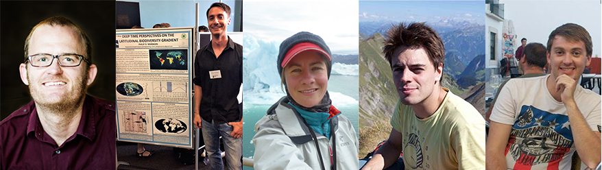
Meet the Staff: Dr Matthew Fox.

I am fascinated by the processes that shape Earth’s surface - from the tectonics that build mountain ranges to the rivers and glaciers that erode them.
Hazard Centre News: Mining disaster déjà vu.

For the foreseeable future we are certain to experience more tailings failures, they are occurring worldwide at an average rate of at least two per year.
Research: The Arctic Sea Ice Cover NERC Project.

The proposal provides a unique opportunity to collect in situ radar data of full annual cycle of sea ice formation, snow pack accumulation and melt onset.
Research: Clues to Antarctica’s future.

The geological record contains clues on how the ice sheet has responded to past climatic change; new evidence emerges proving its sensitivity to warming.
Outreach: How Much it Snows in the Arctic?

Finding out how much snow there is in the Arctic, especially on top of the sea ice, turns out to be incredibly difficult.
Press Release: The Earth’s deep mantle.

As ancient ocean floors plunge over 1,000 km into the Earth's deep interior, they cause hot rock in the lower mantle to flow much more dynamically than previously thought.
Research Seminars: The LOGIC group
The LOGIC lunch seminars not only offer opportunity to know more about the research of the members of our own team but also bring other researchers to us.
Student Society: Greenough, a year in review.

This year's events has been complemented by a plethora of successful events highlighting the importance of the Society in connecting its members & staff in the Department.
Events: Presenting without fear.

“Presenting a well delivered, interesting and concise scientific talk is the gold dust of academia, the gateway to successful collaboration and addressing audience.
PhD News: Collaborate with EU scientists.
Elodie Kendall receives an award from European Cooperation in Science and Technology organization to collaborate with Italian geodynamicist.
Alumni News: Duncan Hawley, Year 1978, visit

Welcome back Duncan Hawley (UCL Geology, 1975-1978), now Chair of the History of Geology Group (HOGG) of the Geological Society).
Update from Prof Paul Upchurch, Head of Department.
The post-Christmas term has drawn to an end, so the Department is a little quieter as we enter the Easter Holiday period. However, this does not mean that members of the Department are resting on their laurels. Several key activities continue, including marking recently submitted coursework, undergraduate fieldtrips, Research Excellence Framework tasks (such as reviewing papers for our submission), and of course research itself.
As we welcome five new lecturers (and the postdocs and PhD students they have brought with them) to our Department, the deadline for applications for another three posts is only a day away as I write. The new round of hires will be in the areas of Climate Studies, Earth Resources and Sustainability, Geological Hazards and Sedimentology – all areas where we need to strengthen our teaching and where there is the potential for REF-related impact in the future.
As is clear from the contents of the current Newsletter, this Department continues to work on some of the most challenging and important aspects of the Earth Sciences, especially with regard to climate change, geological hazards, ground water pollution and so on. Some congratulations are also in order, especially to Prof Graham Shields who has just been awarded a prestigious Leverhulme Research Fellowship, Dr. Ana Ferreira for acceptance of a paper in Nature Geosciences, and Prof Lidunka Vocadlo for the award of a major NERC grant. We are also delighted to have received support from the London NERC Doctoral Training Program for six new PhD students – the largest number we have achieved during the first five-year funding period of this scheme. So, as we approach the one-year anniversary of Sir David Attenborough’s official re-opening of the refurbished Kathleen Lonsdale building, the Department continues to be vibrant and successful. And, oh yes, the scaffolding and boards have been removed so you can now see the beautiful and clean facade of our home. ↑ Back to top
The Department Welcomes Five New Lecturers.
The department made five new appointments to the positions of lecturers in Earth Sciences. These appointments were made in the area of geodynamics, vertebrate paleontology, geochemistry, geomorphology & mineral physics. We warmly welcome our new staff and hope that three more appointments in the areas of Climate Studies, Earth Resources & Sustainability, Geological Hazards & Sedimentology will be made in time for new academic year.
Maxim Ballmer
Maxim's research focuses on the structure and evolution of planetary mantles. The mantle of the Earth and of other terrestrial planets in (and beyond) the solar system are shaped by the processes of accretion (e.g., giant impacts), differentiation (magma ocean crystallization, partial decompression melting), solid-state segregation and convective mixing. Mantle present-day structures can be indirectly sampled by e.g. gravity measurements, seismic waves, or the chemistry of hotspot volcanism. To understand planetary evolution, my tools of choice are numerical modeling of mantle convection, and the quantitative comparison of model predictions with geophysical observations and geochemical data.
Matthew Fox
Matt's research focuses on understanding landscape evolution in order to deconvolve complex feedbacks amongst climate and tectonics: how do changes in climate modulate the processes or rates of erosion? how do tectonic processes respond to this redistribution of mass? how quickly does CO2 in Earth’s climate decrease due to increased silicate weathering driven by tectonic activity?
"In order to address these fundamental questions, I combine geomorphic and geophysical data with novel numerical methods to study surface processes at a range of spatial and temporal scales. At the large scale, I investigate the rates of orogenesis using large databases of geomorphic data or digital topographic models with geophysical inverse methods. At the small scale, I am improving our understanding of thermochronometric methods (temperature – time) to maximise the amount of information that constrains landscape evolution".
Susan Little
Susan's research focusses on the role of the oceans in Earth's climate system. She is particularly interested in the importance of trace metals (including copper, zinc, cadmium) to ocean carbon cycling. Trace metals are micronutrients - they are essential for life in small quantities - but they can also be toxins at high, polluting, concentrations. She aims to develop the isotope systems of these metals as tracers of carbon cycling in the past and present ocean.
Philip Mannion
Phil's research examines the macroevolutionary history of terrestrial vertebrates over the last 250 million years, combining ‘traditional’ comparative anatomical approaches, via the description of fossils (primarily sauropod dinosaurs and crocodiles), with the assembly and analysis of comprehensive, quantitative datasets. A significant theme of his research has focused on characterising the statistical relationships between deep time biodiversity and the geological biases that can obscure our understanding of macroevolutionary patterns. In particular, his research aims to understand how past climatic changes constrained the evolution and distribution of ancient biodiversity, with relevance to predicting the long-term responses of climatically-threatened living organisms.
Andrew Thomson
Andy's research focusses on understanding deep Earth processes by using high pressure-temperature experiments to determine both geochemical and geophysical properties of mantle mineral: "I perform experiments at extreme conditions (several gigapascals) using multi anvil and diamond anvil cell devices, often in combination with synchrotron x-rays or neutron diffraction to investigate geological processes occurring throughout the mantle.
My main interest is understanding the behaviour and influence that volatile species, mostly carbon and hydrogen, have throughout the mantle. Currently I am focused on the role that hydrogen plays in controlling mantle geodynamics, through investigating its affect on the strength of mantle phases."
↑ Back to top
Philip Kreussler, MSc Geophysical Hazards Student
Creating vulnerability, hazard and risk maps using ArcGIS
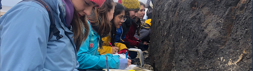
I am Philip Kreussler (26) and I am studying the MSc Geophysical Hazards programme within the department of Earth Sciences at UCL. I chose to study natural hazards because I believe that studying extreme events will be increasingly important in the future, especially when considering the global growth of population and the impacts from climate change. This master’s course offers the opportunity to learn about these complex relationships and thus provides students with the expertise to work across a range of different working environments, from positions in academic research and non-governmental organisations, the insurance and reinsurance industry, to the fields of emergency planning and environmental management. After graduating from UCL, I aspire to use my knowledge to work as a catastrophe modeller within the insurance sector.
 showing the relative risk across the island in the event of an eruption from the Soufrière volcano.")
As part of the MSc course, we were asked to use our newly developed skills in ArcGIS to create maps of vulnerability, hazard and risk associated with the Soufrière volcano on the eastern Caribbean island of St. Vincent. We were required to manipulate, analyse and display spatial data before developing maps that clearly and concisely communicate the relevant information as if they were to be used by the public and decision makers in the region.
By integrating vulnerability and volcanic hazard data, we were able to generate a map of St. Vincent showing the relative risk from the Soufrière volcano across the entire island. By definition, risk is a measure which combines a population’s vulnerability (access to information, transport, age etc.) and the hazards given by a natural or anthropogenic event (in this instance the ash fall, lahars, pyroclastic density currents and ballistics produced during an eruption). The results showed that locations close to the volcanic vent in the north of the island tend to be at greater risk, but in particular in locations where local vulnerability was also found to be highest. These types of maps are of great importance because they inform the public and decision makers about the potential threat from a specific hazard.
↑ Back to top
Dr Matthew Fox, Lecturer & NERC Senior Research Fellow interested in Geomorphology &Thermochronometry
I am fascinated by the processes that shape Earth’s surface - from the tectonics that build mountain ranges to the rivers and glaciers that erode them. Ultimately this is vital for understanding the evolution of life on Earth, the occurrence of natural resources, climate across spatial and temporal scales, and seismic hazards. This fascination has taken me to lots of exciting places to conduct fieldwork and collect samples.

In 2017, I was part of an expedition to the Antarctic Peninsula. We sailed south from Punta Arenas, Chile and spent 6 weeks sailing in and out of glacial fjords along the Antarctic Peninsula. Our goal was to collect sediment that has been eroded from below, and deposited by the impressive glaciers that have shaped the landscape. By measuring the amount of different elements in crystals of apatite collected from the sea floor, we are able to reconstruct an ancient landscape that existed before the growth of ice caps on Antarctica. This then provides a unique insight into the climatic condition required to grow the glaciers on the ancient landscape. Our trip was very successful and we were able to visit fjords that had never been visited before, surprising whales, seals and penguins along the way! Fortunately, on our United States Antarctic Program ship there were also marine biologists and our interactions with the local wildlife provided vital research opportunities.

Last year, I visited the Beijing University of Geosciences to teach a short course on “Numerical Modeling of Thermochronometry” and travel across the Tibetan Plateau to Mount Everest Basecamp. One of the big questions in the Himalaya is “Are rivers eroding mountains at the same rate the mountains are being pushed up?” To answer this question, we travelled along the largest river in Tibet, the Yarlung Tsangpo. Here the river runs across large flat plains and several narrow gorges before it cuts its way off the Tibetan Plateau and becomes the Brahmaputra River. Using numerical models of how rivers erode into bedrock, we are working find the tectonic scenarios that predict the observed geomorphology.
I analyze samples from these fieldtrips at the London Geochronology Centre to provide erosion rate estimates and constrain these models. We are currently one of the only labs in the world that provide the expertise and facilities to collect these high precision data and work with colleagues around the world to understand Earth’s dynamic surface. Follow Matt on Twitter @apatite4life
- Photo 1. Dr Matt Fox on-board the research vessel - an expedition to the Antarctic Peninsula, 2017.
- Photo 2. The largest river in Tibet, the Yarlung Tsangpo.
Related Links:
- Dr Matt Fox Research Profile
- Study of the Glacial Erosion in the Antarctic Peninsula
- The London Geochronology Centre
News from the UCL Hazard Centre: Mining disaster déjà vu in Minas Gerais, Brazil by Dr Stephen Edwards.
The Meet the Staff section of the December 2018 newsletter carried an article outlining the work being led by the UCL Hazard Centre on the impacts of natural hazards and mining in South America through its RRAIMS (Reducción de Riesgos por Amenazas e Impactos Mineros en Sudamérica) programme. In that piece I reported on my visit in November 2018 to the Samarco Germano and Fundão tailings sites in Minas Gerais, the hub of mining in Brazil, exactly three years after the catastrophic failure of the Fundão tailings dam left 19 people dead. Days later I gave a presentation on the risk management of mine tailings to an audience of industry, government and academic professionals attending the UK Brazil Mining Forum. Then, on 25 January this year, there was another terrible tailings catastrophe in Minas Gerais, this time at the Córrego do Feijão Mine. The human death toll resulting from this failure may reach beyond 200. Many of the problems I had highlighted in November 2018 were unfortunately reinforced by this latest disaster. Déjà vu for all of the wrong reasons.

For the foreseeable future we are almost certain to experience more tailings failures, and at the moment they are occurring worldwide at an average rate of at least two per year. In a recent BBC interview, I stated that there is a global tailings time bomb, so things need to change, and fast. To this end, in a blog for PreventionWeb of the United Nations Office for Disaster Risk Reduction, I advocated the need for the following measures to reduce the numbers and impacts of tailings disasters; this list is by no means exhaustive.
• A publicly accessible global database of all tailings facilities is required as a first step to understanding exposure to tailings hazards worldwide. The national tailings database of Chile could be adapted for this purpose.
• Open, inclusive, transparent and trusting multi-stakeholder engagements to ensure that the risk posed by tailings is effectively communicated and well understood by all exposed to the hazard.
• Assessments of and changes to land use to ensure that people and critical infrastructure have limited exposure to tailings hazards.
• Establishment of effective tailings monitoring and early warning systems linked to emergency and evacuation plans.
• A global ban on the construction of upstream storage facilities, the most prone to failure, which will require a change in the economics and politics of tailings management.
• A paradigm shift in the mining sector globally to put safety rather than economics first, as advocated by the United Nations Environment Programme.
• Use of risk transfer mechanisms, such as insurance, to ensure best practice regulation is implemented and maintained worldwide.
• More research on how to turn tailings from an unwanted residue into a useable resource.
The UCL Hazard Centre is working with global partners in academia, government and non-government organisations, business and industry to ensure that the risk associated with tailings is reduced. However, it is a slow and challenging process and there is an elephant in the room: our future trajectory, with its increasing and more developed population and technologies, will require more of the Earth’s resources to be mined than ever before. This will mean that for at least the immediate future the rate of production of tailings will be the greatest it has ever been, which may translate into a significant increase in the exposure to the hazard they present. Therefore, each and every one of us has a duty to demand and consume much less in order to reduce this exposure. No more déjà vu please.
The loss of the Arctic sea ice cover by Prof Julienne Stroeve, Polar Observation & Modelling Researcher
The loss of the Arctic sea ice cover is an important indicator of climate change, and plays a fundamental role in Arctic energy and freshwater balance. Sea ice also plays an important role of the marine ecosystem. While satellites have been monitoring the changes in area of the sea ice cover for the last 40 years, measurements of ice thickness have been more limited. Since 2010, the European Space Agency (ESA)'s CryoSat-2 radar altimetry mission has been providing observations useful for retrieving sea ice thickness. However, one key uncertainty in accurately measuring sea ice thickness from radar altimetry is knowledge on how far the radar penetrates into the overlying snow cover. The general assumption has been that the radar return is from the snow-ice interface, yet field evidence has questioned this general assumptions, even for a homogeneous snowpack.

Photo: Training in Finland for MOSAiC Project - Radiometer set up.
Our newly funded NERC-MOSAiC proposal provides a unique opportunity to collect in situ radar data throughout a full annual cycle of sea ice formation, snow pack accumulation and melt onset. This is essential in order to understand how factors such as brine wicking into the snow pack, temperature and density variations influence the radar penetration into the snow. These data will allow us to better quantify the uncertainty in current sea ice thickness data products and improve our satellite algorithms.
The backbone of MOSAiC will be the year round operation of RV Polarstern, drifting with the sea ice across the central Arctic during the years 2019 to 2020. During the set-up phase RV Polarstern will enter the Siberian sector of the Arctic in thin sea ice conditions in late summer. A distributed regional network of observational sites will be set up on the sea ice in an area of up to ~50km distance from RV Polarstern. The ship and the surrounding network will drift with the natural ice drift across the polar cap towards the Atlantic, while the sea ice thickens during winter (red dotted line in the Figure below).

Related Links:
- MOSAiC (Multidisciplinary drifting Observatory for the Study of Arctic Climate)
- UCL scientists to join Arctic research ship 'drifting' past North Pole
- Professor Julienne Stroeve's academic profile
Clues from the seafloor shed light on Antarctica’s future by Dr David Wilson.
What is my research about? Decoding the geological record can be challenging, but provides crucial evidence to understand the earth system and to predict future changes. For example, what has controlled our ocean currents in the past? How has the earth’s atmospheric composition remained within habitable limits for millions of years? And how will earth’s climate, ocean currents, and ice sheets change in the future? By applying isotope geochemistry to explore the earth system, my research is addressing questions such as these.
Where did it all start? To take a step back, my training as an undergraduate was in geology, where I had a keen interest in fieldwork, petrology and hard rock geochemistry. However, I became intrigued by paleoclimate research during my MSci project, when I saw for the first time just how remarkably well we can reconstruct past ocean conditions using marine microfossils. In my PhD, I advanced the use of radiogenic isotopes of neodymium (Nd) and lead (Pb) as ocean tracers, in particular exploring the role of ocean circulation in glacial-interglacial cycles, and the response of Himalayan chemical weathering to climate change. More recently, I have started working on deep-sea corals as archives of centennial timescale variability in the oceans, and have also been using sediment provenance tracing to reveal past ice sheet behaviour – with the example below from my recent research on Antarctica.
Why study the Antarctic ice sheet? Because observational records are short, the dynamics of the giant Antarctic ice sheet are poorly understood. This represents a major uncertainty in predicting future global sea levels in a warming world. However, the geological record contains clues on how the ice sheet has responded to past climatic change – and new evidence is starting to emerge that highlights its sensitivity to warming. Here I describe one such study into the past behaviour of the East Antarctic Ice Sheet in the Wilkes Subglacial Basin [1]. To set this region in context, if all the ice in this marine-based portion of the ice sheet melted, it would contribute around 4 metres to global sea level rise.

What did we do? To understand how warming affected the ice sheet in the past, we analysed the chemistry of sediment layers deposited on the continental rise over the last 480 thousand years. The samples were recovered during IODP Expedition 318 [2], and analysed by mass spectrometry for their neodymium (Nd) and strontium (Sr) isotopic compositions. These isotopic fingerprints allowed us to reconstruct the changing sources of the sediment eroded and transported by the ice sheet, from which we could infer advance and retreat of the ice margin. Combining this information with biological data (e.g. diatom abundance) and sedimentological data (e.g. iceberg-rafted debris) provided a complete picture of environmental change through time.
What does the data show? Changes in sediment provenance indicate that the ice sheet retreated in the Wilkes Subglacial Basin during recent warm interglacial periods [1], as well as during the warm Pliocene [3]. In particular, changes occurred during interglacials 125,000 and 400,000 years ago, when temperatures in Antarctica were around 2 ̊C above pre-industrial conditions for several millennia. Global sea levels were 6-13 metres higher than today, and ice loss from low-lying regions of the East Antarctic Ice Sheet probably contributed to those higher sea levels.
What are the implications for the future? Recent observations have mostly indicated changes in the West Antarctic Ice Sheet. This study now shows that low-lying areas of the East Antarctic Ice Sheet will also be susceptible to future ice loss if there is sustained Antarctic warming of around 2°C above pre-industrial conditions. With current global temperatures already 1°C higher than pre-industrial, we will need to rapidly decarbonise our economy in order to restrict future sea level rise [4, 5].
What next? This geological approach needs to be applied in other key regions of Antarctica and fully integrated with ice sheet modelling. But for me, having recently moved from Imperial College to UCL, it is onto a new project where we will be using lithium (Li) isotopes in speleothems to explore the role of continental weathering in the global carbon cycle.
Further reading
[1] Wilson, D.J. et al. (2018) Ice loss from the East Antarctic Ice Sheet during late Pleistocene interglacials. Nature 561, 383-386.
[2] https://iodp.tamu.edu/scienceops/expeditions/wilkes_land.html
[3] Bertram, R.A. et al. (2018) Pliocene deglacial event timelines and the biogeochemical response offshore Wilkes Subglacial Basin, East Antarctica. EPSL 494, 109-116.
[4] Pattyn, F. et al. (2018) The Greenland and Antarctic ice sheets under 1.5 °C global warming. Nature Climate Change 8, 1053–1061.
[5] Rintoul, S.R. et al. (2018) Choosing the future of Antarctica. Nature 558, 233–241.
Outreach: How Do We Still Not Know How Much it Snows in the Arctic?
Dr Sammie Buzzard, sea ice researcher and Postdoctoral Research Fellow writes in The CosmicShambles Network. They bring together the world’s leading scientists, comedians, writers and performers to create entertaining content fuelled by curiosity. This network creates and curates podcasts, digital content and live events for people with curious minds for people who want to find out more about our universe through science, art, history, philosophy, music, literature.

There’s a lot of snow in the Arctic. But you might be surprised to know that scientists don’t actually know how much. And that matters. As a scientist who used to study Antarctica I know first hand that getting information about our polar regions can be incredibly difficult. Yet even I was surprised when I switched to working on Arctic sea ice (the frozen layer of ocean water that sits on top of the Arctic ocean) that we knew so little about the Arctic- we’ve known about it much longer, and people have lived there for thousands of years. Read the full article.
↑ Back to top
Press Release: Earth’s Deep Mantle Flows Dynamically.
As ancient ocean floors plunge over 1,000 km into the Earth's deep interior, they cause hot rock in the lower mantle to flow much more dynamically than previously thought, finds a new UCL-led study. The discovery answers long-standing questions on the nature and mechanisms of mantle flow in the inaccessible part of deep Earth. This is key to understanding how quickly Earth is cooling, and the dynamic evolution of our planet and others in the solar system.
“We often picture the Earth’s mantle as a liquid that flows but it isn’t – it’s a solid that moves very slowly over time. Traditionally, it’s been thought that the flow of rock in Earth’s lower mantle is sluggish until you hit the planet’s core, with most dynamic action happening in the upper mantle which only goes to a depth of 660 km. We’ve shown this isn’t the case after all in large regions deep beneath the South Pacific Rim and South America,” explained lead author, Dr Ana Ferreira (UCL Earth Sciences and Universidade de Lisboa).

Image: Cross-sections of Earth’s mantle down to 1,400 km depth showing changes in its flow as ancient ocean beds fall into Earth’s deep interior credit: Ana M. G. Ferreira et al.
“Here, the same mechanism we see causing movement and deformation in the hot, pressurised rock in the upper mantle is also occurring in the lower mantle. If this increased activity is happening uniformly over the globe, Earth could be cooling more rapidly than we previously thought”, added Dr Manuele Faccenda, Universita di Padova. The study, published today in Nature Geoscience by researchers from UCL, Universidade de Lisboa, Universita di Padova, Kangwon National University and Tel Aviv University, provides evidence of dynamic movement in the Earth’s lower mantle where ancient ocean floors are plunging towards the planet’s core, crossing from the upper mantle (up to ~660 km below the crust) to the lower mantle (~660 – 1,200 km deep). The team found that the deformation and increased flow in the lower mantle is likely due to the movement of defects in the crystal lattice of rocks in the deep Earth, a deformation mechanism called "dislocation creep", whose presence in the deep mantle has been the subject of debate. The researchers used big data sets collected from seismic waves formed during earthquakes to probe what’s happening deep in Earth’s interior. The technique is well established and comparable to how radiation is used in CAT scans to see what’s happening in the body. “In a CAT scan, narrow beams of X-rays pass through the body to detectors opposite the source, building an image. Seismic waves pass through the Earth in much the same way and are detected by seismic stations on the opposite side of the planet to the earthquake epicentre, allowing us to build a picture of the structure of Earth’s interior,” explained Dr Sung-Joon Chang, Kangwon National University.
By combining 43 million seismic data measurements with dynamic computer simulations using the UK’s supercomputing facilities HECToR, Archer and the Italian Galileo Computing Cluster, CINECA the researchers generated images to map how the Earth's mantle flows at depths of ~1,200 km beneath our feet. They revealed increased mantle flow beneath the Western Pacific and South America where ancient ocean floors are plunging towards Earth’s core over millions of years.This approach of combining seismic data with geodynamic computer modelling can now be used to build detailed maps of how the whole mantle flows globally to see if dislocation creep is uniform at extreme depths. The researchers also want to model how material moves up from the Earth’s core to the surface, which together with this latest study, will help scientists better understand how our planet evolved into its present state. “How mantle flows on Earth might control why there is life on our planet but not on other planets, such as Venus, which has a similar size and location in the solar system to Earth, but likely has a very different style of mantle flow. We can understand a lot about other planets from revealing the secrets of our own,” concluded Dr Ferreira.
The study was funded by the Leverhulme Trust, NERC, the Korea Meteorlogical Administration Research and Development Program, the Progetto di Ateneo FACCPTRAT12 granted by the Università di Padova and by the ERC StG #758199 NEWTON.
Related Links:
- Ana M. G. Ferreira, Manuele Faccenda, William Sturgeon, Sung-Joon Chang, Lewis Schardong, ‘Ubiquitous lower mantle anisotropy beneath subduction zones’ Nature Geoscience, 2019, March.
- Ana Ferreira's research profile
- William Sturgeon's PhD profile
Research Seminar series: The LOGIC group (The London Geochemistry & Isotope Centre)
For the academic term of 2018 to 2019, the LOGIC group (The London Geochemistry & Isotope Centre) has continued its lunch seminar series, and so far we had 5 talks: 3 invited speakers from outside of the UK and 2 from UCL. The topics were very diverse. Weiqiang Li from Nanjing University, China, talked about “Oscillations in Phanerozoic Seawater Chemistry: constraints from Mg isotopes in dolostones”; then Susanna Porter from Santa Barbara, University of California, gave us “Some thoughts on Oxygen, Biomarkers, and the Nature of Early Eukaryotes”; and Zhenbing She, from Chinese University of Geosciences, gave a talk on “Phosphogenesis and rise of metazoans in the Ediacaran”. Except for the invited speakers, our own David Wilson talked on “Late Pleistocene instability of the East Antarctic Ice Sheet? Insights from radiogenic isotope provenance tracing”, which was followed by Guiseppe Saldi talking on “Boron isotope fractionation during sorption on calcite: insights into its incorporation mechanism”.
Overall, the LOGIC lunch seminars not only offer opportunity to know more about the research of the members of our own team but also bring other researchers to us. Currently, the LOGIC seminar is still going on and a lot of interesting talks are to come.
A warm welcome to Dr Colin Mettam who has joined us as a postdoctoral research associate. He will work with Graham Shields and Philip Pogge von Strandmann on Earth’s marine environment during Earth’s Middle age (mid-Proterozoic), which gets him the full set of eons to go with his Ph.D. work at the University of St. Andrews on The ‘Neoarchean and Permo-Triassic nitrogen cycles’.
Student Greenough Society: a Year in Review.
This year of Greenough events was marked by a theme of Greenough Getting something! If that was hungry, going, festive, and a job! At the beginning of the year the first event Greenough engaged in was our welcome social for all the new members of the department and those who had returned. The eve of events came into fruition upon the arrival of now infamous paper geologist that you can still to this day observe in the upstairs common room. After many attempts of pinning a hammer and compass-clino to their respective positions without the aid of sight, members also played geologically themed twister – which ended as you can imagine. The first social event of the year was a great success and a wonderful opportunity for all the different years to mingle, and to welcome some old faces back.
Following on from the fun Greenough invited Duncan Hawley a past president of the Greenough society to lecture members on the ‘Discovery of the Silurian’ which focused on the 19th century pioneering geologist Sir Roderick Murchison's methodology and location of his ground-breaking discovery of the Silurian period.To mark the end of the year, Greenough hosted the notorious Christmas meal which was hosted at Lockside, Camden. The evening was marked by the advent of black ties, red dresses, and the grace of Dr Tom Mitchell. The Christmas meal was a great success and enjoyed by all, some more than others (you know who you are).

To kickstart the new year members were subjected to (they volunteered actually) an arduous three-legged race between Phineas and Huntley. Some say wearing a hard-hat greatly increased your change of winning. More recently some Greenough members were given exclusive access to a private tour of the Geological Society’s London Headquarters at Burlington house. The tour took them through their Library and Council Rooms where they were shown material of the founding member of Greenough!
In summary, this year of Greenough events has been complemented by a plethora of successful events showcasing the ever more importance of the society in connecting its members and staff throughout the Earth Sciences Department. We would like to thank all who got involved and welcome next year’s committee.
Presenting without fear by Isra Ezad, PhD student.
Presenting a well delivered, interesting and concise scientific talk is the gold dust of academia, the gateway to successful collaboration and an ability to avoid panicking in front of audience questions. But how often do you find yourself unable to concentrate on the talk before yours, palms sweating and heart racing while you silently whisper through your presentation?
The solution? Spend a day with a Royal Academy of Dramatic Arts (RADA) qualified actor, rolling around on yoga mats, not wearing shoes for the best part of the day and learning to breathe properly. Yes, you read that correctly – learning to breathe properly. Even when we relish the challenge of presenting our work, we can always improve. Nerves can creep up on us at anytime: just like supervisors do when asking us what we have been doing for two weeks, when the answer is quite obviously not as much as expected.
So, to improve my improv skills and general ability to breathe ready for the next stealth attack of supervisor and nerves, I joined the students from the MSc in Geophysical Hazards on their RADA course ‘Storytelling with Impact’. The course is a full day at RADA Studios. You are split into small groups of eight and the day is led by a RADA trained actor-turned-tutor. Our day began with "circle time", introductions of everyone taking part and sharing your favourite story book - not too dissimilar to every time you started a new school and were forced to bond with complete strangers. I had no idea where this was going.
The real fun began next. Shoes off with seven strangers lying on yoga mats, being asked to repeat sounds like ‘pa pa pa’, ‘ha ha ha’ and more. After rolling around on the floor and doing some stretches, we were now ready to be taught how to breathe properly. By this point, any feelings of sheepishness and looking like an idiot in front of other people are completely banished. The day was beginning to make sense.
By mid-morning we were learning to stand properly, feet apart looking forward and breathing from our bellies. When you find it difficult to get your words out during a talk, it is because your breathing has quickened; becoming aware of this and learning to adjust your breathing helps to slow you down and get your voice out. Half of the secret to presenting well isn’t what you are actually saying, it’s how you stand, talk and hold the audience's attention. These are soft skills not often taught or emphasised in a scientific setting, where it’s usually all about content. But think back to some great talks you have seen: you may well remember more about the way in which the talk was delivered than what it contained.
Now masters of our art and armed with the tools to stand upright, position our hands properly and breathe from below ... it was time to present. I found myself able to carry my voice much further than ever before, slow my breathing and actually have time to listen to what I was talking about and, best of all, at the end I felt calm. I also saw huge transformations in others who had started off shy, unconfident and barely able to get their voice out. By the end of the day they were smiling, breathing and delivering an incredible talk to a room full of people. I can’t recommend this course highly enough to anyone looking to improve their skills in presenting, so, if you are interested, get in touch with Chris Kilburn for more information.
↑ Back to top
PhD News: Elodie Kendall receives an award from from European cooperation in science and technology to collaborate with Italian geodynamicist.
In fall last year I won a STSM (short term scientific mission) from COST (European cooperation in science and technology) for a two month collaboration with a very talented geodynamicist, Manuele Faccenda at the University of Padua, Italy. This project provides new inter-disciplinary views focused on a seismic tool known as radial anisotropy. This powerful probe provides crucial information to understand mantle flow in our dynamic planet. It is critical to understand the geometry, strength and mechanisms of radial anisotropy and therefore flow causing a potentially flat “thermo-mechanical” boundary (lithosphere-asthenosphere, LAB) in the Pacific in order to understand the relationship between deep mantle convection and its surface expressions. Several mechanisms have been proposed for this flat signature, such as lithosphere-plume interactions.

This EU collaboration, which should be presented at EGU, was crucial for this multi-disciplinary approach, combing seismology, mineral physics and geodynamics, trying to provide the community with new insights into the fundamental mechanisms of mantle flow around forming oceanic lithosphere. Insights into these complex, active processes from massive earthquake datasets and geodynamic modeling will be of use to the wider community studying surface observables such as plate motions and studies on volatiles recycling. This project was a success because of the support of Dr Ana Ferreira, Prof Manuele Faccenda and also the STSM grant, so thank you again.
Alumni News: the Department was very pleased to welcome back Duncan Hawley.
The day before the Alumni Dinner last term, the Department was very pleased to welcome back Duncan Hawley (UCL Geology, 1975-1978). Duncan, who is now Chair of the History of Geology Group (HOGG) of the Geological Society), gave a fascinating talk to the Greenough Society on The Discovery of the Silurian: following the footsteps of Murchison. Duncan spoke with great enthusiasm on Murchison’s work, illustrating his account with his photographs of many of Murchison’s original field sites. Prior to his talk, Duncan was also able to show us some photographs from his student days, including the one below, taken on the Introduction to Geology field trip at Loughborough in Easter 1976. Many of you will recognise the distinctive figure of Eric Robinson in the foreground – though the question of why Eric considered a geological hammer to be a necessary accompaniment to eating ice cream will probably never be solved.

The 2019 Alumni Dinner is provisionally booked for Friday 22nd November 2019; we know that some alumni who joined the Department in 1999 are making a special effort to attend for their 20th anniversary, so perhaps those of you came to UCL in 1969, 1979 .... 2009 might like to do the same?
Further in the future, did you know that 2020 will see the bicentenary of Greenough’s Geological map of England and Wales? HOGG are organising a special meeting to celebrate this, to be held at UCL in May 2020, at which there will be some places for alumni – watch this space for further details.
Greenough Talks and visiting the Department: Any alumni who would like to come back to visit the Department, or who would be willing to speak about their careers to our current students would be very welcome; just Email Ian Wood (ian.wood@ucl.ac.uk) to arrange to come.