 Close
Close

Study of the Glacial Erosion in the Antarctic Peninsula
9 February 2017
The topographic evolution in Antarctica is vital to accurately reconstruct past glaciers, their sensitivity to climate and sea level changes. I will be traveling to the Antarctic Peninsula to collect samples that I can use to measure the long-term pattern of glacial erosion.
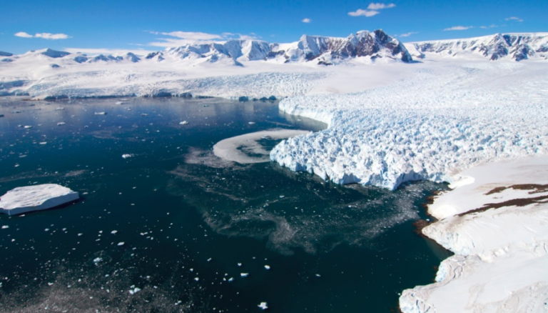
One of the challenges in working in Antarctica is that most of the rocks are covered by ice and in valley bottoms this ice thickness can be well over 1000 m. In mid-latitude landscapes, rocks from the valley bottoms have proved the most useful in constraining landscape evolution, yet in Antarctica these areas are inaccessible. Therefore, I rely on the processes of glacial erosion, transport and deposition close to the grounding lines of major glaciers to gain access to samples from below the ice.
The method I will use to measure landscape evolution is called apatite (U-Th)/He low-temperature thermochronometry. This geochemical approach is based on the predictable decay of U and Th producing He. At high temperatures helium is lost, but it is retained below temperatures of approximately 70 degrees Celsius. This temperature is encountered at depths of about 2 km and therefore a (U-Th)/He age provides the time that glaciers take to erode about 2 km. These data will be collected at the London Geochronology Centre and the Berkeley Geochronology Center.
Information can be gained from the detrital database by using numerical models coupled with inverse methods. I will use these models to find the optimal parameters describing landscape evolution and the present spatial pattern of glacial evolution.
On this trip I will be collecting sand from the grounding lines of major glaciers that have eroded the Western Antarctic Peninsula. The trip will take us from Punta Arenas in Chile across the Drake’s Passage to the Peninsula. We will then spend 6 weeks traveling up and down the Peninsula.
For my project, I will collect sand from the upper 20 cm of the sea floor using box cores. These samples can be processed on the ship to extract only the sand sized fraction. I will also work with other researchers who are interested in measuring the rate of change of elevation along the Peninsula using GPS and understanding how animals living along the Peninsula respond to climate change.
Follow Matt on Twitter @apatite4life