 Close
Close

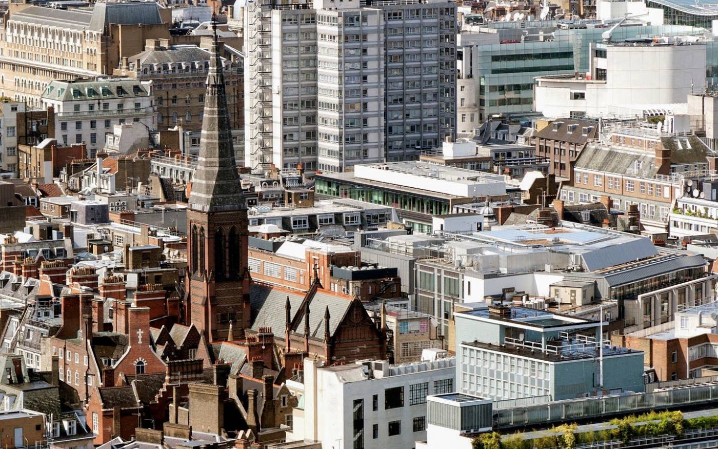
View of the spire of All Saints, Margaret Street, looking north-west from Centre Point in 2010. (© Historic England, Chris Redgrave)
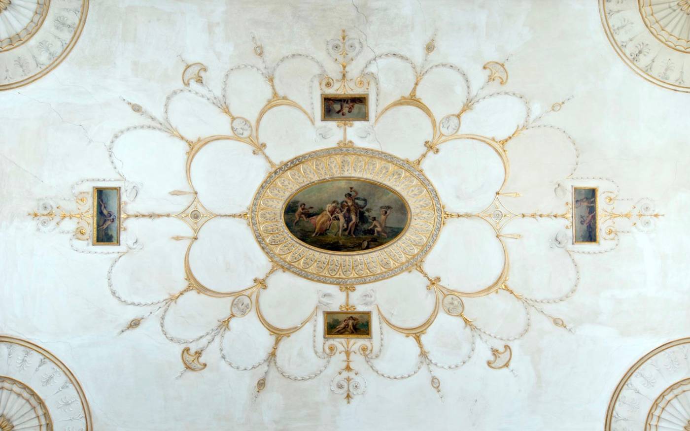
Drawing-room ceiling designed by Robert Adam at 9 Mansfield Street, photographed in 2012. (© Historic England, Chris Redgrave)
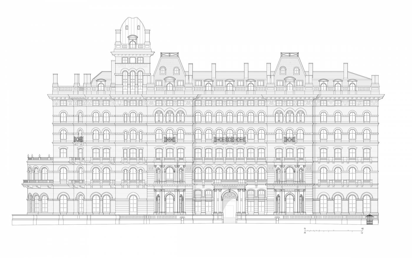
The Langham Hotel, Portland Place, elevation based on measured survey by Helen Jones and Andy Crispe. (© Survey of London, Helen Jones)
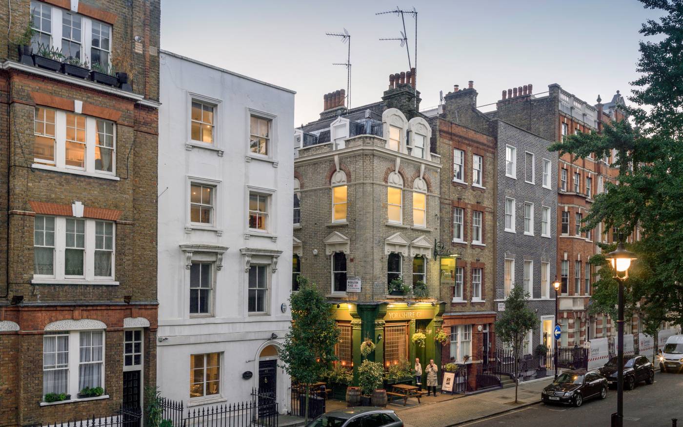
38–50 Langham Street in 2016. (© Historic England, Chris Redgrave)
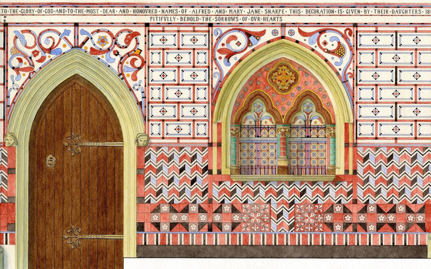
St Michael and All Angels’ Church, Woolwich, chancel wall mosaic-tile and painted decoration of 1890. Drawing based on measured survey in 2010. (© Historic England, George Wilson)
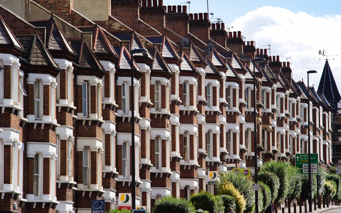
Latchmere Road, Battersea, looking south in 2012. (© Historic England, James O. Davies)
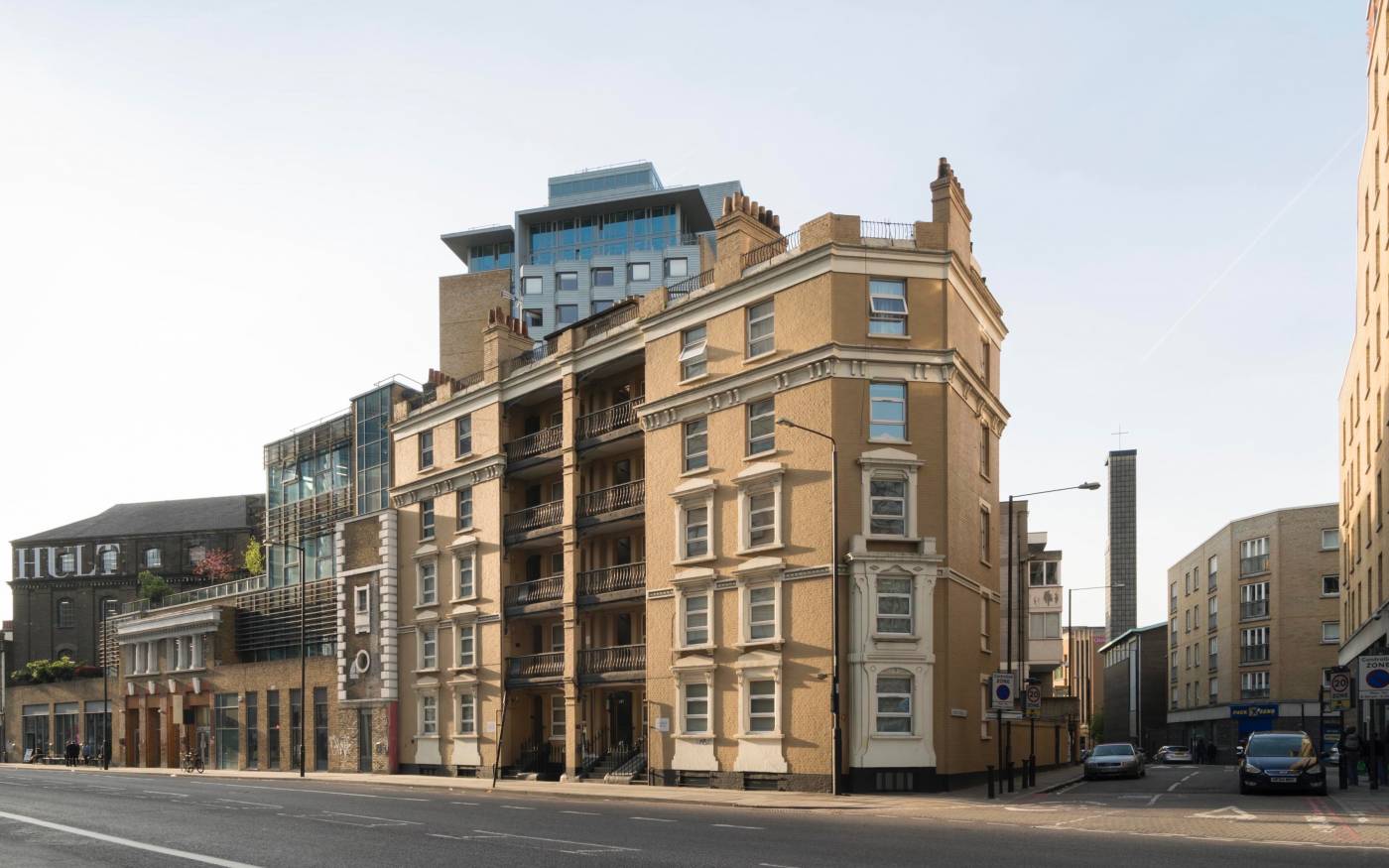
Morrison Buildings North, 35A Commercial Road, Whitechapel, view from the south-east in 2017. (© Derek Kendall)
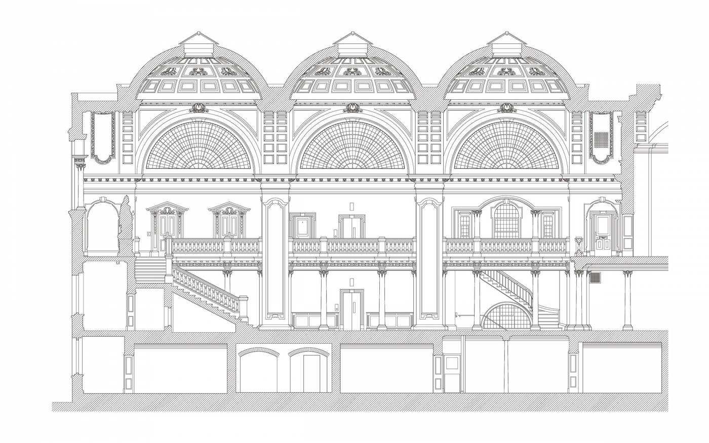
Woolwich Town Hall, long section through the entrance hall in 2011. Based on measured survey by Jon Bedford and Hannah Clarke. (© Historic England, Jon Bedford)

Lombard Road riverside, looking south from Oyster Pier towards Battersea Reach in 2012. (© Historic England, James O. Davies)
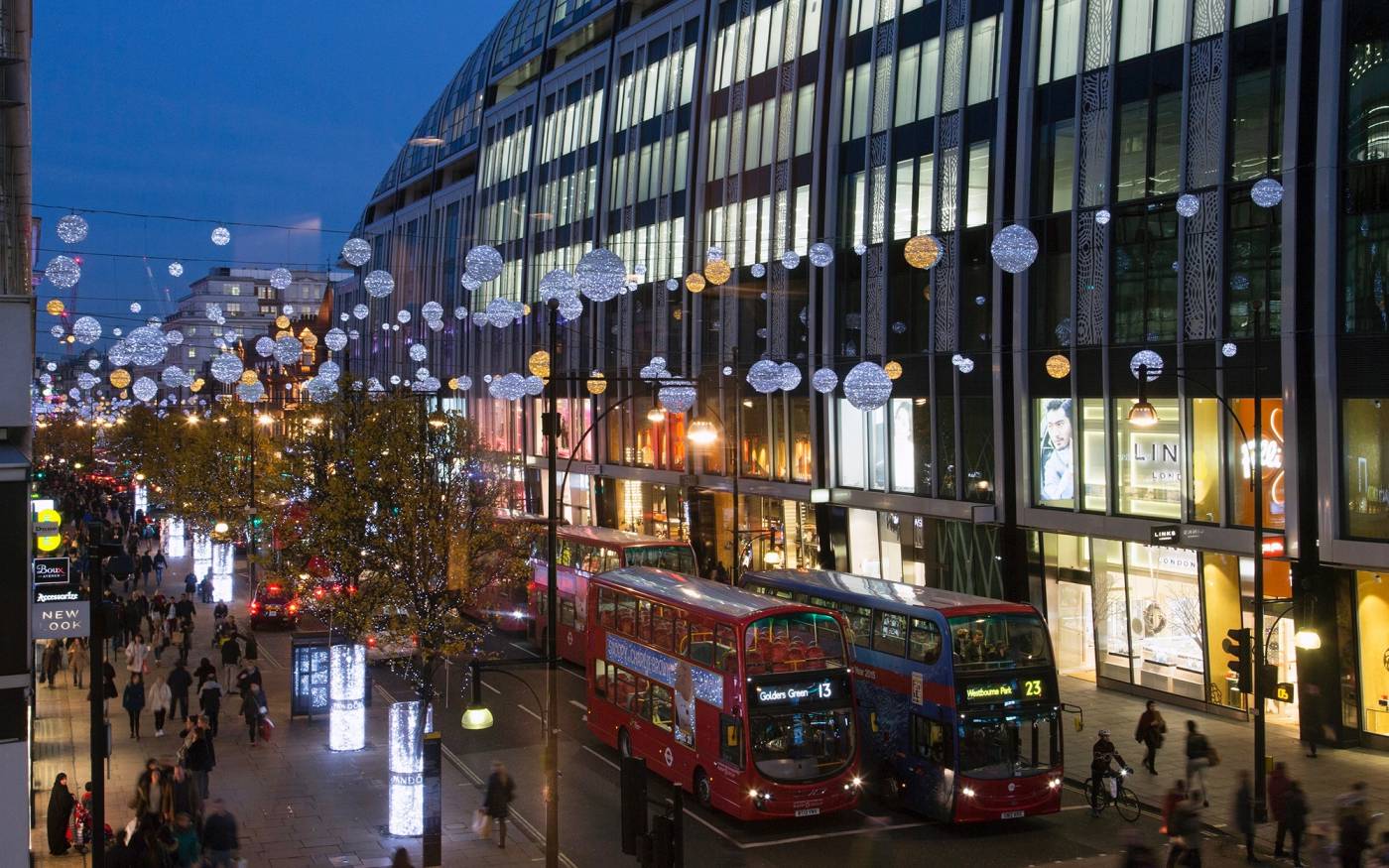
Park House, 455–497 Oxford Street, looking south-east in December 2015. (© Lucy Millson-Watkins)
The Survey of London is a long-running series of volumes documenting the buildings of London past and present, their development, architecture, history and associations.
It began in 1894 as a high-minded attempt to list and record all London’s surviving historic buildings and monuments. That proved over-ambitious, but the project’s area-by-area approach and focus on timely publication allowed it to evolve. From the earliest volumes, dealing with relatively few buildings in each area covered, it has developed into a detailed, diverse and inclusive work of urban and architectural history.
Volumes are the outcome of intensive documentary research and on-site investigation, and are profusely illustrated with measured drawings, maps, archive images and specially commissioned photographs.
Internationally acknowledged for its authority and accessibility, the Survey of London has no parallel in any other world city.
Areas covered
The Survey’s focus is the former County of London, which covers the whole of central London and many of the inner suburbs. The main series covers defined areas, usually one of the historic parishes that have coalesced into the present London Boroughs, while a shorter monograph series deals with individual sites and buildings not covered by these volumes.
Areas covered to date include much of the historic West End, the whole of Kensington and Knightsbridge, Clerkenwell, the Docklands district of Poplar, and Lambeth, Woolwich and Battersea in South London. Recent volumes are South-East Marylebone (2017) and Oxford Street (2020). Whitechapel is due for publication later in 2022, and South-West Marylebone is currently in progress. In the monograph series, the most recent is The Charterhouse (2010), and there are plans for a monograph on University College London to mark the university’s bicentenary in 2026.
Survey of London volumes are listed on our map. Online versions of all but the most recent publications on Battersea, South-East Marylebone and Oxford Street are available from British History Online. The volume on Woolwich is available to read and download from this website. Please refer to our online catalogue for links to freely accessible online versions of each volume.
Contact
General enquiries
Send an email to the Survey of London team
Copyright enquiries
Send an email to Colin Thom
Dr Sarah Dowding
Send Sarah an email
Helen Jones
Architectural Illustrator
Send Helen an email
Dr Emily Mann
Send Emily an email
Dr Aileen Reid
Send Aileen an email
Dr Amy Spencer
Send Amy an email
Philip Temple
Send Philip an email
Colin Thom
Director
Send Colin an email
Postal address: Survey of London, The Bartlett School of Architecture, 22 Gordon Street, London WC1H 0QB