Close
Close

Along with Woolwich, Battersea was studied by the Survey of London in part to redress a long-standing bias within the series in favour of districts north of the Thames.
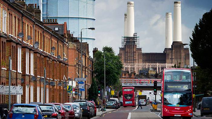
While much of Battersea is quintessential Victorian suburbia, it is a large and strikingly varied parish, cut about by innumerable railway lines to and from Clapham Junction. Its industrial riverside continues a transformation that began fifty years ago.
From the early seventeenth century to the early nineteenth century Battersea was best known for market gardening, and supplying vegetables, fruit and flowers to the London markets. The village nucleus itself was by the river, close to the parish church, and there was a scattering of industry along the riverside.
Beyond the Thames lay marshland, then market gardens and small villas stretching back to Clapham Common and Wandsworth Common. From about 1840, railway lines, industry and large-scale housing erupted, taking the population from 4,000 to 120,000 in half a century. Handsome Battersea Park was laid out just in time to prevent the whole of the area beside the Thames being engulfed by building.
Social conditions in the north of the parish were severely impoverished, while after 1870 street after street of better suburban houses rose within reach of the commons. The criss-cross of different railway lines and their works was exceptionally tangled, leaving the topography of northern Battersea permanently scarred, though it is still marked by memorable sites such as Battersea Power Station and Clapham Junction.
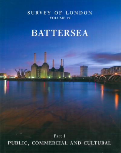
Publication of Volumes 49 and 50
The Survey of London completed its work on Battersea in 2013. Volumes 49 and 50 of the Survey were published by Yale University Press, with support from the Paul Mellon Centre for Studies in British Art.
Both volumes are fully illustrated books, with around 200 new drawings, a similar number of new photographs, and altogether more than 900 illustrations.
Volume 49, which contains a general historical introduction to Battersea, is arranged thematically to cover all building types (except housing), including public buildings, hospitals, churches, schools, buildings for entertainment, shopping, railways and industry - with a whole chapter on the power station - parks and open spaces, New Covent Garden Market, the heliport, as well as a chapter on the current large-scale regeneration of Nine Elms.
Volume 50 follows more traditional Survey of London lines and is divided topographically into nineteen chapters, with a general introduction to housing history in Battersea.
Draft chapters of Volumes 49 and 50
Pending a full online version, we have placed the draft texts of all thirty-two chapters from both Battersea books here, with a map to explain the chapter divisions in Volume 50.
- Volume 49: Draft Chapters
Following the success of making a draft of Woolwich (Volume 48, October 2012) available online in advance of its publication, we have placed all thirty-two chapters from both Battersea books online, with a map to explain the chapter divisions in Volume 50. We include references but not illustrations in the texts. View online or download each chapter of Volume 49 as a PDF.
- Introduction
- Chapter 1: Public Buildings
- Chapter 2: Buildings for Health and Welfare
- Chapter 3: Churches and Chapels
- Chapter 4: Schools and Colleges
- Chapter 5: Parks and Open Spaces
- Chapter 6: Entertainment
- Chapter 7: The Railways
- Chapter 8: Industry
- Chapter 9: Battersea Power Station
- Chapter 10: The Shops of Clapham Junction
- Chapter 11: New Covent Garden Market
- Chapter 12: Heliports
- Chapter 13: The Reconstruction of Nine Elms
- References
- Volume 50: Draft Chapters
Following the success of making a draft of Woolwich (Volume 48, October 2012) available online in advance of its publication, we have placed all thirty-two chapters from both Battersea books online, with a map to explain the chapter divisions in Volume 50. We include references but not illustrations in the texts. View online or download the explanatory map and each chapter of Volume 50 as a PDF.
- Map explaining Volume 50 chapter divisions
- Introduction
- Chapter 1: Battersea High Street area
- Chapter 2: Battersea Bridge Road to York Road
- Chapter 3: Around Battersea Park
- Chapter 4: Nine Elms
- Chapter 5: Park Town and district
- Chapter 6: Battersea Park Road to Latchmere Road
- Chapter 7: Falcon Road to Poyntz Road Triangle
- Chapter 8: North of Clapham Junction
- Chapter 9: West of Plough Lane
- Chapter 10: Lavender Hill: Introduction
- Chapter 11: Development north of Lavender Hill
- Chapter 12: Shaftesbury Park
- Chapter 13: Clapham Common to Lavender Hill
- Chapter 14: Lavender Sweep Area
- Chapter 15: West of St John's Road
- Chapter 16: St John's Hill area
- Chapter 17: Between the Commons 1
- Chapter 18: Between the Commons 2
- Chapter 19: South of Wandsworth Common
- References