 Close
Close

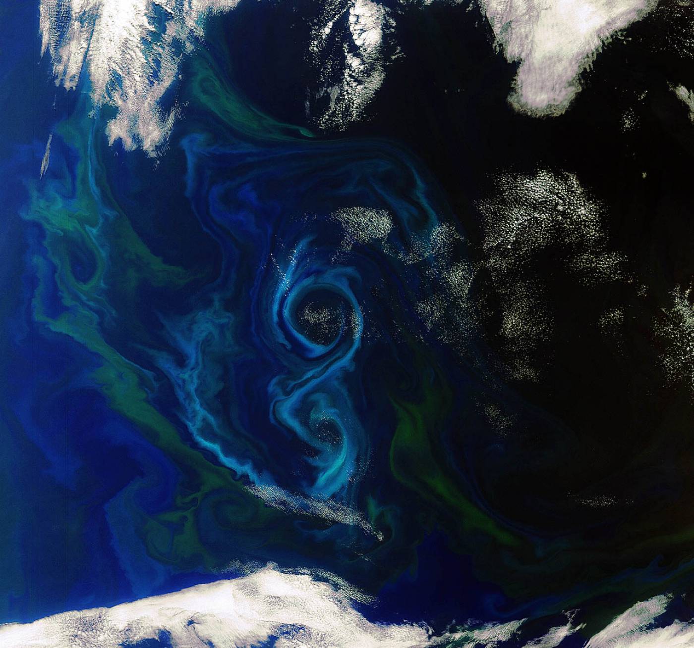
Earth from Space: A southern summer bloom (ESA from: http://www.esa.int/esaEO/SEMB88KX3XG_index_1.html)
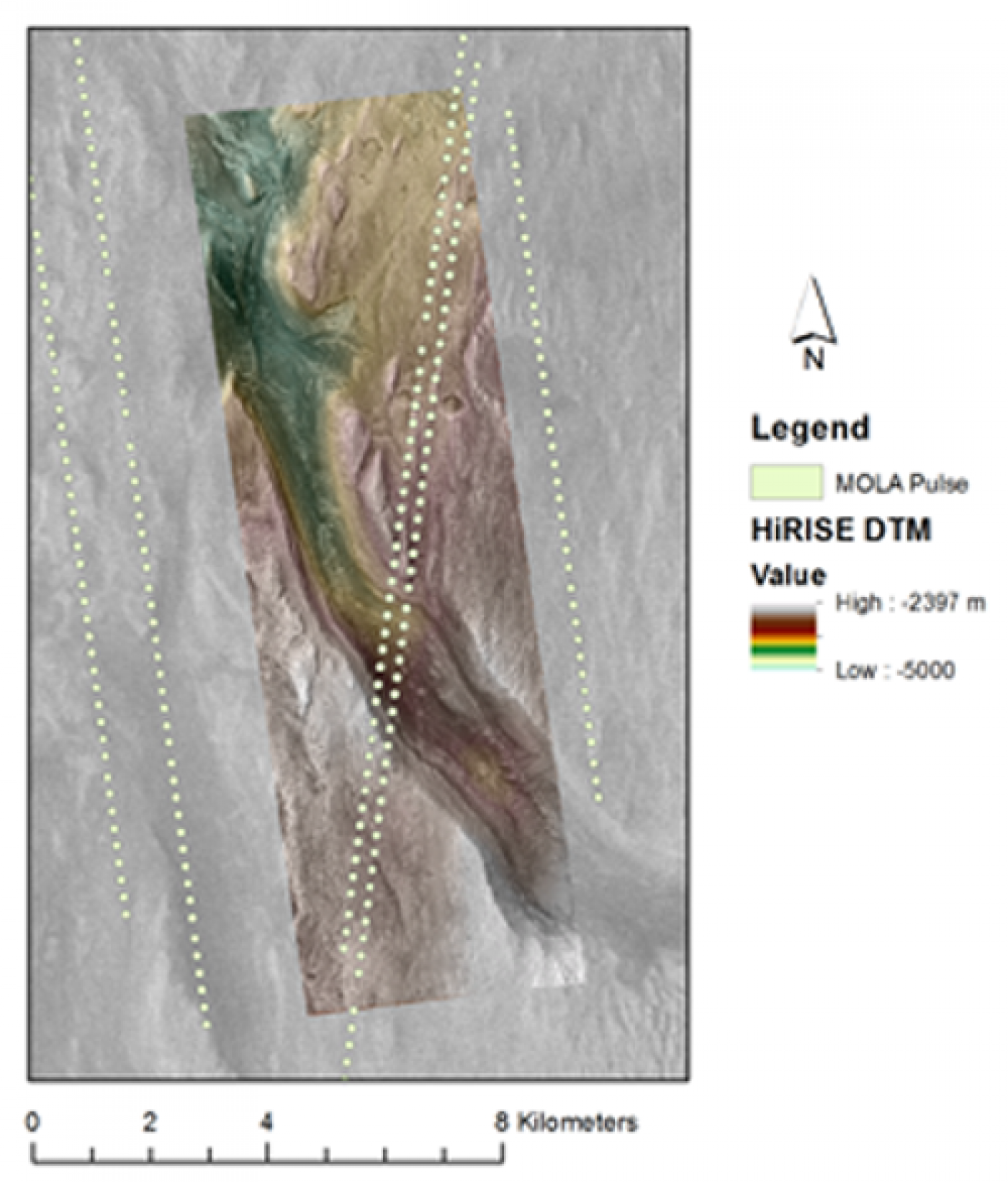
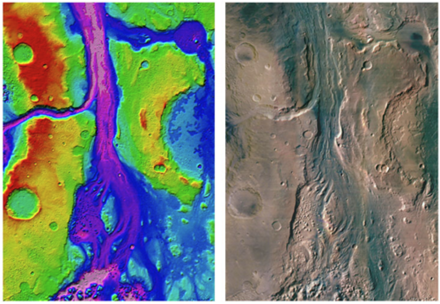
HiRISE, HRSC and MOLA map composite over part of Gale Crater, the landing site of the upcoming NASA MSL Curiosity mission
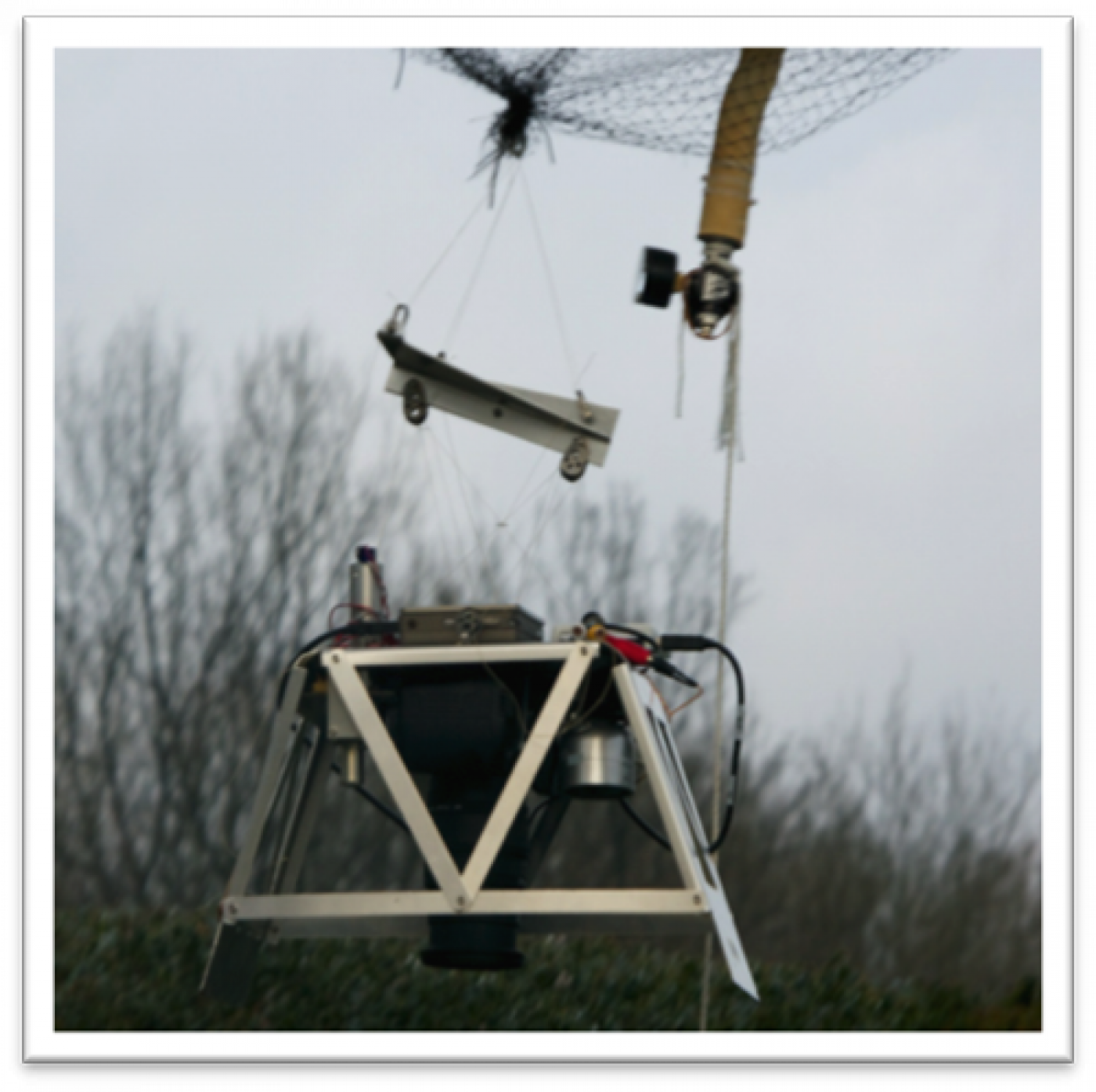
Balloon-borne fluorescent imaging platform, developed under the EU-FP7 ProViScout project.
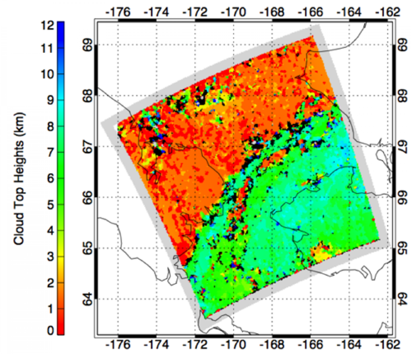
AATSR stereo-matched cloud top heights over Baring Straits [Muller and Fisher, 2010]
50m HRSC DTM and orthoimage mosaic of Iani Valles created in the imaging group [Warner, Muller and Gupter, 2009].
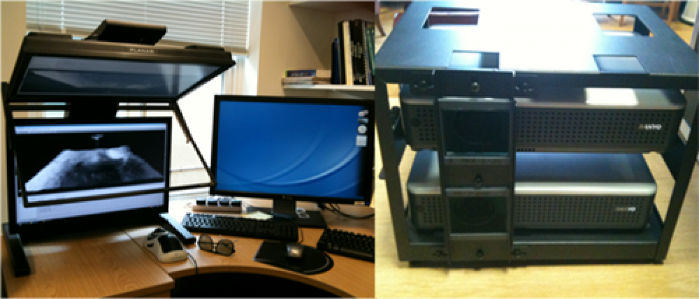
3D display system used in the Imaging group: High quality passive stereo display from Planar (Left) and GeoWall stereo projector for multiple viewers (Right)
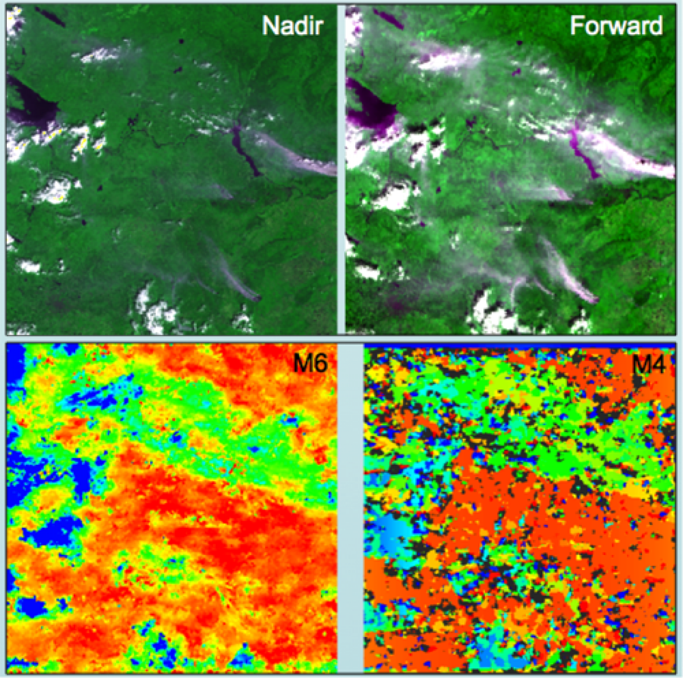
AATSR false colour composites of the nadir and forward together with corresponding stereo-matched smoke, cloud and ground heights [Muller, Fisher and Yerchov, 2010].
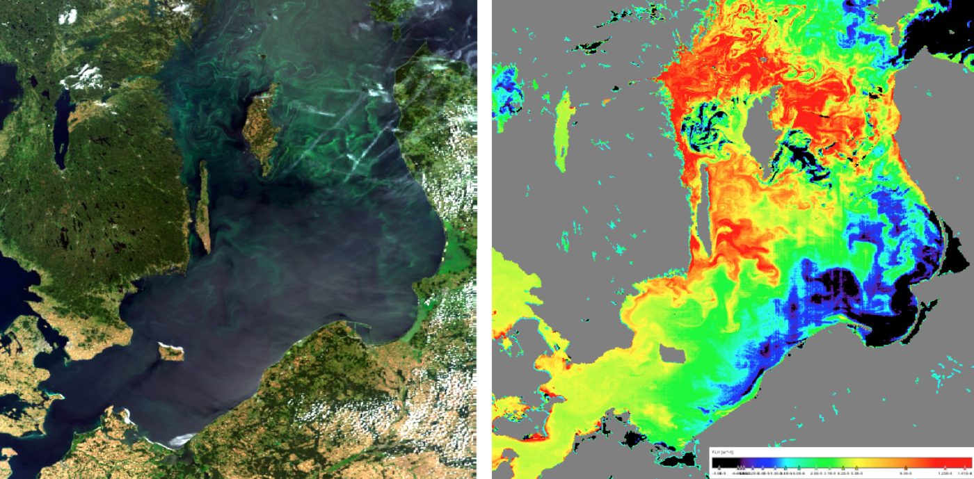
True colour image of an algal bloom spreading in the Baltic Sea on 27-07-2008 derived from MERIS (left), Chlorophyll-a fluorescence image of phytoplankton retrieved using the BEAM FLH algorithm (right).