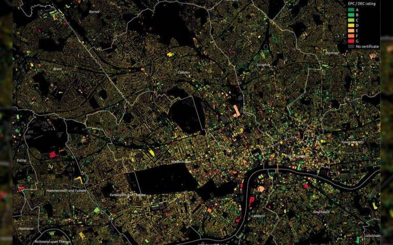
Energy efficiency of London buildings mapped in 3D by UCL researchers
14 September 2020
The 3D maps grade the energy efficiency of more than 3.5 million properties and will help the Greater London Authority tackle fuel poverty and reduce carbon emissions.

The digital models were created by a team at the UCL Energy Institute and the UCL Centre for Advanced Spatial Analysis (CASA). This project was supported by UCL Consultants (UCLC), part of UCL Innovation & Enterprise.
The models provide data on every domestic and non-domestic property in all 33 London boroughs. This includes, for each building:
- its age
- 3D proportions
- construction materials
- servicing systems
- the nature of the activities on each floor
- an energy efficiency grading
The London Building Stock Model, which took two years to build, can help identify energy inefficient buildings. This will help guide local authorities to tackle fuel poverty as well as advise retrofit programmes to improve the energy efficiency of the building stock.
The London Solar Opportunity Map reveals the potential solar energy available from London’s roofs and open land, in the form of electricity from photovoltaic (PV) installations or heat from solar thermal collectors.
Read the full story on the UCL News website.
Links
Find out more about:
- UCLC
- innovation and enterprise support for UCL staff
- support for external organisations wishing to work with UCL
- UCL Energy Institute
- UCL Centre for Advanced Spatial Analysis (CASA)
Image from the London Building Stock Model © Greater London Authority
 Close
Close

