Digital 3D models of London chart path to lower emissions
14 September 2020
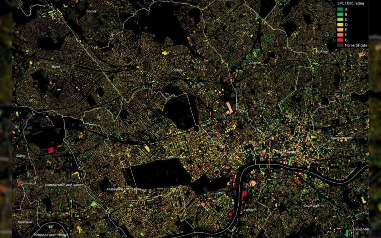
An interactive 3D map of London that grades the energy efficiency of more than 3.5 million properties has been built by UCL researchers for the Greater London Authority (GLA) to inform efforts in tackling fuel poverty and reducing carbon emissions.

The London Building Stock Model, created by a team at the UCL Energy Institute and the UCL Centre for Advanced Spatial Analysis (CASA), contains detailed data on every single domestic and non-domestic property in all 33 London boroughs. This includes the age of buildings, their 3D proportions, construction materials, servicing systems, and the nature of the activities on each floor of commercial and public buildings, as well as an energy efficiency grading for each building.
The digital model, which took two years to build, can be used to identify energy inefficient buildings and to help local authorities tackle fuel poverty as well as guide retrofit programmes to improve the energy efficiency of the building stock.
A second model, the London Solar Opportunity Map, reveals the solar energy potentially available from all roofs and open land across Greater London, either in the form of electricity from photovoltaic (PV) installations or heat from solar thermal collectors.
UCL Consultants, a part of UCL Innovation & Enterprise, provided support preparing proposals for and contracting on both projects.
Carlos Huggins, Senior Consultancy Manager for The Bartlett, said “The UCL Energy Institute team have been developing their models and accesses to underpinning robust data for years, and it is fitting that they have now a direct impact on the evolution of energy efficiency in London, opening a path to maybe supporting other cities in the future.”
Read the full piece on UCL News
Image:
 Close
Close


