 Close
Close

There is a strong emphasis on field training in all earth science degree programmes.
The field provides a natural laboratory where students can learn, apply and develop skills such as rock identification, fabric recognition, map-making, and the geometrical solving of complex three-dimensional structures, which complement and build upon lectures and laboratory-based coursework, and expose students to the true complexity of natural systems.
E-learning Fieldwork ResourcesList of video resurces and open access tools. | |
| South-West England | Properties of Minerals and Rocks |
| Ries, Germany - the site of an asteroid impact | A catalogue of minerals & textures in thin section |
| Introduction to Micropalaeontology | IsoplotR is a free and open statistical toolbox for geochronology. |
Virtual Filedwork resources:
Our staff developed a rich set of virtual resources to replace lost fieldwork opportunities during COVID-19, using drone technology, sophisticated mapping tools, and 3-D scans of samples. ES-Virtual Fieldwork
Cornwall

This fieldtrip aims to introduce (1) basic field skills, (2) basic structural geology observations, (3) igneous intrusions and geological mapping, and (4) granitic rocks and minerals, and metosomatic reactions.
Dorset

This field trip provides an introduction to Dorset coast geology of Jurassic and Cretaceous rocks (1) sediments & fossils, (2) past environments, (3) stratigraphy (4) Mezozoic Earth history, (5) geological hazards.
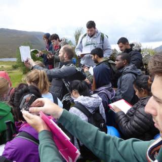
Scotland
Pyrenees, Spain

This fieldtrip introduces (1) sediment transport/deposition processes (2) palaeontological studies including living habits, fossil preservation & trace fossils, (3) structural features of an evolving fold-and-thrust belt, (4) tectono-stratigraphy of an orogen, (5) sequence stratigraphy.
Betics, S. Spain

This field course is designed as a problem-based approach. It provides 3rd and 4th Year students with an up-to-date perspective on micro- to macro-scale geological features and processes in the geological framework of crustal evolution and dynamics.
Ries Impact Crater, S. Germany

This field course explains the formation of the impact crater. The impact extinguished all life within a radius of 100 km and had a lasting effect on the landscape. We examine unique rocks formed by the shock pressures associated with meteorite impact and study the endemic salt lake unique habitat.
Fieldwork is a compulsory component of each degree programme and all fieldwork is assessed. Field classes are structured so that there are specific exercises that must be completed to a high standard and handed in for assessment. These exercises may be undertaken as part of a team, so that as well as developing skills as an earth scientist, students should also be able to develop the personal transferable skills needed to organise, delegate and participate in teamwork activities. Many students find fieldwork one of the most enjoyable parts of their undergraduate career. It is essential to have suitable clothing and equipment, and to strictly observe standard codes of practice with respect to safety, behaviour and land access. Fieldwork Curriculum