 Close
Close

CASA Seminar Series 2023-24
20 March 2024, 4:00 pm–5:00 pm
This academic seminar series explores a broad range of topics such as data science, urban planning and urban networks and their impact on the dynamic of cities.
Event Information
Open to
- All
Availability
- Yes
Organiser
-
Dr Fulvio D. Lopane
Location
-
CASA Room 106/107UCL Centre for Advanced Spatial Analysis90 Tottenham Court RoadLondonW1T 4TJ
The CASA seminar series explores topics like urbanism, data science, geography, planning, complexity, and network science. It is a chance to learn from experts in these fields and engage in discussions with fellow attendees. Each seminar will feature presentations and discussions, offering insights into how data science is impacting our understanding of cities, the ins and outs of urban planning, and the complexities of urban networks.
Whether you're a professional in these fields, a student looking to expand your knowledge, or just someone curious about the dynamics of cities, the CASA Seminar Series is a great opportunity to gain insights and connect with others who share your interests.
This series runs weekly in a hybrid format with the opportunity to join in person at CASA's Living Laboratory in London or engage online. The series is curated by Dr Fulvio Lopane and Dr Ollie Ballinger.
Please sign up to each individual event in the drop down below for both in-person and online attendance.
Please note the seminar on the 3 October is at a one off time of 3pm on Tuesday. All usuall seminars are 4pm on a Wednesday.
- 3 October | 15:00 | Dr Takahiro Yabe
Resilience of urban socioeconomic networks to behavioural changes
Abstract
Urban economic resilience hinges on understanding how shocks propagate across local businesses and amenities during pandemics, disasters, and technological shifts. While disruptions in supply chains and physical infrastructure have been extensively studied, it is imperative to recognise that human behaviour changes may also amplify shocks to businesses and amenities that are connected via mobility and lifestyle patterns. In this talk, I will present novel network-based methods that leverage large-scale human mobility data to predict the network cascades of urban shocks, and further discuss policy applications to design infrastructure systems to achieve urban resilience.
Biography
Dr Takahiro Yabe (Taka) is a Postdoctoral Associate at the MIT Institute of Data, Systems, and Society (IDSS) and the Media Lab with Alex 'Sandy' Pentland and Esteban Moro. His research focuses on computational social science and network science approaches to model the resilience of cities to disasters, pandemics, and disruptive mobility technology. He obtained his PhD from Purdue University in 2021, and his MS and BS from the University of Tokyo in 2017 and 2015, respectively. He is an incoming Assistant Professor in the Center for Urban Science and Progress at New York University, starting January 2024.
This event has been co-organised with Dr Neave O'Clery. This event is at a one off time of 3pm on a Tuesday. All usual seminars are 4pm on a Wednesday.
- 11 October | 16:00 | Grant Tregonning
Participatory urban analytics for mapping in deprived areas
Abstract
The IDEAMAPS project has co-designed and developed a participatory data-modelling ecosystem to produce deprived area maps routinely and accurately at scale across cities in lower middle-income countries (LMIC) to support multiple local stakeholders in their decision-making.
IDEAMAPS combines artificial intelligence (AI) analysis of earth observation data with community mapping and engagement to improve how we define and understand areas of deprivation ("slums") in cities. The project integrates multiple public, official, and community-generated datasets to produce granular surface maps of deprived areas across individual cities.
Working with collaborators from the pilot cities in Nigeria (Lagos and Kano) and Kenya (Nairobi), the IDEAMAPS project will generate new data and enhance the capabilities of various stakeholders to understand and address urban poverty, health, and well-being. The result is that community members and decision-makers will have an improved, co-produced evidence base, as well as strengthened communication networks based on common understandings and trust. These outcomes will support pro-equity interventions to effectively address current issues on urban planning, slum upgrading and urban health.
Biography
Grant Tregonning is a geospatial scientist with a particular interest in climate change, sustainability, inequalities and citizen science. He mainly uses participatory urban analytical methods to understand issues associated with urban sustainability and liveability in deprived areas. He is currently situated at the Urban Big Data Centre within the University of Glasgow and is working on the 'IDEAMAPS' project and is also part of the centre's Data Service programme.
Prior to joining Glasgow, Grant was a Research Fellow in Geospatial Data Science at the University of Warwick, and worked on a number of projects including the 'Creating Interfaces', 'Slum Mapping' and 'Data & Displacement' initiatives. Previous to Warwick, Grant was a Visiting Research Fellow at the University of Auckland and completed a PhD in Geospatial Science at Newcastle University.
- 18 October | 16:00 | Chris Thompson
Delivering Commercial Location Intelligence
Abstract
Location intelligence and spatial data science have seen a rapid rise in adoption in the last 5 years. In part, this has been driven by significant advancements in technology, new data sources and the need to understand inherently local behaviour across the globe. Many organisations from retail, financial services, telecommunications through to governments are now putting location at the centre of its analytics functions. Chris Thompson will be discussing the practical uses cases of location intelligence and the direction he see's the capability developing in the future – specifically focusing on the emergence of GeoAI and the opportunities presented by generative AI.
Biography
Dr Chris Thompson has a 15 years experience in Location Intelligence (LI), analytics, data science and Business Intelligence (BI) – underpinned by a mix of consulting, in-house and academic roles.
- 25 October | 16:00 | Federico Messa
Free-flow car-sharing - Toward a Vehicle Allocation Model
Abstract
During the last few years, sharing mobility has been one of the emerging transport modes, but seldom its planning is entrusted to private operators and not seen as a major vector of urban mobility. The understanding on how the introduction of sustainable and shared vehicles has an impact on the overall movement pattern of a city is still an open conversation.
Given the Internet of Things (IoT) aspect of sharing mobility, vehicle locations are constantly collected along with many other diagnostic information. This factor leads to the opportunity to analyse the utilisation patterns, with the scope to understand how this service is used to move around the urban environment.
This seminar will focus on two Transform Transport research projects about free-flow car-sharing data in the city of Milan, Italy. The first project consists of the analysis of demand data by analysing its temporal and spatial nature. Since both these dimensions are influencing the utilisation patterns: time-invariant factors (e.g., resident population density, etc.) and time-variant factors (e.g., public transport offer) are taken into consideration and analysed in relation to starting and ending point of rentals, and OD couples’ characteristics. The second project was done in collaboration with a carsharing operator in Milan. Zity by Mobilize, and the NYU CUSP (Center for Urban Science and Progress), focusing on operational optimisation through spatial and user-segmented demand analysis.
The two projects exemplify a non-network-based approach to understand demand patterns, by linking the service utilisation to the city characteristics, with a particular focus on the opportunity to anticipate the demand and streamline operational strategies.
Biography
Federico Messa is Senior Researcher at Fondazione Transform Transport ETS and Senior Consultant at Systematica. He is an Architect who has been active as a transport consultant on a diverse set of projects that range from territorial studies to master plans and complex buildings mobility strategies. Federico is also involved in architecture and mobility research studies mainly related to urban dynamics, mobility data analysis and visualisation, project performance analysis, and spatial analysis.
- 1 November | 16:00 | Sarah Wise
Complex Symptoms: Understanding epidemics from the perspective of complexity science
Abstract
The epidemic outbreak of disease is now perhaps the prototypical example of a complex system. From non-linear surges in case numbers to the disproportionate impact of individuals in varying contexts, epidemics are certainly more than the sum of their individual parts. In historical epidemics of bubonic plague, Spanish Flu, and Ebola virus, we can see how human behaviour has driven the rise and fall of case numbers. Patterns in mobility, demographics, cultural practices, and even governance can have profound impacts on the health of populations. Humans are not alone in this - animals too are subject to epidemics, which intersect with human civilisation in profound ways. What similarities can we see in the outbreak of disease across time and space? What dynamics can we identify, which we should ensure that we incorporate into models and simulations in this domain?
Biography
Sarah Wise is an Associate Professor of Agent-Based Modelling at the Centre for Advanced Spatial Analysis, UCL. Her current work is part of a Future Leaders Fellowship grant, for which she is collaborating with Médecins Sans Frontières and the British Red Cross to develop simulation of the spread of disease as a function of human behaviour and movement. In general, her research deals with exploring and forecasting the development of systems involving people, infrastructure, and information.
- 15 November | 16:00 | Sondre Solstad
How The Economist uses satellite data to track conflict
Abstract
Most data on conflict is only available long after the shooting ends. Commanders do not publicise their war plans or activities: and numbers released by warring parties are, naturally, to be taken with more than a grain of salt. In this talk, Sondre will introduce some of the ways in which he and the data team at The Economist use satellite data to cover conflict in real time. He will illustrate their methods using concrete examples from Ukraine, Sudan, China and Gaza. He will then briefly discuss some of the special challenges faced by data journalists who cover conflict, and where the field might be headed. The talk will conclude with a Q&A.
Biography
Sondre Solstad is The Economist’s Senior Data Journalist. He writes data-driven articles, as well as models, algorithms and simulations. He is received a doctorate from Princeton University in 2019, and since September 2022 has been an affiliate at the Institute for Quantitative Social Science at Harvard University, which is dedicated to solving society’s greatest challenges through bold and collaborative social science. Since starting at the Economist in February 2020, his journalistic work has been cited in over 100 academic publications, by BBC World News, Le Monde, Der Spiegel, the New York Times, Wired, Foreign Policy, New York Magazine, Politico, Nature, The BMJ, National Geographic, New York Magazine, CNN, the UN, WHO, World Bank, in the annual lecture of the Royal Medical Society in the UK, and many others.
- 22 November | 16:00 | Dan Stockdale, Gaila Comesana Gonzalez and Obi Thompson Sargoni
Immersive simulation exercises for responding to terrorist attacks in crowded venues - & - Spatial data science for national infrastructure
Abstract
This is a two-part talk presented by the Movement Strategies and Insights and Analytics teams at GHD.
Part 1: The Movement Strategies team will focus on a government funded research project into how people respond to terror attacks in crowded venues. The team develops behaviourally realistic models of people movement, using this to inform security control room response and operational plans.
Part 2: The Insights and Analytics team will discuss how they use spatial data science to model national infrastructure. They will discuss how to use methodologies like discrete simulation, machine learning, and geocomputation to answer questions around mobility, sustainable farming, and rail infrastructure.Biographies
Dan Stockdale is a Managing Consultant at GHD having completed the MSc Geospatial Analysis at UCL in 2016. Over the past six year has delivered high-profile projects for stadia, arenas and major events including most recently for the Qatar 2022 World Cup and the Birmingham Commonwealth games.
Gaila Comesaña González is a Consultant at GHD. She attended the MSc Mathematical Modelling at UCL and has since been working as a people movement specialist, with a focus on sports and major events. Currently, Gaila is working in the expansion of the FC Barcelona and Manchester City FC stadia, as well as on the presented terrorism response modelling project.
Obi Thompson Sargoni is a Senior Advisor at GHD. Obi completed a PhD at CASA in 2023 and prior to that worked for an Open Data consultancy. Currently, Obi is working on producing national datasets related to farming and the natural environment and is working towards a national wildfire risk model.- 29 November | 16:00 | Stef De Sabbata
Exploring the use of graph neural networks for urban analytics
Abstract
As graph theory has provided one of the core analytical frameworks used in urban studies, the recent development of graph neural networks offers the opportunity to explore new GeoAI approaches in urban analytics. In this talk Dr De Sabbata will present two studies exploring the use of unsupervised graph representation learning.
The first is a systematic investigation of graph neural networks for spatial geodemographic classification. Using Greater London as a case study to compareda range of graph autoencoder designs with the official London Output Area Classification and baseline classifications developed using spatial fuzzy c-means. The results show that this framework can perform similarly to classic approaches on class homogeneity metrics while providing higher spatial clustering.
The second is a preliminary study investigating the use of graph neural networks to explore a simple understanding of urban form based on street networks. The results illustrate how an unsupervised model can be trained to generate embeddings that are similar but distinct from classic metrics and capture key aspects such as the shift from urban to suburban areas. Dr De Sabbata will conclude by discussing the challenges and opportunities posed by GeoAI in urban analytics.
Biography
Dr Stef De Sabbata is an Associate Professor of Geographical Information Science at the School of Geography Geology and the Environment and Research Theme Lead for Cultural Informatics at the Institute for Digital Culture of the University of Leicester. Their research focuses on geographic data science and the application of artificial intelligence to human geography and internet studies. They teach data science, geographic artificial intelligence, information visualization and GIS. They are the Chair of the Geographic Information Science Research Group of the Royal Geographical Society with IBG and part of the steering committee of GIScience Research UK (GISRUK).
- 13 December | 16:00 | Giulia Jole Sechi
Data Collection and Mapping in the Humanitarian Sector
Abstract
In case of natural disasters, data collection and mapping are two crucial components of emergency responses, which should be fast and efficient. Miyamoto International responded to more than 100 earthquakes in the last 50 years, and witnessed and participated in the evolution of the approaches in the humanitarian sector. This seminar will share the findings and the methodology that, among the others, allowed Miyamoto International to assess 180,000 houses in 5 months in Haiti, reach 41,000 households in Turkey, evaluate 5,000 of apartments and 80 schools in Ukraine, working together with local partners, NGOs and UN agencies. When combined with data collection, mapping can be used in several different ways that are variably useful for humanitarian scopes. Some of them are a game changer and have a real impact on people's lives.
Biography
Giulia Jole Sechi is a Project Manager and Structural Engineer who has worked on projects in Italy, Peru, Chad, New Zealand, India, Tanzania, Nepal, Haiti, Afghanistan, Ukraine, Turkey, Syria, Morocco and Gabon. Over the last 10 years, among others, she has been involved in early emergency responses, post-disaster and post-conflict reconstructions. With Miyamoto International, Giulia has created and implemented damage and repair assessments programs, developed and conducted training courses, built relationships with local authorities, and liaised with donors. Currently, she is also undertaking a PhD on the role of digital technology in Disaster Risk Reduction at the Internacional Universitat de Catalunya.
- 10 January | 16:00 | Professor Les Hatton
Why and how Zipfian power-law behaviour dominates (nearly) all discrete systems
Abstract
Starting with coloured beads this seminar demonstrates two fundamental ways in which power-law behaviour comes to dominate nearly all discrete systems. One of these is immediately recognisable as the venerable Zipf’s law with a slight twist and the other turns out to model extremely precisely, the length distributions of systems as diverse as software components (measured in programming language tokens) and proteins (measured in amino acids). The culmination of 15 years research, this behaviour and its proof can be traced forward across 50 centuries, spanning the development of written language, the kinetic theory of gases, the emergence of information theory and digital communication and on into digital biology and the genome.
Biography
Les Hatton is an Emeritus Professor of Computer Science. He graduated from King’s College Cambridge in mathematics and did his Ph.D. at the University of Manchester. He was a geophysicist in the early part of his career for which he was awarded the Conrad Schlumberger prize. With his co-author the biochemist Professor Greg Warr, he is responsible for the discovery of the Fundamental Law of Inequality.
- 17 January | 16:00 | Greg Sheng
Powers of Ten
Abstract
In pursuit of an improved, safer, more environmentally resilient, ecologically sustainable, and energy-efficient "new global urbanism," our extensive experience in the professional field has allowed us to amass diverse strengths and establish a robust operational platform.
However, to advance our aspirations, we are seeking insights, contributions, and active engagement from experts in the field of data science. In the “Powers of Ten” seminar, we will present two of our current working projects and highlight the potential of how data science can be engaged in these two collaboration opportunities, like quantifying strategies for net zero goals, and supporting self-sustaining agriculture systems in developing countries.
Biography
Greg Sheng is an architecture and planner adviser with a career spanning the Far East and the UK. Currently serving as the Senior Urban Planning and Architecture Design R&D Director at CY Lee & Partners/Dayuan Architecture, and Managing Director at TCK Global's Prefabrication Green Building System R&D Centre. With 15 years in the Far East and a decade in the UK, Greg has made significant contributions to renowned firms such as Foster and Partners, Glas Architects London, and Lab Architecture Studio London. Alongside his professional accomplishments, he has dedicated seven years to senior lecturing positions at UEL University, London Met University, and UAL University.
- 24 January | 16:00 | Mateo Seré
Don't Stop Me Now: Gender Attitudes in Academic Seminars Through Machine Learning
Abstract
This study, utilising a novel dataset from economic seminar audio recordings, investigates gender-based peer interactions, structured around five key findings: (i) Female speakers are interrupted more frequently, earlier, and differently than males; (ii) the extra interruptions largely stem from female, not male, audience members; (iii) male participants pose fewer questions but more comments to female presenters; (iv) audience members of both genders interrupt female speakers with a more negative tone; (v) less senior female presenters receive more interruptions from women.
Biography
Mateo Seré is a Ph.D. candidate at the University of Antwerp (Belgium). He holds a Master Degree in Applied Economics (University of Antwerp) and a Master Research in Economics (Université Libre de Bruxelles). His interests lie in the fields of applied microeconomics with a focus on artificial intelligence, economic policy and measurement of well-being.
- 31 January | 16:00 | Dr Alina Ristea
Spatial crime distribution and prediction for sporting events
Abstract
Crime concentrates in small areas, and it is highly dependent on the surroundings and precipitators. Numerous studies demonstrate that gatherings of sizable crowds in a location (e.g. stadiums) can both attract and contribute to violence. With an emphasis on sporting events, the current session highlights relevant research, approaches, and potential directions for stadiums as particular activity nodes influencing criminal behaviour. The works often correspond to two subsets: one for the game days and one for the comparative days. Routine activities around stadiums change on game days, which might result in spatiotemporal shifting crime hotspots both inside and beyond the area—for example, at pubs or bars where people congregate to watch games. In addition to the standard crime hotspot analysis that combines proximity or density of risky points of interest, this work will address the significance of including dynamic spatiotemporal and contextual factors (such as social media) into the framework. Additionally, the significance of several risk factors and the biases present in crime prediction models will be discussed.
Biography
Dr. Alina Ristea an Assistant Professor in Security and Crime Science at the Department of Security and Crime Science, UCL. Her PhD is in GeoInformatics from the University of Salzburg, Austria, working on the “Integration and Evaluation of Social Media in Crime Prediction Models”. During her PhD studies she was a visiting research scientist at Simon Fraser University, University of Virginia, Krakow University and Louisiana State University. She worked for two years as a postdoctoral research associate at Northeastern University, School of Public Policy and Urban Affairs. She is an academic with broad research interests in spatial crime analysis, social media mining, predictive analytics, safety perception, neighbourhood disorder, GIScience, and urban informatics.
- 7 February | 16:00 | Yu Tian
Role Extraction, dynamics, and optimisation on networks
Abstract
There are many fundamental problems in industry that are also of great research value. With our industrial partner Tesco, we were particularly interested in the retail industry, where one primary problem would be to understand the intrinsic relationships between products, including complements and substitutes. Once such relationships have been estimated, a subsequent problem would be to understand the inter-related demand changes between products, and further to make decisions, e.g. on which products should we implement promotions in order to maximise the overall revenue at the end of the promotional period.
In this talk, we will first formulate the problem of identifying product relationships as role extraction on networks, and propose a novel data-driven network-based approach for this purpose. Then we will model the propagation of demand change as information spreading on networks, and consider its optimisation as a variant of the classic influence maximisation problem, first on simple networks only of one relationship and then on signed networks of two competing types of relationships. To do so, we will introduce a general class of model, unifying the mechanisms underlying the classic spreading models while accounting for specific features of demand dynamics, and a framework for the corresponding influence maximisation, via a customised direct search method with local convergence.
Biography
Yu Tian is a research fellow at the Nordic Institute for Theoretical Physics (Nordita), funded by Wallenberg Initiative on Networks and Quantum information. Yu received her PhD from the University of Oxford, where she was supervised by Renaud Lambiotte. Her PhD research was in collaboration with Tesco, where she has developed various data-driven methods based on structural and dynamical properties of networks, inspired by several important industrial problems. Her research interest lies in the broad area of network science and data science, including dynamics and optimisation, the incorporation of negative signs and complex values, and community detection.
- 21 February | 16:00 | Dr Jia Wang
Mapping Minds: Revisiting My Doctoral Study a Decade Later in the Era of GeoAI
Abstract
Analysing mental maps provides insights into the ways we memorise, encode, understand, and reason about our surroundings. One method to externalise these mental maps is through sketch mapping. We found that sketch maps typically include representations of real-world geographical features, the spatial relationships between these features, and often incorporate symbols and text. Generally, sketch maps preserve only the qualitative relationships of limited spatial features. Despite their incompleteness and inaccuracies, we efficiently use these sketch maps to communicate about our environment and to navigate within it. Regrettably, such human spatial intelligence has not been effectively captured and integrated into the current wave of GeoAI. The predominant methodologies in GeoAI are heavily data-driven, overlooking the human-level intelligence of spatial understanding and conceptualisation. With navigation as an example, we demonstrate the necessity of integrating human intelligence to comprehend and learn spatial perception and cognition, as well as the importance of including ‘common sense’ knowledge that is essential for effective wayfinding.
Biography
Jia Wang currently works as a senior lecturer in spatial data science at the University of Greenwich. Her research is centred on spatial cognition, knowledge representation, and the processes of wayfinding and navigation, with a particular emphasis on promoting sustainable travel within urban environments through the development of formal and computational models. Additionally, Jia is actively involved in research dedicated to investigating accessibility and inequality affecting marginalised communities.
- 28 February | 16:00 | Prof Joshua Epstein
Generative and Inverse Generative Social Science: Agent_Zero, the Rational Actor, and Beyond
Abstract
The agent-based model is the principal scientific instrument of generative social science, whose principal tenet is that: to explain a macroscopic pattern, it does not suffice to demonstrate that the pattern is an equilibrium. Rather one must demonstrate, mathematically or computationally, how the pattern could emerge on time scales of interest in a population of cognitively plausible agents. Although systematically violated by humans, the rational actor model persists as the dominant idealisation in the social sciences for lack of explicit formal alternatives. Epstein’s Agent_Zero is one candidate. Based on cognitive neuroscience, Agent_Zero generates important macro-phenomena and group behaviours that violate Rational Choice Theory. Applications to violence, epidemics, and financial contagions are discussed.
Agent_Zero is an example of the “intelligent design” of completed agents - fully endowed with rules and parameters to grow macroscopic target patterns from the bottom up. Inverse generative science (iGSS) stands this approach on its head: Rather than handcrafting completed agents to grow a target - the forward problem - we start with the macro-target and evolve micro-agents that generate it, stipulating only primitive agent-rule constituents and permissible combinators. Rather than specific agents as designed inputs, we are interested in agents-indeed, families of agents as evolved outputs. This is the backward problem and tools from AI and Evolutionary Computing can solve it, extending the reach of agent-based modelling, while addressing common criticisms of it. Examples of iGSS and outstanding foundational issues surrounding it are discussed. An important goal of iGSS is to evolve further formal alternatives to the Rational Actor, with Agent_Zero as one possible point of evolutionary departure.
Biography
Joshua M. Epstein is Professor of Epidemiology and Affiliated Faculty at the Courant Institute of Mathematical Sciences and the Department of Politics. He is founding Director of the NYU Agent-Based Modeling Laboratory and External Faculty Fellow at the Santa Fe Institute. He was Professor and founding Director of the Johns Hopkins Center for Advanced Modeling in the Social and Behavioral Sciences, with Joint appointments in Economics and Applied Mathematics. Earlier, he was Senior Fellow in Economic Studies at the Brookings Institution. He models complex social dynamics using mathematical and computational methods, notably the method of Agent-Based Modeling in which he is a recognised pioneer. For this innovation, he was awarded the NIH Director’s Pioneer Award, an Honorary Doctorate of Science from Amherst College, and other distinctions. Epstein’s seven books include Nonlinear Dynamics, Mathematical Biology, and Social Science (Wiley); Generative Social Science (Princeton; Agent_Zero (Princeton)), and with Robert Axtell, Growing Artificial Societies (MIT). Epstein holds a BA from Amherst College and a Ph.D. from MIT.
- 6 March | 16:00 | Steve Halsall
Taking the next step in your career - from CV to your ideal job
Abstract
This presentation, drawing on Steve's c30 years in the geospatial industry, will provide sound advice on stages of the job search process, from understanding your strengths, developing your skills, marketing yourself (CV, LinkedIn), through to the perfect interview.
Biography
Steve Halsall has worked in analytics for over 25 years – with various senior roles in consulting and client side. He is also an experienced entrepreneur – having successfully started 5 businesses to date, two of which went on to be acquired.
- 13 March | 16:00 | Juliana Gonçalves
Spatial Justice in Practice: Combining Critical Theory and Data Science to Inform Policy
Abstract
In the late 1960s and early 1970s, when social and political movements of unprecedented strength exploded around the world, urban scholars and academics were propelled to include a moral dimension into studies about the urban environment and the urban living condition. This movement was the origin of critical urban theory. The period also witnessed a “spatial turn”, marked by the incorporation of socio-spatial dialectics in urban studies to conceptualise the complex interrelationship between social and spatial structures in cities. Here emerges the concept of “spatial justice”, emphasising that the spatial arrangement of (in)justice significantly impacts society and social life, just as social dynamics shape spatial patterns of (in)justice. Over the past years, spatial justice theory has provided a solid basis for qualitative studies, shedding light on the importance of place and space across various topics, such as housing and transportation. More recently, spatial justice scholarship has also served as a theoretical foundation for quantitative studies.
This seminar provides a brief overview of spatial justice scholarship, followed by two applied examples where critical theory intersects with data science to inform energy policy in Dutch municipalities through a spatial justice lens. The first example highlights cumulative and multidimensional factors of energy poverty across the city of Amsterdam, while the second reveals socio-spatial inequalities in the energy transition in The Hague. These case studies demonstrate the potential of a spatial justice approach to elucidate the complex interplay between social and spatial factors in data-driven analyses, advocating for policies tailored to the socio-spatial characteristics of the urban population with a focus on vulnerable groups. *Figure: London Poverty Map, 1898-9. Sheet 1: eastern district by LSE Library on Unsplash
Biography
Juliana Gonçalves is an Assistant Professor in the section of Spatial Planning and Strategy, Department of Urbanism, TU Delft. She is also the co-director of the Centre for Urban Science (CUSP), a member of the Centre for the Just City, and contributes to the TU Delft Climate Action Program and the Delta Urbanism Interdisciplinary Research Program. Juliana has an interdisciplinary background and works at the intersection of social sciences and urban planning, design & engineering, often combining quantitative and qualitative research methods. Through the lenses of spatial justice, she draws from feminist and decolonial scholarship to understand socio-spatial dynamics in cities, with a focus on energy transition and climate adaptation. She is interested in how citizens and stakeholders engage with or react to urban transitions and how urban transitions impact people and communities, interacting with and often reinforcing existing inequalities.
- 20 March | 16:00 | Cate Heine
Leveraging Geospatial Data to Understand Social Mixing in Cities
Abstract
As the world rapidly urbanises, understanding the nuances of how people move through urban areas, access one another, and form social connections is critical to designing sustainable, equitable cities. In this talk, Cate Heine outlines two studies that leverage large-scale, passively-collected geolocation data to characterise urban mobility and experienced segregation in cities. These studies highlight the value of fine-grained mobility data in understanding the types of urban spaces and layouts that foster social interactions between diverse groups of people and those that exacerbate social segregation.
Biography
Cate Heine is a Research Fellow studying equity and segregation in transportation systems at the Centre for Advanced Spatial Analysis at UCL. She recently completed her PhD in Social & Engineering Systems at MIT, where she was a research assistant in the Senseable City Lab. Her PhD thesis focused on using large-scale human mobility datasets to study the impact of urban design choices on social mixing and experienced segregation in cities.
Watch Previous Seminar Recordings:
More Information:
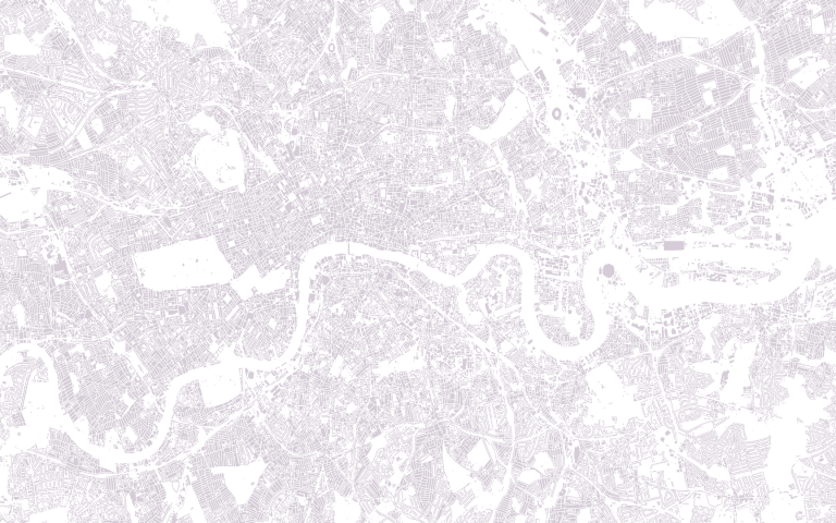
Image: Data Output created by Dr Fulvio Lopane from The London Data Store