This module concentrates on two aspects of archaeological remote sensing: terrestrial geophysical survey and satellite image processing.

The module teaches skills useful in both the commercial and academic sectors.
The module includes a detailed examination of the main geophysical survey techniques: Earth Resistance survey, magnetometry, Ground Penetrating Radar and magnetic susceptibility. Lab-based exercises in the processing of geophysical survey data and their incorporation into a GIS system are provided using TerraSurveyor and QGIS.
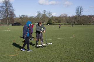
A two-day field class at Verulamium, the Roman city at St Albans, Hertfordshire, is run during reading week.
The processing and analysis of satellite imagery includes practical classes using GIS and ENVI software.
The module is assessed via an essay and a practical portfolio.
Aims of the module
The module aims to provide:
- An advanced knowledge of remote sensing techniques
- Practical experience of geophysics and survey equipment
- The statistical and theoretical concepts behind image-based processing and classi fication
Teaching Methods
A mixture of lectures, computer-lab practicals and fieldwork.
Module information
- Code: ARCL0143
- Credits: 15
- Coordinator: Kris Lockyear
- Prerequisite: There are no formal prerequisites for this module, but it is strongly recommended that students have at least some prior experience of GIS.
- Handbook: open»
For registered students
- Reading list:
Availability
- Running in 2023-24
 Close
Close


