 Close
Close

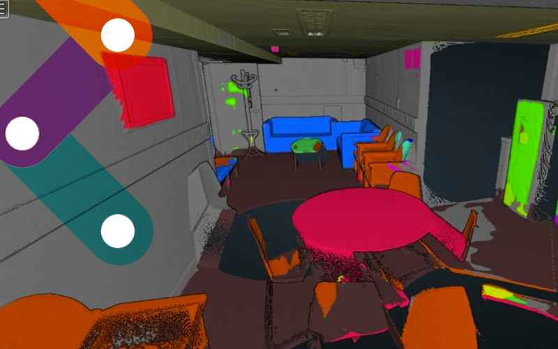
Semantic Segmentation of Terrestrial LIDAR Data Using Co-Registered RGB Data
To develop a method for semantic segmentation of 3D point cloud using 2D Convoluted Neural Networks (CNNs).
28 July 2021
Abstract
This project proposes a semantic segmentation pipeline for terrestrial laser scanning data. We achieve this by combining co-registered RGB and 3D point cloud information. Semantic segmentation is performed by applying a pre-trained off-the-shelf 2D convolutional neural network over a set of projected images extracted from a panoramic photograph.
Publication: Publisher