 Close
Close

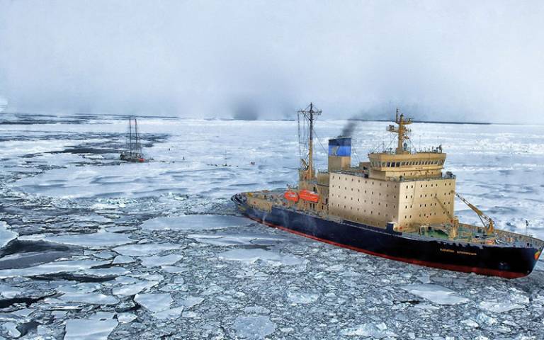
Mapping the Arctic in partnership with those who use the seas
Professor Julienne Stroeve, within the NERC Centre for Polar Observation and Modelling (CPOM) in UCL Earth Sciences, started a network called the Sea Ice Prediction Network (SIPN) in 2013
27 September 2021
SIPN (now in its second phase and referred to as SIPN2) aims to bring together scientists and stakeholders to improve sea ice forecasts and provide a more efficient service for end-users.
Professor Stroeve received Global Engagement Funds, which allowed her team to run a workshop with a wide variety of stakeholders who used these predictions. As a valuable source of engagement and information, this workshop proved essential to progressing this project and growing its broad network.
This study was originally funded from a variety of agencies in the United States, including the National Science Foundation (NSF), National Oceanic and Atmospheric Administration (NOAA), Office of Naval Research (ONR), Department of Energy (DoE) and NASA. In 2018, joint funding from NSF and the Natural Environment Research Council (NERC) secured the continuation of SIPN.
Seasonal sea ice predications – essential information for many
Being able to predict the formation and movement of sea ice in the Arctic is essential for organisations and groups (referred to as stakeholders) such as:
- Ship operators and shipping companies
- Tourism companies
- National, regional and local policy makers and planners
- Those working in affected industries such as fishing and resource extraction
- Local and indigenous communities who rely on the ice for travel and subsistence hunting
- Research scientists
There were many different ways of reporting, analysing and communicating the data, which weren’t always efficient or ideal (for example much modelling is created for climate use and it’s difficult to model sea ice thickness accurately).
There was also little understanding of how stakeholders actually integrated the data into their planning and what the economic benefits were for them.
SIPN2 aims to improve the predications by better understanding their use by stakeholders, providing more visualisation and mapping outputs, improve their accuracy and better communicate uncertainties.
Funding to bring people together
The Global Engagement Funds helped Professor Stroeve’s team partner with the Climate and Cryosphere (CliC) project, the Arctic Research Consortium of the U.S. (ARCUS) and the Norwegian Polar Institute (NPI) to host a workshop at the Arctic Frontiers Conference.
The interactive workshop was a vital platform for sea ice forecasters to hear directly from stakeholders – to hear if they use their forecasts, and if so, whether they base economic decisions on them.
It was also a vital opportunity to increase engagement within the user community and understand what they need. It was important that the entire community contribute and help inform the research so that the prediction tools would be beneficial to them.
Professor Stroeve describes the funds as being “critical in helping us to bring folks to the meeting to participate in the discussions”.
A huge network working for a common cause
Building on the initial work of SIPN, they are now in phase two (SIPN2) using a multi-disciplinary approach to improve the modelling, data analysis and nurturing the scientific and stakeholder networks.
With further joint funding from National Science Foundation Arctic Sciences Section (NSF) and Natural Environment Research Council (NERC), the team is focused on regional sea ice forecasts and the economic benefits of these forecasts.
A new paper recently accepted in Polar Geography by SIPN2 team members and a co-organiser of the stakeholders workshop, supported by Global Engagement Funds, details how a better understanding of user needs can improve the usability of forecasting systems and tailoring of satellite data products.
Prof Stroeve said: “Insights into user needs shows how there is no one product that fits all, and specific products will need to be developed at multiple spatial and temporal resolutions depending on the end-user.”
More information
- Professor Julienne Stroeve’s academic profile
- The Sea Ice Prediction Network (SIPN)
- Arctic Frontiers Conference
For the latest news about UCL’s international activity, partnerships and opportunities, subscribe to the bimonthly Global Update newsletter.