 Close
Close

Location: Kathleen Lonsdale Building, Basement Level
Telephone Extension: 56317
Laboratory Manager: Neil Hughes
- General conditions for borrowing
1. Management of the equipment is by Neil Hughes.
2. Bookings should be made by contacting Neil Hughes.
3. Insurance:
- For UCL members, extra insurance must be arranged when the equipment is taken off-site. This must be arranged through the departmental administrator (Mrs Celine Ahmed). You must provide an account code to which this is to be charged.
- For non-UCL members, insurance must be arranged by your institution. Any transit arrangements made for the equipment must be met by your institution’s insurance polices. Please notify your department of any arrangements made.
4. Priority for booking will be given in the following order:
1. Taught courses and taught field classes
2. Research projects by staff and students
3. Research projects in other UCL departments
5. Trained personnel only will be allowed to use the equipment.
6. Technical support will be provided by Neil Hughes. Serious problems can only be dealt with by the manufacturer.
7. Repairs. In the event of equipment being damaged it is the responsibility of the member of staff running or supervising project work to report any problems to Professor Peter Sammonds or Neil Hughes.
8. Equipment must be checked out and checked back in again by Neil Hughes
9. A small charge will be made for use, to be put towards equipment maintenance and upkeep.
10. Commercial hire rates are negotiable.
11. Separate conditions apply for the Ground Penetrating Radar- Geophysics field equipment bookings calendar
If your chosen dates are available, please confirm availability by emailing Neil Hughes as far in advance as possible with your request, stating:
- Equipment Required
- Dates
- Purpose and Location of where equipment will be used.
Google Calendar Widget Placeholdern.hughesucl@gmail.com
General Conditions of Use:
Geophysics field equipment is available for use by qualified staff and students members of the London Colleges Geophysics Field Equipment Pool.
List of Equipment
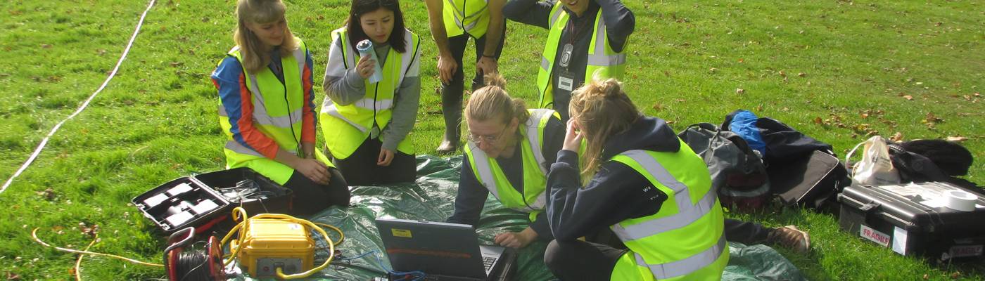
- Ground Penetrating Radar(GPR)
Sensors and Software pulse EKKO PE-100A GPR (1000V) system with 100 and 200MHz antennae.
Introduction
Ground penetrating radar (GPR) has recently become the must-do geophysical survey technique because of its ease of use and unparalleled ability to image the near sub-surface in detail. In archaeology it is used to locate burial grounds and determine buried structures (most famously, the Tomb of Christ beneath the Church of the Holy Sepulchre). In geology it is used to map sedimentary structures (e.g. ancient lake beds, braided river channels). In geography it is used to characterize sand dunes, glacial moraines and glacial ice stratigraphy. In civil engineering it is used for site investigation, to determine soil properties, log deterioration in structures (such as bridges) and locate utilities, buried pipes and cables. In environmental science it is used to locate buried waste drums, groundwater, contaminant leaks or plumes.
Details of equipment
Purchased: 2002 Cost: £30k Condition: Excellent
Funded by: UCL Supplementary Teaching Equipment Grant (50%); Birkbeck College, School of Earth Sciences (50%).
Notes: The equipment is not weather-proof so plastic bags must be taped around transmitter & receiver, and the laptop needs to be kept dry. Car battery is needed for operation.
GPR equipment is also available from Kings College. Contact Mark Mulligan for further details.Borrowing the equipment Conditions Of Use:
1. Management of the equipment loans is by Dr Charlie Bristow (Birkbeck College)
2. Booking Requests should be made through Dr Charlie Bristow or Neil Hughes.
3. Insurance: The equipment is owned by UCL and insured by UCL.
- For UCL members, extra insurance must be arranged when the equipment is taken off-site. This must be arranged through the departmental administrator (Mrs Celine Ahmed). You must provide an account code to which this is to be charged.
- For non-UCL members, insurance must be arranged by your institution. Any transit arrangements made for the equipment must be met by your institution’s insurance polices. Please notify your department of any arrangements made.
4. Priority will be given in the following order:
1. Taught courses and taught field classes in Birkbeck Earth Sciences, UCL Earth Sciences and Civil Engineering
2. BSc, MSci, MRes and PhD student projects
3. Projects by academic staff members of the Birkbeck Earth Sciences and UCL Earth Sciences
4. Research projects in other Birkbeck and UCL departments.
5. Trained personnel only, authorised by Dr Charlie Bristow, will be allowed to use the equipment.
6. Technical support will be provided by Neil Hughes. Serious problems can only be dealt with by the manufacturer.
7. Repairs. In the event of equipment being damaged it is the responsibility of the member of staff running or supervising project work to report any problems to Dr Charlie Bristow and Neil Hughes.
8. Equipment must be checked out and checked back in again by Neil Hughes.
9. A charge will be made for use, to be put towards equipment maintenance and upkeep.- Seismic
Geode 12-channel in-field Seismograph
Seismic surveying is one of the most effective ways to explore rock and subsoil. It is ideal for finding groundwater, oil and useful minerals. Common applications include:
- Depth to Bedrock
- Site Investigation
- Geotechnical Properties
- Groundwater Exploration
- Hydrocarbon and Coal Exploration
The new Geode seismic recorder is the next generation of seismic recording systems. It can be used for refraction or reflection, downhole or VSP - even tomography surveys.
Details of equipment: GEODE 12-CHANNEL IN-FIELD SEISMOGRAPH
With built-in high-speed connection to interface with PC-compatible. Suitable for seismic reflection, refraction, downhole, cross-hole, surface wave, and tomography surveys, and vibration and earthquake monitoring.High-speed over sampling combined with digital signal processing give a 24-bit result using Crystal Semiconductor sigma-delta A/Ds. Extra wide bandwidth (1.75 Hz to 20 kHz) permits high- resolution user-selectable sampling intervals from 20 microseconds to 16 milliseconds. Data acquired and summed in 32-bit stacker then transferred back to host computer for storage in SEG2 format on hard drive. Built-in pretrigger and 16,000 sample memory for each channel. Includes software selectable low-cut, high-cut, or notch real-time digital display filters for noise reduction.
Purchased: 2003 Cost: £12k Condition: Excellent
Funded by: UCL Department of Earth Sciences- Gravimeter
Sodin 420-T Gravimeter; UCL Earth Sciences
Gravity surveying involves the measurement of the Earth's gravitational field, which is a function of:
- Distance from the centre of the Earth
- Centrifugal acceleration due to the Earth's rotation
- The distribution of the mass, which is controlled by topography and changes in the density of rocks
After making the necessary corrections to the recorded data, the final gravity anomaly map represents variation in the mass distribution in the Earth. The method is being increasingly used in the location of cavities, voids, and abandoned mine shafts. [Geomatrix Earth Sciences Ltd.]
Details of equipment: Sodin 420-TGravimeter with thermostatic control
Purchased: 1973 Cost: £20k Condition: Fair
Funded by: UCL Department of Earth Sciences
Notes: The Sodin gravimeter is difficult to operate and very difficult to transport as it cannot be clamped (sharp sideways accelerations and tilting past 45o can cause severe damage). Due to the fragile nature of this equipment, it is not available for hire.
- Magnetometers
In a magnetic survey variations in the Earth's magnetic field are measured. The method has the advantage of being one of the easiest and cheapest geophysical techniques to carry out, since large areas can be covered quickly at a low cost and few corrections to the field data are required.
Magnetic surveying has been widely used for many years in the mineral and oil exploration industries but with recent advances in the speed of operation and resolution of portable systems can be used for industrial and environmental applications such as the detection of abandoned mine shafts and adits, detection of man-made targets such as brick lined shafts or the remains of ancient dwellings. Additionally the technique can be used for the location of underground storage tanks and buried steel drums, as well as high resolution archaeological surveys. [Geomatrix Earth Sciences Ltd.]Geometrics 856 Proton Precision Magnetometer
Purchased: 2006 Cost: £5k Condition: Excellent Funded by: UCL Department of Earth Sciences
Purchased: 2006 Cost: £5k Condition: Excellent
Funded by: UCL Department of Earth SciencesGeometrics 858 Cesium Vapour Magnetometer
Purchased: 2004 Cost: £30,000 Condition: Excellent Funded By: UCL Earth Sciences, UCL Institute of Archeolgy, Birbeck Archeology & RHUL Earth Sciences
Purchased: 2004 Cost: £30,000 Condition: Excellent
Funded By: UCL Earth Sciences, UCL Institute of Archeolgy, Birbeck Archeology & RHUL Earth Sciences- Communications Equipment
Satellite phone
Applied Satellite Technology GMP 2000
Worldwide coverage
Purchased: 1999 Cost: £3k Condition: Good
Funded by: UCL FriendsWalkie-talkies
(i) 6 x ICOM IC-F22 Professional Radios
Use in the UK on licensed commercial radio frequency
Use in Europe on PMR frequency
Range up to 20km
Purchased: 2003 Cost: £1.5k Condition: Excellent
Funded by: UCL Friends & Department of Earth Sciences(ii) 6 x Cobra PMR Radios
Use in the UK/Europe on PMR frequency.
Range up to 3km
Purchased: 2006 Cost £200 Condition:Excellent
Funded by UCL Earth Sciences- Field Sampling
Akkerman Sediment Coring Rig & Portable Rock Saw
(i) Sediment coring rig
Akkerman sediment coring system
Includes tripod with extended legs, winch, 100m wire, core barrels and Akkerman Purchased: 1999 Cost: £15k Condition: Good
Funded by: University of London Central Research Fund and NERC(ii)Borrowing the equipment
Available to all University of London staff and students. General conditions of use apply
- GPS
4 Garmin Etrex Summit GPS Units
12-channel handheld global positioning satellite (GPS) receiver
Purchased: 1999 Cost: £1k Condition: Good
Funded by: UCL Department of Earth Sciences9 Garmin eTrex Vista® HCx GPS Units
Hand held, High sensitivity, WAAS-enabled, Colour GPS receiver
Purchased 2008 Cost £2000
Funded by: UCL Department of Earth Sciences
- Glaciology / mountaineering
Miscellaneous field equipment: Crampons, ice axes, sledge stretcher etc.
- Surveying equipment
Sokkia Set3C Total Station