Raising the 'Standard' - UCL Consultants and CASA
Maps can help businesses reflect where they currently are and where they're aiming to go.

16 January 2014
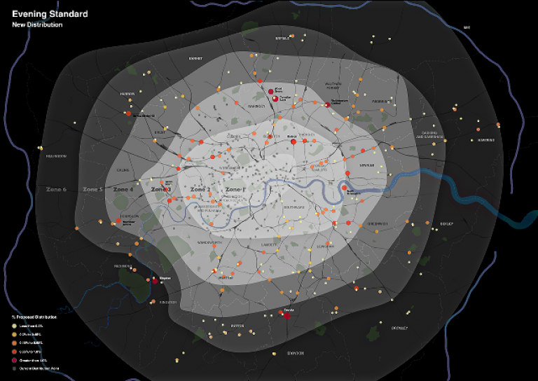
In late November, when faced with the challenge of how to best communicate significant changes in the distribution network of the London Evening Standard newspaper, ESI Media turned to UCL Centre for Advanced Spatial Analysis (CASA) for their expertise in mapping and visualisation.
Adding an extra 200,000 newspapers per day to their existing distribution network of 700,000 newspapers represented a big step for the company, and was a change in which they wished to engage employees, clients and key stakeholders. Attractive, high-specification mapping it was decided, would be great way assist in the communication of these changes both internally and externally.
Without the expertise to complete this task in-house, ESI, with the support of UCL Consultants Ltd (UCLC) asked Dr Ed Manley, of CASA, to develop a set of maps that reflect current and proposed distribution networks. Ed worked closely with ESI, drawing up a set of specifications for the map, and established the types of information ESI saw as suitable for supporting the message they wished to send out.
In developing the visualisations, Ed undertook the management and cleaning of all datasets, the sourcing of supporting information (including the construction of transport zone regions), and the design and cartography of the maps. Throughout the process, Ed and UCLC remained in close contact with ESI, exchanging draft designs for review and responding to feedback, until the point where ESI were happy with the product. The expansion was announced, alongside the supporting maps, on the London Evening Standard website on the 9th January 2014.
At the conclusion of the project, the client lead on the project, Adam Joseph - Strategic Insights Manager for ESI - said "We were impressed with CASA's high levels of expertise in the mapping area, and delighted with both the level of the service we received and the high quality of the resulting maps. They say a picture tells a thousand words - our new maps from UCL tell 900,000+ stories"
 Close
Close


