 Close
Close

People in harm’s way: Estimating global flood risk
2 February 2021
CASA PhD Researcher Melda Salhab, working with the economist Jun Rentschler, has produced a new study estimating flood-risk exposure around the world
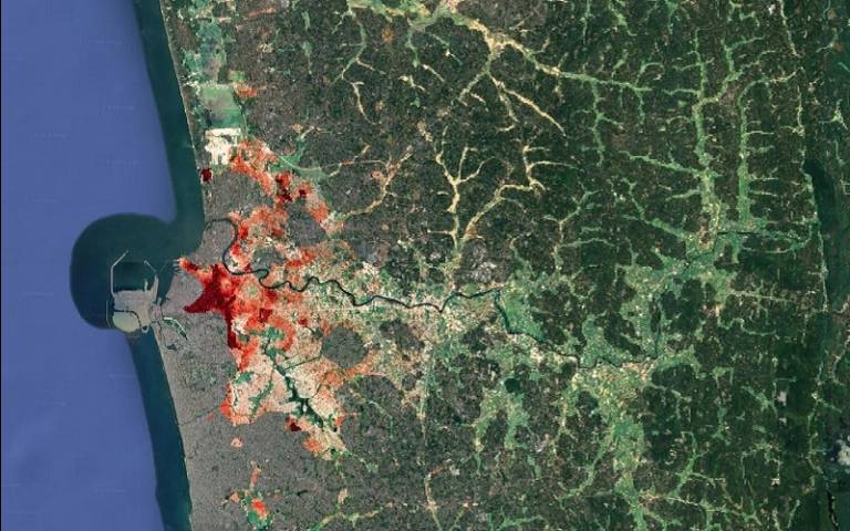
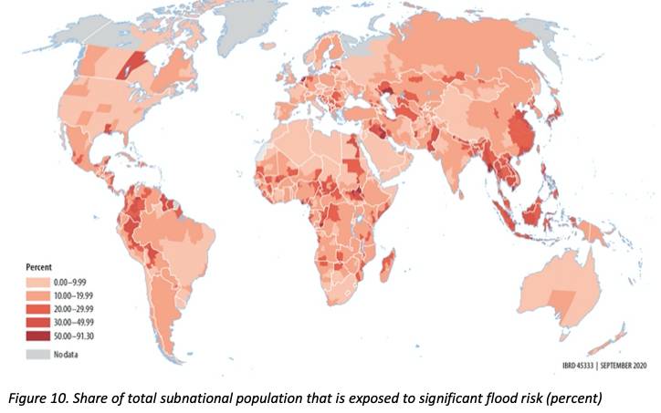
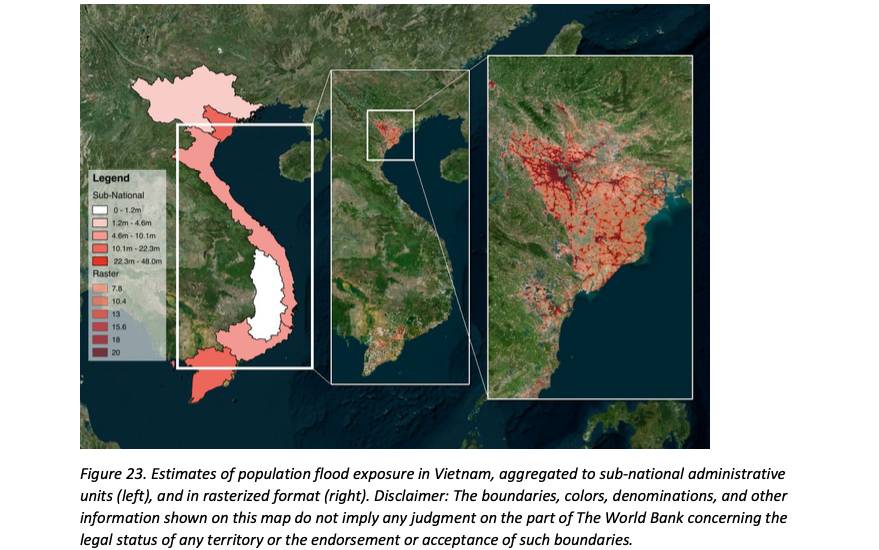
How many people around the world are exposed to the risk of intense flooding? Using global high resolution spatial data on flood risk and population density, this study estimates people’s exposure to flood risks. Results suggest that globally around 1.4 billion people are living in high risk flood zones, of whom 522 million are in Sub-Saharan Africa and South Asia. These exposure estimates are matched with sub-nationally disaggregated poverty estimates from the World Bank’s Global Monitoring Database of household surveys — thus, yielding the estimate that around the world at least 124 million poor people (defined as $1.9/day) live in high flood risk areas. Besides offering exposure headcount estimates for 184 countries (and 2,260 subnational administrative units), this study provides detailed exposure maps with global coverage that can serve as input to further analyses, for instance on the relationship between household characteristics and risk.
Read more at the World Bank blog.
You can also read the working paper for the study here.
Jun Rentschler is a Senior Economist at the World Bank’ Chief Economist Office for Sustainable Development, working at the intersection of climate change and sustainable resilient development. Prior, he served as an Economic Adviser at the German Foreign Ministry, as an Economist at the European Bank for Reconstruction and Development (EBRD), and led economic research with Grameen Microfinance Bank in Bangladesh and the Partners for Financial Stability Program by USAID in Poland. He is a Visiting Fellow at the Payne Institute for Public Policy, and holds a PhD in Economics from University College London (UCL), specializing in development, climate, and energy.
Melda Salhab is a doctoral researcher at the Bartlett Centre for Advanced Spatial Analysis where she is focused on extracting economic insights from satellite data using machine learning. She is also the co-founder of Open Map Lebanon, an open data community that aims to promote data driven decision making in Lebanon. Prior to commencing her PhD, she worked as a management consultant at Monitor Deloitte in Dubai, UAE. Melda has a BA in Economics and Peace & Justice Studies (double major) from Wellesley College, Boston, USA. She also has an MSc in Urban Economic Development and an MRes in Spatial Data Science & Visualisation, both from University College London, UK.