 Close
Close

The Street Mobility and Network Accessibility project is funded by three research councils (the EPSRC, ESRC, and AHRC), as part of the Lifelong Health and Wellbeing Cross-Council Programme. The research team is based in three faculties at UCL: Population Health Sciences, Engineering Science and Built Environment . The project aims to develop tools to measure and overcome community severance
What is community severance?
Community severance (CS) occurs where transport infrastructure or the speed or volume of traffic act as a physical or psychological barrier to the movement of people. Busy roads lead to trip avoidance; mitigation measures may increase distances or be considered inaccessible, unsafe or unpleasant. This leads to reduced mobility as well as less use of streets as social spaces due to concerns for physical safety.
Residents living on busy streets have smaller social networks; people with fewer social contacts have worse physical and mental health and die younger. All these effects are worse in older and other vulnerable groups, for whom mobility and social ties are fundamental to good health. The negative impact of CS on social contacts and social cohesion increases social inequalities and exclusion, with consequent economic and social costs.
Currently no tools allow CS to be routinely measured or modelled, so it is difficult to assess the nature and severity of CS and to identify its effects on mobility and wellbeing.
Street Mobility will develop methods to measure the extent of CS at individual and neighbourhood levels - as a foundation for future work to assess impacts on older people’s mobility and wellbeing - and to test interventions.
What is Street Mobility going to do?
The research will deliver: an increased understanding of residents’ perceptions and priorities regarding CS; questionnaire tools to measure CS at the individual level; a modelled CS index, based on readily available data; the testing of measures and associations with individual, demographic, cultural, and/or infrastructure factors; an analysis of the impact of CS on wellbeing and other CS.
See below for a full two-page information sheet:
- People
Jennifer Mindell (Principal Investigator)
Clinical Senior Lecturer in the Health and Social Surveys Research Group, UCL Research Department of Epidemiology and Public HealthNora Groce (Co-Investigator)
Leonard Cheshire Chair of Disability and Inclusive Development, UCL Research Department of Epidemiology and Public HealthMuki Haklay (Co-Investigator)
Professor of Geographical Information Science, Co-Director of the UCL Extreme Citizen Science groupPeter Jones (Co-Investigator)
Professor of Transport and Sustainable Development, UCL Centre for Transport StudiesShepley Orr (Co-Investigator)
Lecturer in Ethics and Policy Appraisal, UCL Department of Civil, Environmental and Geomatic EngineeringShaun Scholes (Co-Investigator)
Social statistician in the Health and Social Surveys Research Group, UCL Research Department of Epidemiology and Public HealthLaura Vaughan (Co-Investigator)
Professor of Urban Form and Society, Space Syntax Laboratory, UCL Bartlett Faculty of the Built EnvironmentPaulo Anciães (Post-doctoral researcher)
Research Associate, UCL Centre for Transport StudiesSadie Boniface (Post-doctoral researcher)
Research Associate, Health and Social Surveys Research Group, UCL Research Department of Epidemiology and Public HealthAshley Dhanani (Post-doctoral researcher)
Research Associate in the Space Syntax Laboratory, UCL Bartlett Faculty of the Built Environment- Outputs
Please refer to the following webpage for project publications: http://www.ucl.ac.uk/street-mobility/Publications
- Impact
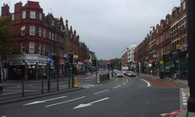
The project will develop and test tools in four case study communities: two in London (Woodberry Down and Finchley Road), and two outside London The tools will be developed with on-going feedback from community engagement work led by social enterprise Mapping for Change.
Outputs will include a policy toolkit comprising linked tools:
a) A modelling tool for local government use to derive the level and type of CS in an area from existing data;
b) A community level survey tool (also usable by local communities) that can identify suppressed travel and activity engagement, and the wider wellbeing consequences of CS;
c) Briefing notes for professional groups (transport planners and engineers, spatial planners, public health) on policy implications of CS and its mitigation;
d) Valuation of improvements to CS using ‘stated preference’ surveys and ‘willingness to pay’ data for assessment of policy options
This toolkit will enable cross-sector policy development and appraisal, allowing the creation of a common language and set of issues
Our user impact plan will ensure that findings are disseminated across the many users in the UK and internationally, using our extensive experience in disseminating research through traditional routes and also novel means including public-facing articles and reports, mass-media and new web-based communication (including social media), and workshops for policy-makers and planners nationally run jointly with local communities. We will invite residents from the case study areas to participate in dissemination activities alongside other local stakeholders. Where possible we will build capacity amongst end users for long-lasting impact.