 Close
Close

Crowdmapping for Food Security in Ethiopia
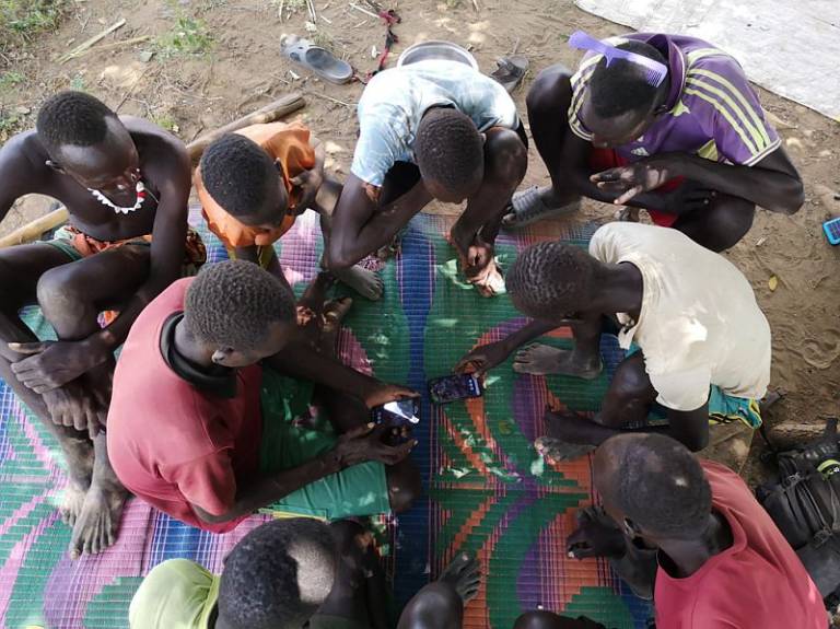
Supporting agro-pastoralist communities in Southwest Ethiopia to map and monitor the natural resources and facilities that they depend on.
1 September 2022
In the Lower Omo Valley in Ethiopia, a food security crisis is unfolding. According to the Famine Early Warning Systems Network (FEWSNET), the situation in the area has passed ‘stressed’ to reach the ‘crisis’ stage. The research builds on the recent projects implemented in the Lower Omo, Ethiopia: ‘Extreme Citizen Science: Analysis and Visualisation’ and the project ‘Conflict Prevention and Low-Carbon Development: Opportunities for promoting and sustaining peace through renewable energy projects (Locacons)’.
The six-month pilot project supported agro-pastoralist communities in Southwest Ethiopia to map and monitor the natural resources and facilities that they depend on. The activity provided critical real-time information for decision-makers and humanitarian actors who monitor the poor condition of the resources and act. Initially, the project started in 2021 but expanded in 2023 in collaboration with the Humanitarian OpenStreetMap (HOT) and OpenStreetMap Ethiopia (OSME).
The data generated was valuable for several reasons:
- Monitoring food insecurity and improved early warning systems.
- Monitoring water bodies and grazing areas to prevent conflicts and improve the resilience of pastoralists.
- Monitoring the condition of water infrastructure to ensure access to clean water and irrigation systems.
- Monitoring crops to address farming issues and improve sustainable land use practices.
- Evaluating the health and veterinary station conditions to allocate medical resources and prevent pandemics.
- Documenting land use rights to prevent land grabs or to ensure fair compensation if resettlement.
The research findings led to better use of participatory mapping to include both the positive and negative impacts of private and open mapping. In addition, the project led to improved and built connections between remote mappers and local mappers (or user-generated maps and land user-generated maps). The project team are seeking funding to scale the implementation in the Omo-Turkana region.
