The Environmental Modelling and Observation research cluster comprises a diverse group of researchers who are leading efforts to better understand the complexities of atmospheric, hydrological, geomorphological and ecological systems and their responses to, and feedbacks with, environmental change. The complexity and inherent non-linearity of environmental system behaviour means that such questions must necessarily be approached through modelling of various kinds.
Innovative model-based science combined with rigorous observation and validation is central to the work of this cluster. We have received significant and sustained external funding from, inter alia, UKRI (NERC, ESRC), The Royal Society, Crown Estate, EA, ESA, NASA, EU Framework, DEFRA, FCDO, and UK Met Office, and enjoy strong collaborative linkages with the other research clusters in UCL Geography, as well as across UCL more widely. Our work is focused under two major themes: (1) Observing and Modelling Climate Change, Its Impacts and Adaptation; and (2) Modelling and Observing Terrestrial Ecosystems. There is considerable crossover between these themes, especially through the development, enhancement and implementation of numerical and analytical methods.
- 1. Observing and Modelling Climate Change, Its Impacts and Adaptation
Our aim under this theme is to elucidate the subtleties of climate change and to contribute new and more robust methodologies with which to understand and predict the response of diverse earth surface systems to environmental variability and change more generally, and the appropriateness of alternative adaptation strategies. Our work in this area is characterised by a wide spectrum of models and methodologies deployed over a cascade of scales, from the global to the local. Key highlights and achievements under this theme include:
Understanding global climates (Chris Brierley). Simulations of past warm climates have provided new insights into feedback processes and also allowed us to evaluate the ability of climate models to respond to climate drivers. UCL plays an important role in PMIP (the Palaeoclimate Model Intercomparison Project) and has contributed to the IPCC AR6 on the topic. Other strands of research have looked at uncertainty quantification in future projections and regional climate impacts.
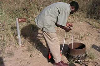
Impacts of climate change at multiple scales (Richard Taylor, Julian Thompson). Global climate model projections, with appropriate downscaling, provide crucial boundary conditions for analyses of climate change impacts at global, regional, catchment and smaller scales. Through the combination of process based hydrological models and GCM projections, Taylor and Thompson have investigated the uncertainty associated with hydrological and water resource impacts of climate change. Uncertainty assessments have included use of large ensembles of climate projections (multiple GCMs and climate change scenarios), alternative hydrological model codes, varying process descriptions and parameterisations, and modified input data sources and spatial distributions. Ecological implications of changing hydrological conditions have been assessed using a range of approaches and at different scales. Thompson has, for example, used downscaled regional climate model projections to assess fine-scale modifications to UK wetland water levels and flood extents and, in turn, the likely impacts of these changes on wetland flora and fauna. This research has contributed to methodologies designed to provide nationwide assessments of the sensitivity of wetlands to climate change. Taylor’s research combines empirical and remotely sensed observations with models to examine the impact of climate change and human development on freshwater resources with a specific focus on groundwater and other natural stores of freshwater. His transdisciplinary research explores the role of groundwater and the conjunctive use of groundwater and surface water in improving access to safe water and food security.
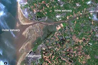
Coastal system responses to climate change and human activity (Helene Burningham, Jon French). At a coastal shelf scale, the first detailed analysis of historical seabed dynamics in the southern North Sea and Greater Thames has revealed a remarkable persistence of the major tidal bank systems, with change over a 200-year period being predominantly oscillatory rather than secular in nature. In the most detailed analysis to date of the linkages between the North Atlantic Oscillation winter index and wind data from land stations in northwest Europe, we have shown that the NAO is a much weaker proxy for storminess than is commonly supposed, but is still implicated in forcing coastal changes through its influence on wind and ocean wave direction. Numerical hydrodynamic modelling has been used to challenge the appropriateness of flood defence realignment as an adaptive response to sea-level rise, and this has highlighted incompatibilities between flood protection and habitat restoration goals. A new Coastal Resilience Model has been developed to quantify the resilience of coupled physical, ecological and human systems to flood and erosion hazard. This work has included the first national-scale modelling of the economic, social and natural dimensions of resilience to climate change around the British coast.
- 2. Modelling and Observing Terrestrial Ecosystems
Our aim under this theme is to develop our understanding of radiation interaction with the terrestrial land surface, particularly vegetation, and exploit this understanding in the application of Earth Observation (EO) to monitoring and quantifying terrestrial ecosystem dynamics. Through the work of Philip Lewis and Mat Disney, the cluster is playing a leading role in international efforts to improve the way we exploit observations of the land surface, particularly in moving the field from loose empirical correlations to using physically-based models for retrieving biophysical parameters. Recent highlights and achievements under this theme include:
New methods for exploiting global-scale satellite observations. (Lewis, Mat Disney) New products developed by the group have become firmly established as de-facto standards, disseminated by both NASA and ESA. The MODIS albedo product for example, developed in collaboration with NASA colleagues, is used by hundreds of researchers world-wide across a wide range of disciplines e.g. in radiative forcing in GCM climate simulations (IPCC AR4-6). A second theme of our work is developing new frameworks for combining observations with models, through data assimilation. We have published some of the first results using satellite observations of the land surface to constrain terrestrial ecosystem models. We have been funded via ESA, NASA, NERC and others for this work.
New 3D measurements of trees and forests: (Mat Disney) We have developed new ways to exploit terrestrial laser scanning (TLS) to make detailed 3D measurements of trees and forests. The group have pioneered TLS measurements across the tropics, in temperate forests and urban areas. These measurements are helping change the way we see trees, address fundamental questions about the relationships between tree size, shape and function, in particular how much carbon trees and forests can store, and how this is changing with climate and other disturbance e.g deforestation and degradation. This work is funded by NERC, ESA, NASA, EC, NSF and others. We have worked very widely with partners across academia, industry and the public sector (eg local authorities, charities etc) to exploit these new measurement opportunities. This work has led to a wide range of knowledge exchange and public outreach opportunities eg exhibitions, public lectures, TV documentaries and print and other media (even featuring in a comic!)
EO data products. (Lewis, Mat Disney) We have also been instrumental in developing EO products quantifying disturbance, due to fire in particular, as shown by our work on the development of the MODIS Burned Area product, and through ESA-funded work on monitoring fire impacts. The group have also carried out work developing new ways to assess and monitor the status of crops and crop yields, through combining observations from different EO sensors. This work feeds into UK and international efforts to deliver agricultural improvements from EO data, and has led to partnerships with researchers in China, Ghana and elsewhere, funded by NERC, STFC and others. The EO group have been funded since the inception of the NERC Centres of Excellence in EO, now through the NERC National Centre for Earth Observation, which was established by the UK Government in part to allow more direct pull-through from EO science to policy. As an example, we have provided evidence to DEFRA on how EO can contribute to monitoring UK commitments on emissions.
Model – data linkages. (Lewis) The third key area of our work is developing new modelling methods for understanding existing observations and paving the way for new and novel observation techniques. We have been funded by ESA for quantifying the performance of proposed new satellite systems. We are currently funded to develop modelling tools to allow researchers to simulate the observation characteristics of new ESA satellite systems.
- 3. Understanding Global, Regional and Local Atmospheric Composition and Air Quality
We combine data from multiple platforms (models, aircraft, satellites, lab and field measurements) to better understand the influence of humans on atmospheric chemistry, air quality, and climate from urban to regional to global scales. Details of research group members, projects, collaborators, presentations, publications, media coverage, and new datasets can be found at our research group website.
Air pollution and health. The group works on a range of projects on this topic. These include determining the local and distant sources that contribute to fine particulate matter (PM2.5) pollution in UK cities using GEOS-Chem, addressing uncertainties in UK agricultural emissions of ammonia (NH3) using Earth observations, quantifying trends in air pollution in fast-growing cities in the tropics to determine the impact on public health, adverse health outcomes due to exposure to air pollution from oil and gas supply chain activities in Texas, and top-down estimates of air pollution precursor emissions in India. Funding is from NERC, the Stockholm Environment Institute (SEI), and the Newton Fund and includes Research Fellows Dr Vohra, Dr Kelly, and Dr Mottungan.
Space industry impact on the environment. The space sector is growing rapidly but lacks environmental regulation. We construct inventories of air pollutant emissions from contemporary rocket launches and returning space debris, and a speculative space tourism industry. We implement these in the state-of-science GEOS-Chem chemical transport model coupled with a radiative transfer model to determine the impact of the protective stratospheric ozone layer and climate. This work is funded by an ERC Starting Grant awarded to Dr Marais and includes Research Fellow Dr Ryan.
Reactive nitrogen in the global upper troposphere. Reactive nitrogen is central to the influence of the upper troposphere on the global troposphere, but even the most advanced chemistry models misrepresent their sources and sinks and chemical and physical processing. We develop new and examine existing datasets to address these issues. This work is funded by an ERC Starting Grant awarded to Dr Marais and includes Research Fellow Dr Ryan and PhD students Nana Wei and Rebekah Horner.
The EMG incorporates the UCL component of the NERC National Centre for Earth Observation and is involved in NCEO projects such as the ESA-DA project, as well as the Coastal and Estuarine Research Unit (CERU), the Climate & Water Research Unit (CWRU) and the Wetland Research Unit (WRU).
People
- Academic Staff
- Professor Mat Disney (Cluster Lead ; Remote sensing)
- Professor Chris Brierley (Climate modelling)
- Professor Helene Burningham (Coastal and estuarine geomorphology; GIS)
- Professor Jon French (Environmental modelling; geohazards and infrastructure; climate change adaptation)
- Professor Philip Lewis (Remote sensing; vegetation modelling)
- Dr Eloise Marais (Atmospheric chemistry and air quality modelling)
- Professor Richard Taylor (Hydrogeology and climate change)
- Professor Julian Thompson (Wetland hydro-ecology and hydrological modelling)
- Research Staff
- Dr Jose Gomez Dans (Earth observation, data assimilation)
- Feng Yin (Earth observation, crop modelling, parameter retrieval)
- Dr Phil Wilkes (Earth observation, lidar, tree structure and function)
- Dr Jamie Kelly (Research Fellow in atmospheric chemistry and air quality)
- Dr Robert Ryan (Research Fellow in atmospheric chemistry and air quality)
- Dr Karn Vohra (Research Fellow in atmospheric chemistry and air quality)
- Emeritus Staff
- Professor Ray Harris (Earth Observation and data policy
- Professor Andrew Warren (Aeolian processes; dryland management
Research Units
Climate and Water Research Unit | Coastal and Estuarine Research Unit |
 Close
Close


