 Close
Close

I am a physical geographer with research interests that include wetland hydrology, hydrological and hydraulic modelling, hydroecology and climate change impact assessment.
- More about Professor Thompson

I first joined the UCL Department of Geography as an undergraduate student. After graduating with a BSc on a Friday, I joined the research staff of the Department, whilst also registering for a PhD, the following Monday.
Three weeks later I was in Nigeria undertaking fieldwork in floodplain wetlands. Following my PhD, I did post-doctoral research in the Department on a number of externally-funded projects focussing on wetlands in the UK and overseas. A few years later I joined the academic staff and made my way up through the ranks until being appointed Professor of Physical Geography - Hydrology and Wetlands.
My administrative roles in the Department have included Deputy Head of Department and Undergraduate Tutor.
Qualifications
- 1995: PhD Geography (Hydrology, Water Management and Wetlands of the Hadejia-Jama'are Basin, Northern Nigeria), University of London (UCL)
- 1991: BSc Geography (First Class Honours), University of London (UCL)
Academic Career
- 2018: Professor of Physical Geography - Hydrology and Wetlands, Department of Geography, UCL
- 2012: Reader in Physical Geography, Department of Geography, UCL
- 2010: Senior Lecturer in Physical Geography, Department of Geography, UCL
- 1997: Lecturer in Physical Geography, Department of Geography, UCL
- 1995: Postdoctoral Research Fellow, Department of Geography, UCL
- 1991: Postgraduate Research Officer, Department of Geography, UCL
Academic Peer Review
NERC moderating panels
- "Understanding the Effectiveness of Natural Flood Management" (London, September 2017)
- "Understanding the Impacts of Hydrometeorological Hazards in South East Asia (Kuala Lumpur, Malaysia, July 2018)
Journal editorial board membership
- Associate Editor: Hydrological Sciences Journal, 2014-2022
- Wetlands Ecology and Management, 2022-present.
Journals
- Applied Vegetation Science
- Area
- Earth Surface Processes and Landforms
- Ecological Economics
- Ecological Modelling
- Environment and Planning B
- Environmental Conservation
- Environmental Management
- Environmental Modelling and Software, Environmental Monitoring and Assessment
- Estuarine, Coastal and Shelf Science
- Hydrobiologia
- Hydrological Processes
- Hydrological Sciences Journal
- Hydrology and Earth System Sciences
- Hydrology Research
- International Journal of Disaster Risk Science
- International Journal of Remote Sensing
- International Water Management Institute Research Reports
- Journal of Coastal Conservation
- Journal of Environmental Management
- Journal of Hydrology
- Journal of Hydrology: Regional Studies
- Marine and Freshwater Research
- Natural Resources Forum
- Polish Journal of Environmental Studies
- Quaternary International
- River Research and Applications
- Science of the Total Environment, Water, Air and Soil Pollution
- Water Resources Research
- Wetlands
Research Grants
- Natural Environment Research Council (NERC - UK)
- Engineering and Physical Sciences Research Council (EPSRC - UK)
- Economic and Social Research Council (ESRC - UK)
- Royal Society (Africa Awards, Future Leaders - African Independent Research (FLAIR) Fellowships)
- Hydrologic Sciences Program - National Science Foundation (NSF - USA)
- Biodiversity and Climate Change – BiodivERsA (EU Horizon 2020 ERA-NET COFUND scheme)
- British Council (PMI 2 Connect Research Awards)
- International Foundation for Science (IFS - Sweden)~
- Comisión Nacional de Investigación Científica y Tecnológica (CONICYT - Chile)
- Teaching

Undergraduate
- Physical Geography Field Research (GEOG0017, Convenor)
- Surface and Groundwater Hydrology (GEOG0026, Convenor)
- Water and Development in Africa (GEOG0036)
- Dissertation (GEOG0037)
- Thinking Geographically I (GEOG0151)
Postgraduate
- Surface Water Modelling (GEOG0067)
- Wetlands (GEOG0091) (Convenor)
- Models in Environmental Science (GEOG0109)
- Research Project and Dissertation (GEOG0105)
- Climate Change Impacts to Hydro-Ecological Systems (GEOG0112)
Students registered for these modules can access further information via Moodle.
- Publications
To view Professor Thompson's publications, please visit UCL Profiles:
- Research Interests
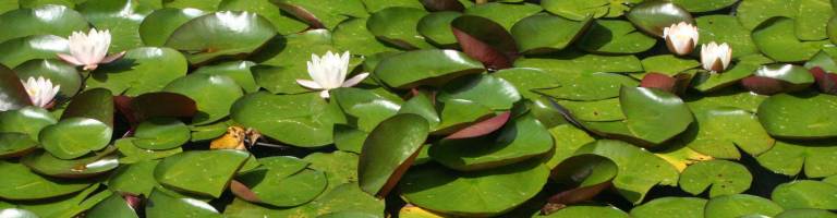
Much of my research focuses on the hydrological functioning of wetland environments (predominantly but not exclusively freshwater ecosystems) often in relation to the wider catchment hydrological context and the links between wetland hydrology and ecology. Research also investigates the impacts of anthropogenic or natural pressures (especially those associated with climate change and related uncertainty) upon wetlands, river basins and water resources. I have participated in and led national and international cross-disciplinary research initiatives with particular expertise being developed in hydrological/hydraulic monitoring and modelling. These approaches have been applied to a range of environments from individual wetlands, to small/medium-sized catchments to international river basins.
Specific areas of current and past research include:
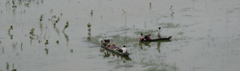
- African floodplain wetlands
- UK wetlands, in particular wet grasslands and floodplains
- Freshwater marshes and swamps in Southeast Asia
- North African coastal wetlands
- Catchment and global scale modelling for climate impact and uncertainty assessment
- Development of tools for water-related ecosystem assessments
Further details of some of my externally funded research projects are provided under Research Grants, Prizes and Awards (see below).
- Impact

My research is strongly translational and has influenced environmental, especially wetland, management in the UK and overseas. In the UK I contributed to two major inter-disciplinary projects involving scientists from multiple research organisations that were designed to provide tools for the Environment Agency as well as conservation agencies and NGOs. These include the development of methods designed to enable the evaluation of the ecological consequences of riverine and coastal flooding and the potential impacts and associated uncertainty of climate change upon wetlands in England and Wales. The latter project included the development of an online, web-based, tool hosted by the Centre for Ecology that enables regional assessments of climate change impacts on wetland hydrological characteristics and resources including plant communities, birds and historical environments. An iOS version of this tool, The Wetland Tool for Climate Change, was developed with funding to UCL from a NERC Impact Award.

Research on the environmental and economic impacts of dams upon African floodplains has been influential in shaping water management policies of international donors. Work undertaken in Nigeria under the auspices of IUCN’s African Wetlands Programme included training courses for Government Ministries and other agencies in hydrological modelling to raise awareness of catchment-wide integrated water management approaches. I led an international team developing an integrated water and fire management strategy for Tram Chim National Park, the largest remaining remnant of Vietnam’s once extensive Plain of Reeds. Recommendations from this strategy, which included large-scale infrastructure developments, were incorporated within a major investment plan for the National Park. Research undertaken as part of the MELMARINA project were utilised in the Tunisian Government’s site description of Ghar El Melh when listing the site as internationally important under the Ramsar Convention. The TEFRIC project developed software to enable the rapid assessment of the potential ecological impacts of changes in river flow due to factors that could include climate change, water resources management and land cover-intensification in Cambodia, the wider-Mekong and elsewhere.
During the course of my overseas research I have provided training for environmental scientists and management practitioners in partner organisations designed to enhance their capacity to manage wetland environments. This has included training of Nigerian hydrologists from state water ministries in field hydrometric techniques and the rehabilitation of monitoring infrastructure, training in wetland hydrological modelling and data analysis for staff in both Cat Tien National Park and U Minh Thoung Nature Reserve, Vietnam, and hydro-ecological monitoring programme design and operation for environmental scientists in Egypt, Morocco and Tunisia. During the MELMARINA project hands-on training in the TEFRIC environmental flow software was provided to academics, environmental practitioners, NGOs and students from Cambodia, Laos, Thailand and Vietnam.

- Research Students
PhD Students
- Honeyeh Iravani: Assessment of the impacts of climate change, water resource developments and land cover change on Iranian wetlands; Self-funding; 2018-
- Olly van Biervliet: The effects of the Eurasian beaver (Castor fiber) on hydrology and nutrient dynamics at variable spatial scales; London NERC Doctoral Training Partnership Studentship; 2017-
- Dr Michel Wortmann: Adaptation and implementation of the European, hydrological model SWIM to arid, glacier and snow melt water dominated catchments in NW China; German Government funding (Non-resident student); 2012-2018.
- Dr Amanda Robinson: Uncertainty in hydrological scenario modelling: An investigation using the Mekong River Basin, SE Asia; Department of Geography Post-Graduate IT Assistantship; 2012-2018.
- Dr Jessica Durkota: Groundwater ecology: invertebrate community distribution across the benthic, hyporheic and phreatic habitats of a chalk aquifer in Southeast England; Self-funding with support from Environment Agency (part-time); 2008-2018.
- Dr Clare Duncan: Planning for change: managing mangroves in the face of climate change; UCL Beams Impact Award / Zoological Society of London; 2013-2017.
- Dr Andrew House: Ecohydrological impacts of climate change on a riparian chalk valley wetland; NERC-CEH Studentship; 2012-2016.
- Dr Mohammed Rahman: Modelling climate change impacts on the water regimes of the river-wetland systems in the data-scarce transboundary Upper Meghna River Basin (Bangladesh and India); Ted Hollis Scholarship in Wetland Hydrology and Conservation; 2012-2016.
- Dr Elizabeth Gardner: The ecohydrology and conservation of a coastal sedimentary lake and wetland system: Sheskinmore Lough, Donegal, Ireland; UCL Graduate School Research Scholarship; 2011-2016.
- Dr Hannah Clilverd: Hydroecological monitoring and modelling of river-floodplain restoration in a lowland river meadow; UCL Department of Geography Post-graduate Teaching Assistantship (part-time); 2006-2016.
- Dr Arnaud Duranel: Hydrology and hydrological modelling of acidic mires in Central France; NERC Studentship; 2009-2015.
- Dr Michael Owor: Groundwater - surface water interactions on deeply weathered surfaces of low relief in the Upper Nile Basin of Uganda; Commonwealth Scholarship; 2007-2010.
- Dr Rebekah Rochester: Uncertainty in hydrological modelling: a case study in the Tern catchment, Shropshire, UK: UCL Department of Geography Post-graduate Teaching Assistantship; 2005-2010.
- Dr Chabungbam Rajagopal Singh: Hydrological and hydraulic modelling for the restoration and management of Loktak Lake, northeast India; Ted Hollis Scholarship in Wetland Hydrology and Conservation; 2005-2010.
- Dr Hong Yang: Spatial and temporal patterns of benthic diatoms in an upland Scottish loch (the Round Loch of Glenhead): with reference to recent environmental changes; NERC Dorothy Hodgkin Postgraduate Studentship; 2005-2009.
- Dr Lucinda Mileham: Impact of climate change on the terrestrial hydrology of a humid, equatorial catchment in Uganda; NERC Studentship; 2004-2008.
- Dr David Mould: Multi-scale assessment of wetland hydrological functioning at a wet grassland in southeast England: NERC-CEH Studentship; 2004-2008.
- Dr Musonda Mumba: Hydrological and vegetation changes in the Kafue Flats, Zambia following dam construction; Ted Hollis Scholarship in Wetland Hydrology and Conservation; 2001-2007.
- Dr Sian O'Dwyer: Monitoring forest cover and wetland sedimentation in Cat Tien National Park, Vietnam; NERC Studentship; 1999-2003.
- Dr Helen Gavin: Hydrology of the Elmley Marshes; UCL / Institute of Hydrology / EU / English Nature; 1996-2000.
- Dr David Gasca-Tucker: The hydrological functioning of the Pevensey Levels wetland; UCL Jackson Environment Institute / Institute of Hydrology / Environment Agency; 1995-2005.
MPhil Students
Yan Li: Assessment of the hydrological impacts of land use change in the Daning River Catchment, China using hydrological modelling; ORS UCL/CSC Scholarship; 2008-2013.
- Research Grants, Prizes and Awards

Hydrological Research in the Hadejia-Nguru Wetlands, Nigeria (1991-1997)
Funding: IUCN, RSPB, WWF
This research was undertaken as part of a cross-disciplinary team and was aimed at enhancing the sustainable development of internationally important floodplain wetlands in northeast Nigeria. The research was undertaken in a series of phases:
(i) Second phase of the Hadejia-Nguru Wetlands Conservation Project (1991-1994). Funding: the International Union for the Conservation of Nature (IUCN) and the Royal Society for the Protection of Birds (RSPB): field monitoring of wetland hydrological processes, (ii) development of a digital hydrological model of the river basin and its wetlands and it's used to assess alternative scenarios for extant and planned dams and irrigation schemes, (iii) development of a user-friendly, menu-driven graphical user interface for the model, (iv) training courses for the model in Nigeria for governmental and non-governmental organisations, (v) analysis of daily flow data and derivation of artificial flood hydrographs for dam releases, (vi) advising engineers and policymakers on water resource developments in the river basin.
(ii) Third phase of the Hadejia-Nguru Wetlands Conservation Project (1994-1998). Funding: the International Union for the Conservation of Nature (IUCN) and the Royal Society for the Protection of Birds (RSPB): Provision of research-based, technical advice regarding the operation and monitoring of wet season releases from large-scale engineering schemes and the establishment of a coordinating council within the river basin. The research comprised hydrological monitoring of river flows and response within shallow aquifers and the further development of the hydrological model developed for the wetland and its catchment.
(iii) Economic evaluation of groundwater recharge in the Hadejia-Nguru Wetlands (1995-1997). Funding: WWF through IUCN. A cross-disciplinary project undertaken with the Department of Environmental Economics and Management, University of York to develop research methodologies for the evaluation of the economic value of groundwater recharge beneath the large floodplain wetland. The research involved field hydrological investigations focussing on groundwater dynamics, economic surveys and hydrological modelling to establish relationships between inundation and recharge and the subsequent economic value of these hydrological processes.
Environmental impact assessment of irrigation development in the Kizilirmak Delta, Turkey (1992)
Funding: Turkish Society for the Protection of Nature (DHKD)
A rapid appraisal of the potential impacts of irrigation expansion based on withdrawals from the Kizilirmak River was undertaken using field visits, review and analysis of documentary sources and extant data.
Hydrology of the North Kent Marshes (1992-1993)
Funding: Ove Arup & Partners with support from the Department of Transport
This project included targeted field investigations and a review of extant hydro-ecological datasets in order to provide a comprehensive evaluation of the hydrology of the North Kent Marshes (with a particular focus on the areas to the north and south of the Swale) and to advise on appropriate engineering designs/mitigation measures for the proposed new road crossing from the mainland onto the Isle of Sheppey.
Hydrological monitoring and modelling of the North Kent Marshes, U.K and Lake Karla, Greece (1994-1998)
Funding: European Commission through the Joint Research Centre, Ispra
This project developed comprehensive hydrological monitoring programmes and the synthesis of secondary hydro-geomorphological data for two internationally important wetlands. These data were incorporated within then state-of-the-art hydrological/hydraulic models (MIKE SHE) to enhance understanding of wetland functioning and ultimately lead to the EU SHYLOC project.
Guidelines for Environmentally Sound Management of River Basins in Asia: Utilizing Wetland Functions and Maximizing Wetland Benefits (1995-1996)
Funding: United Nations Environment Programme / Asian Wetland Bureau (now Wetlands International).
This project focussed on a comprehensive review of existing literature on wetlands and water resources within Asia and, in collaboration with international experts from across Asia and elsewhere, the development of a series of detailed case studies. These were used to develop regionally specific guidelines for the incorporation of wetlands and their water-related ecosystem services within integrated river basin management in Asia. The guidelines, which were widely disseminated throughout the region, were subsequently published as a Wetlands International / UNEP book.
System for HYdrology using Land Observation for model Calibration (SHYLOC) (1997-2000)
Funding: EU Framework IV Programme
SHYLOC was a cross-disciplinary research project with partners in four European countries (JRC Ispra, Italy – Coordinator; UCL - Financial Coordinator; DHI, Denmark; and Aristotle University of Thessaloniki / Greek Biotope Wetland Centre, Greece). It focussed on the development of remote sensing and hydrological modelling tools for wetland management supported by hydrological monitoring. The UCL focus was research in the North Kent Marshes (in particular the Elmley Marshes National Nature Reserve) including the application of coupled hydrological / hydraulic models (MIKE SHE / MIKE 11) to complex wetland environments which included innovative adaptations to existing modelling procedures. This part of the project was the basis of subsequent work on modelling the impacts of climate change and water level management on these wetlands. The SHYLOC remote sensing tool developed as part of the project was designed to monitor water levels within wetland channels. Within the UK it was tested within the Elmley Marshes and at a secondary site, the Pevensey Levels, for which a water level monitoring programme was also initiated.
Wetland Evaporation: The North Kent Marshes (1998-1999)
Funding: NERC Small Grant
This project researched the controls on and spatial distribution of evaporation within lowland wet grasslands through novel high-resolution monitoring of boundary layer meteorology.
Hydrological monitoring of the U Minh Thoung Nature Reserve, Kien Giang Province, Vietnam (1999-2000)
Funding: CARE International in Vietnam
This project developed a site-specific hydrological monitoring programme and its integration with ecological research for the largest remaining area of Melaleuca peat swamp forest in the Vietnamese Mekong Delta. A particular focus was exploring the interactions between peat water tables elevation and water levels in the ditch network through and around the Nature Reserve in order to determine the role of drainage on wetland hydro-ecological conditions and the potential for peat restoration. The project included training of forestry staff in hydro-ecological surveys and monitoring and analysis of the hydrological data provided by the monitoring programme.
Monitoring and modelling coastal lagoons: Making management tools for aquatic resources in North Africa (MELMARINA) (2002-2006)
Funding: EU Framework V INCO Med Programme
MELMARINA was a cross-disciplinary (hydrology, ecology, remote sensing, fisheries, modelling) research project coordinated by UCL involving two European and four North African partners: UCL, DHI (Denmark), University of Sousse (Tunisia), Institut National Des Sciences et Technologies de la Mer, (Tunisia), Institut Scientifique, Rabat (Morocco) and the National Authority for Remote Sensing and Space Science (Egypt). The research pioneered the application of coordinated hydro-ecological monitoring within three large North African lagoons (Merga Zerga, Morocco; Ghar El Melh, Tunisia; and Lake Manzala, Egypt) as well as the application of state-of-the-art coupled hydraulic/ecological models, the parameterisation of these models using remote sensing and their application to both understand ecosystem functioning and assess potential restoration options. Project findings were published in a special issue of Hydrobiologia (opens in new window).
Water and Fire Management Strategy for Tram Chim National Park, Dong Thap Province, Vietnam (2005-2006).

Funding: United Nation Development Programme / IUCN – The World Conservation Union / Mekong River Commission / Global Environment Facility funded Mekong Wetlands Biodiversity Programme (MWBP)
I led a team comprising cross-disciplinary scientists from the UK, USA, the Netherlands and Vietnam to develop an integrated water and fire management strategy for Tram Chin National Park, the last remnant of the once extensive Plain of Reeds (Đồng Tháp Mườ) freshwater wetland system and important habitat for Sarus Crane, a flagship species for nature conservation. The work included the development of a Scientific Workplan for field research undertaken over an 18-month period supported by a Fire and Water Management Strategy for this period in which experimental manipulations of Park management were undertaken. This included water level manipulation and prescribed burning. Project results were presented to Provincial Government alongside recommendations for future Park management. These recommendations were incorporated within large-scale infrastructure investments.]
Global scale impacts of climate change: a multi-sectoral analysis (QUEST-GSI) (2007-2010).
Funding: NERC
QUEST-GSI was a cross-disciplinary project led by the Walker Institute, University of Reading and involving a consortium of twelve partners funded under Theme 3 (Implications of global environmental changes for the sustainable use of resources) of the NERC QUEST programme. The project assessed the global-scale impact of climate change using a range of linked impact modules and impact indicators, representing impacts on water resources, flood risk, food production, biodiversity and human health and well-being on land, at the coast, and at sea. The UCL component focused on the evaluation of catchment scale water resource impacts of a consistent series of climate change scenarios using hydrological models developed for a range of river basins around the world.
Ecological Consequences of Flooding (2007-2011)
Funding: Environment Agency
This cross-disciplinary project involved the Centre for Ecology and Hydrology, UCL, HR Wallingford, the University of Nottingham and the University of Hull. The project developed and tested research led methods for assessing the environmental (including vegetation, birds, fish, invertebrates) consequences of riverine and coastal flooding. These included the development of original GIS based tools to integrate and maximise the utility of existing datasets held by the Environment Agency.
Wetland Vision: Adapting wetlands to climate change (2009-2012)
Funding: The Wetland Vision (English Heritage, Environment Agency, Natural England, RSPB and the Wildlife Trusts)
The project involved the Centre for Ecology and Hydrology, the British Geological Survey, UCL, Open University and the University of Exeter. Research undertaken within the project included the development of a novel tiered approach for assessing the impacts and uncertainty of climate change on characteristics and features (hydrology, vegetation communities, birds and archaeology) of rain-fed, riverine and groundwater-fed wetlands. Approaches ranged from conceptual hydrological models used to simulate the full suite of UK Climate Impacts Programme UKCP09 scenarios (thousands of model runs) to case studies employing high-resolution, fully distributed, physically-based hydrological/hydraulic models and a sub-set of climate projections. A tool developed by the project which provides an assessment of the impacts of climate change on wetlands is available here: The Climate Change Assessment Tool. An iOS version of the tool has been developed with additional support from NERC and is available here: Wetland Tool.
Developing a national capability framework for testing integrated surface–groundwater models (2011-2013)
Funding: Centre for Ecology and Hydrology / British Geological Survey
The research undertaken as part of this project focussed on the development of methods for designing and testing coupled models of cascading degrees of spatial complexity in order to better manage groundwater-dependent ecosystems. The project used Boxford Meadows (Berkshire) as a laboratory to evaluate approaches for providing the necessary field data to develop a conceptual understanding of groundwater-wetland interactions and to subsequently develop and evaluate results from models which will range from simple water balance type approaches to fully distributed, physically based surface / unsaturated/saturated zone models operating at very fine spatial scales. The latter models were coupled with results from existing regional groundwater models providing a pioneering means of reconciling scale / computational resource mismatches associated with fine-scale wetland modelling and large-scale aquifer models. Models were used to assess the impacts of climate change and changing groundwater abstraction regimes on wetland hydrology and ecology.
Building joint India-UK capacity, capability, research and innovation in the environment (2015-2016)
Funding: NERC
This project was led by UCL and undertaken in collaboration with the Centre for Ecology and Hydrology (CEH, UK). It scoped approaches to improve water-related science in India with a focus on environmental flows. The project included the development of a distributed hydrological model of the Narmada River Basin using MIKE SHE / MIKE 11 that was capable of providing river flow projections under a range of scenarios. Model results were compared to those produced from GWAVA hydrological model and were designed to be suitable for future application to common environmental flow assessment methodologies. In addition, the project undertook a pilot baseline assessment of microbial communities in water and soils along the large Indian rivers using metagenomic Next Generation sequencing.
Water climate services to inform food and water security in India (2016-2017)
Funding: NERC
This collaborative project was led by UCL with the Centre for Ecology and Hydrology (CEH, UK) and the National Institute of Hydrology, Roorkee, (NIH, India). Development of the earlier NERC-funded project, it focussed on water-related ecosystem services in the face of climate change. The project applied the UCL-based hydrological/hydrological models of the Narmada Basin (India) and the Barak-Kushiyara River Basin (India and Bangladesh) to explore potential uncertainties associated with alternative meteorological datasets and climate change scenarios. Impacts and uncertainty on future river flows and, in turn, water-related ecosystem services were assessed This included the application of the risk-based environmental flow methodology developed through collaborative research between UCL and CEH.
Translation of Environmental Flow Research in Cambodia (TEFRIC) (2017-2019)
Funding: NERC (Innovation Follow-on)
TEFRIC was a collaborative project led by UCL with the UK Centre for Ecology and Hydrology, the Institute of Technology of Cambodia and the Tonle Sap Authority (Cambodia) designed to introduce state-of-the-art environmental flow approaches to Cambodia and to initiate their application in the wider Mekong River Basin. The project developed a documented, user-friendly, open-access version of the Ecological Risk due to Flow Alteration (ERFA) code using R / shiny. Working with hydro-ecological experts in SE Asia, ERFA was tuned and refined using a wide range of projections of future Mekong River discharge provided by UCL-based hydrological modelling studies. Refinements included the identification of new metrics for use in risks of ecological change due to modifications to river flows resulting from scenarios that could include climate change or water resource development. Cambodian-specific climate change scenarios were formulated and used in the simulation of Cambodian river systems to provide further data for environmental flow assessments using ERFA. The software was demonstrated and hands-on training was provided for academics, environmental managers, NGOs and students from Cambodia, Laos, Thailand and Vietnam.

Falklands wetlands and aquatic habitats: baselines for monitoring future change (2020-2022)
Funding: Darwin Initiative (Darwin Plus)
The project, with partners that include the South Atlantic Environmental Research Institute, Falkland Islands Government and the UK Centre for Ecology & Hydrology, is designed to provide an evidence base that can be applied across the Falklands in order to monitor and manage future changes, in particular those associated with a changing climate. It will include the collation of existing datasets and intensive field assessments including hydrology, water quality and aquatic invertebrates. This work will be used to define a series of indicators of wetland conditions for future monitoring as part of a Wetlands Action Plan for the Falkland Islands.
Somerset Levels and Moors constructed wetlands: Detailed design - Shapwick Moor (2022-2023)
Funding: Esssex Water via Hydro-Ecology Consulting Ltd and RM Wetlands & Environment Ltd
Hydrological analyses to support the design of a series of constructed wetlands proposed to ameliorate nutrient influxes to part of the ecologically sensitive Somerset Levels and Moors. Analyses include establishing surface water inflows to the proposed wetlands under current conditions and a range of climate change scenarios derived from the UKCP18 probabilistic projections as well as model-based assessments of water storage requirements to satisfy wetland evaporative demands.
