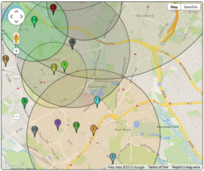
Two maps are included here that show 'distance cutoffs' for schools in a London borough. Distance cutoffs are used as part of the process of allocating pupils to schools. If pupils live further away from the school than the cutoff distance, their application will not be successful (unless further criteria are also relevant).
Important: the links below currently don't work - please see this version for now: http://www.ucl.ac.uk/~uczcodu/leaflet-map/index.html
- Primary school map (old, buggy?)
- Primary school map
- Secondary school map (old version)
- Secondary school map
The information about distance cutoffs is published, but (in this borough, at least) only in the form of tabular data. This leaves potential applicants to make their own assessment about whether or not they live inside a given distance. It's something that's difficult to judge without looking at a map.
Considered as Open Data, the data are not ideal. They have been taken from PDF documents, requiring time-consuming manual editing. Different tables list the schools in slightly different orders, an additional complication for the unwary.
The original version of the secondary school map was done largely as an exercise in methodology: how can material of this sort be added to UCL's content management system? The answer is that it can be quite fiddly....
 Close
Close


