Archaeologists present framework for understanding the distribution of Acheulean archaeological sites
19 March 2016
The Acheulean record of northern France and southern Britain has long been acknowledged as internationally important, having played an important historical role in the development of the discipline.

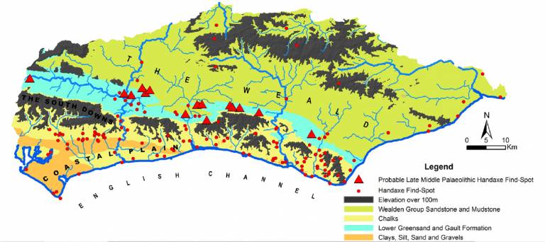
Abundant artefacts have been recovered, primarily from fluvial gravel archives, allowing the responses of Middle Pleistocene human populations on the edge of their geographical distribution to be interrogated. The richness of the record from such deposits can most simply be read as reflecting absolute population numbers - and changes in this over time. However, factors such as regional super-abundance of high quality flint (related to solid geology) and intensity of aggregate exploitation also played their part in generating the apparently regionally dense record of finds. This paper investigates the inter-related patterns of human behaviour, preservation, artefact release and research tradition which underpin these basic distribution maps. We here present a framework for understanding the processes which have created the current distribution map - in terms of where we find material, and which periods are best represented within it. We term this the Unified Palaeolithic Landscape Approach and outline ways in which the spatial and temporal range of the Acheulean record can be addressed through the archaeological record of its heartland.
Behaviour and process in the formation of the North European Acheulean record: Towards a Unified Palaeolithic Landscape Approach
Matt Pope, Lesley Blundell, Beccy Scott, Hannah Cutler
DOI:10.1016/j.quaint.2016.01.070
 Close
Close

