Using drones to map coastal change
13 May 2019
Helene again wins UCL Research Images award

Once again, following last year’s success, Dr Helene Burningham is an award winner in the annual UCL Doctoral School Research Images as Art photographic competition.
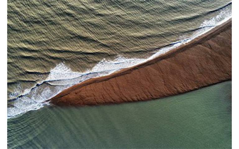
Her drone image, ‘Transitional Waters 1’, shows water from the Deben estuary, Suffolk, (bottom) meeting the North Sea (top), divided by a narrow shingle bank only visible at low tide.
This is one of a number of banks forming the ebb-tidal delta at the estuary mouth which arise from the transient interplay between wave and tidal processes. Such features are hard to capture in traditional surveys, but advances using drones are allowing these morphologies to be mapped in more detail.
The photo contributes to Helene’s research investigating the dynamics of mixed sand-gravel inlets and coastal change on the Suffolk coast. She has been using drones to map the extent of intertidal banks around the inlet to explore the morphological response to wave and tide processes over different timescales.
The imagery provides very high-resolution (cm-level) coverage of the banks and neighbouring beaches. It is thus possible to differentiate various bed forms and morphologies, helping to elucidate the key drivers of sediment transport and morphological change.
 Close
Close

