 Close
Close

The Histories of Whitechapel project was conceived as an experiment in the creation and dissemination of urban history, winning a major grant from the Arts and Humanities Research Council.
Overview
In 2016, the Survey of London launched an in-depth study of Whitechapel, a district located at the heart of the East End. Whitechapel has a long and complex history that was shaped by patterns of immigration embracing German, Irish, East European, Jewish and Bengali Muslim populations. Whitechapel’s rich history made it an excellent testing ground for combining the Survey of London’s high standards for detailed research with new methodologies, working with local communities to document the built environment.
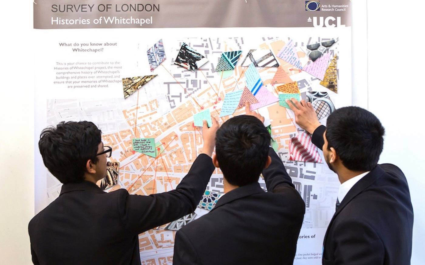
The Histories of Whitechapel project was conceived as an experiment in the creation and dissemination of urban history, winning a major grant from the Arts and Humanities Research Council. In collaboration with The Bartlett’s Centre for Advanced Spatial Analysis, the Survey of London created an interactive map-based website to facilitate the public co-production of research. Project partners included Tower Hamlets Council, the Whitechapel Gallery, the East London Mosque and Historic England. Public collaboration was enriched by workshops, exhibitions, oral history interviews, and the organisation of a local history festival.
The project made a significant contribution to awareness and knowledge of Whitechapel’s history, buildings and places. The website was open for contributions until 2019 and now serves as a public virtual repository, with scholarly text, personal memories, images and voice recordings. The website inspired several spin-offs, including A Memory Map of the Jewish East End. The project also resulted in an eponymous major publication, with Volumes 54 and 55 in the Survey of London’s main series due to be published in 2022.
- People
Principal Investigator
Peter GuilleryCo-Investigators
Dr Martin Zaltz Austwick
Dr Duncan SmithResearcher
Dr Shlomit Flint-AsheryPublic Participation Co-Ordinator
Shahed SaleemWebsite Developer
Dr Duncan HayHistorian and Website Editors
Dr Sarah Dowding
Dr Aileen ReidHistorian
Dr Amy SpencerIllustrator
Helen Jones- External partners
The project was made possible by a major grant from the Arts and Humanities Research Council (reference AH/N00146X/1) and the involvement of the Bartlett Centre for Advanced Spatial Analysis.
- Image credits
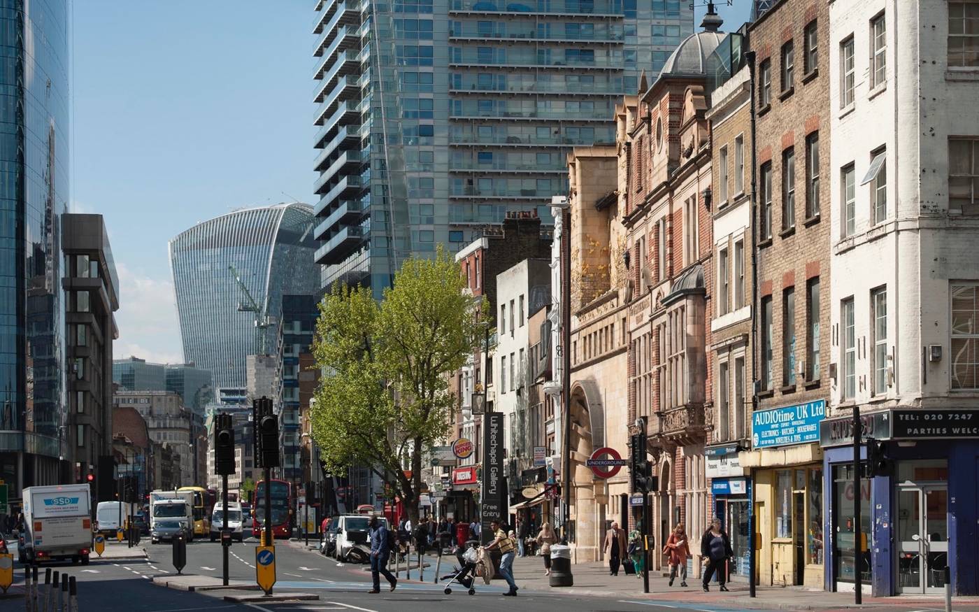
Image 1: Whitechapel High Street from the east in 2017. © Derek Kendall
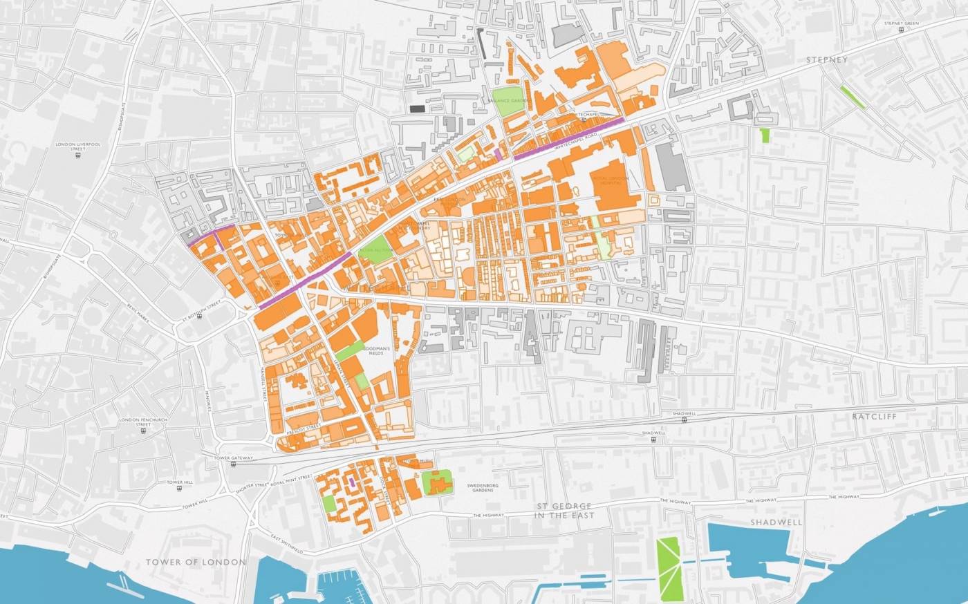
Image 2: Map of Whitechapel from the Survey of London’s public collaborative website, with contributions shaded in orange
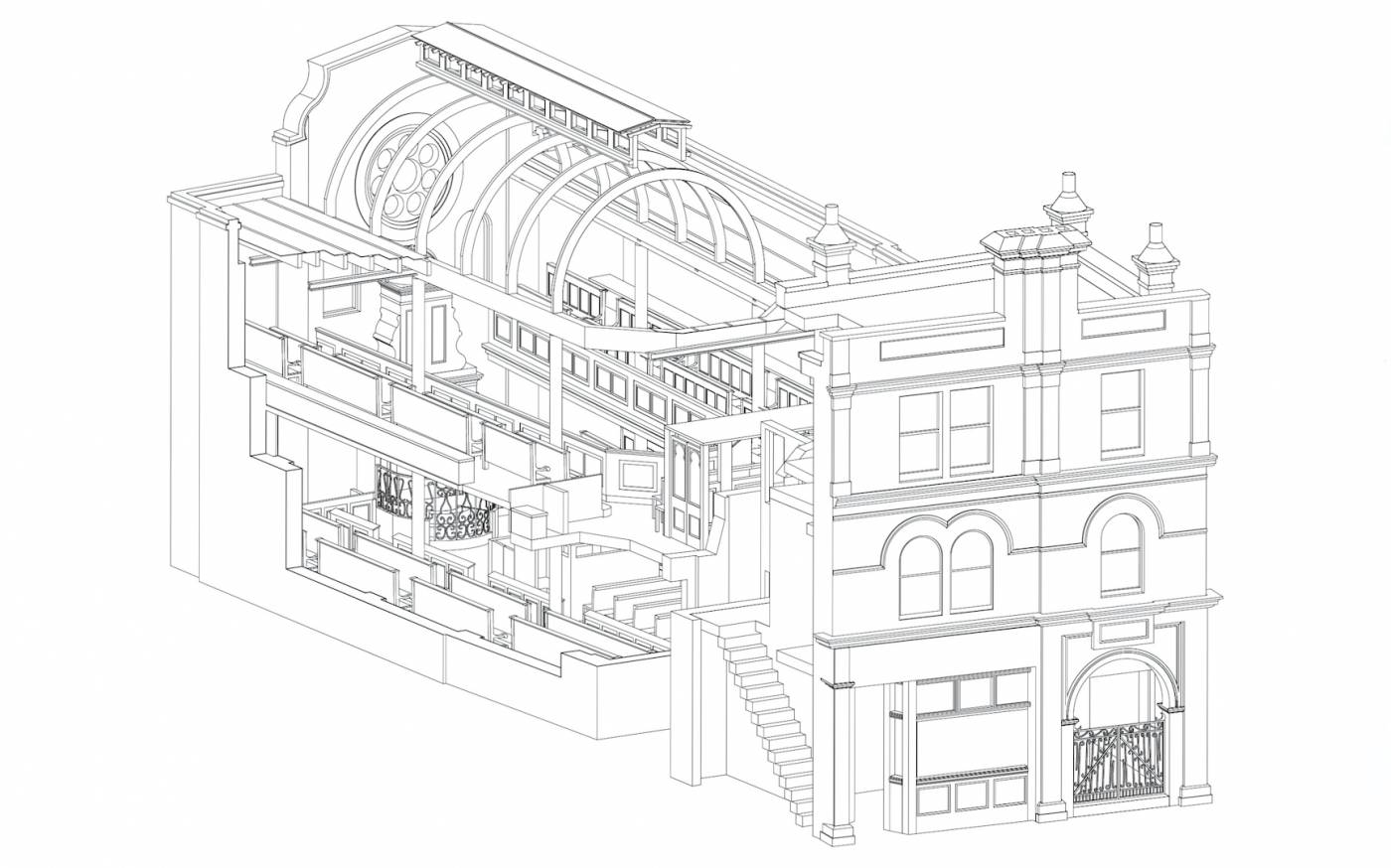
Image 3: Fieldgate Street Great Synagogue as built in 1898–9, cutaway isometric view from the south-west. © Survey of London, Helen Jones
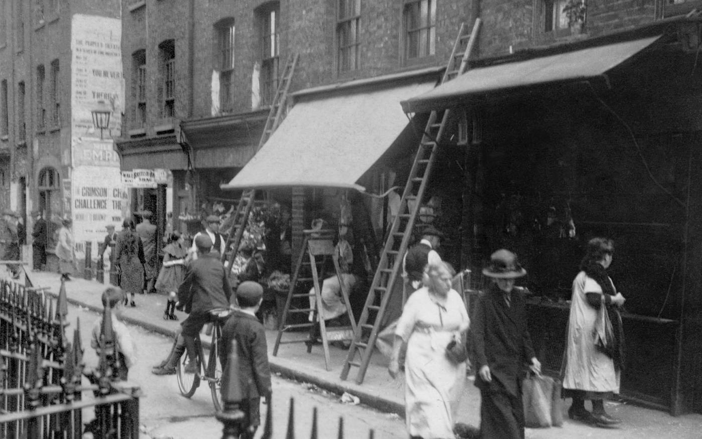
Image 4: 58–70 Old Montague Street and Black Lion Yard, 1922
Image 5: Workshop with the London Enterprise Academy, a local school on Commercial Road, in July 2017. The workshop was organised by the Survey of London in collaboration with the Whitechapel Gallery and artist Sara Heywood. © Rob Harris


