Find estates and plantations in Jamaica, Barbados and Grenada.
We have added copies of the 1817 slave register and other document images to a limited number of estate pages. Here is a list of these estates.
For the latest news on updates made to the maps, please subscribe to our newsletter.
View maps of addresses in Britain.
This map is a search tool and a general guide. More work is needed to produce data for statistical analysis.
There are currently 5,662 addresses in the LBS database, linked to 6,166 individuals. We have located 3,445 of these addresses on the British map so far. Each marker on the map represents a specific address rather than an individual slave-owner; an address may be linked to several different people. For some people we have multiple addresses.
Each address pinpoints a slave-owner or direct beneficiary in a particular place at a specific time. Often the evidence is fragmentary, we don't know when they moved to that address or when they left it but we have found a source – a census, a letter, a directory, a land tax record – for a portion of their stay.
The map identifies addresses at differing levels of detail. For some people we have only a general place of residence, whether the name of a city, town or village. For others we are able to provide an outline of the building itself, particularly in the case of country houses. To see the level of detail represented in each marker, click on the node and select 'See location'.
Many streets have been renumbered since the 19th century so for numbered houses we have identified the whole street rather than the building, with the exception of the New Town of Edinburgh where very little renumbering has taken place. Some street names themselves have changed and where possible we have reflected this in the map.
Locations have been identified using OpenStreetMap. In some cases we have added source data to OpenStreetMap in order to identify addresses in greater detail, particularly when adding rural addresses to the map. In other cases, OpenStreetMap gives only a node for a general location such as a small village and we have simply used the general node. We have used the historic maps available on Digimap to locate specific buildings and changes to street names. Locations in London have been identified using Lockie's Topography of London (1810) and The Hunt House's Old to New Street Names. For farms and hamlets in Scotland we have used the National Library of Scotland's georeferenced images of Aaron Arrowsmith's map of 1807.
The regional and county outlines are based on data provided through EDINA UKBORDERS with the support of the ESRC and JISC and use boundary material which is copyright of EDINA, University of Edinburgh; and also Kain and Oliver historic boundary material which is copyright of the AHDS History [University of Essex], Humphrey Southall, Nick Burton and the University of Portsmouth.
For the latest news on updates made to the maps, please subscribe to our newsletter.
1801 - 25th Nov 1880
English clergyman, resident in Jamaica from 1827 but returning to England with his Jamaican-born wife and children six years later.
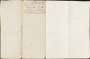
Document comprises 4 parts, written recto and verso across 5 folios: 1. An inventory and valuation of enslaved persons at Windsor Estate, St Elizabeth parish, Jamaica, 1814. 2. An inventory and valuation of enslaved persons at Williamsfield settlement, St Elisabeth parish, Jamaica, 1814. 3. An inventory of animals at Windsor Estate, St Elizabeth parish, Jamaica, 1814. 4. A cover note outlining the contents of the document.
