CLIMBING THE "MOUNTAIN OF DEATH"
by Aaron Nicholas
(Deputy Manager of NCF’s Gashaka Project, 2002-2004, Nigerian
Conservation Foundation)
An Adventurous Challenge
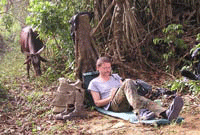
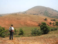
Nigeria's highest mountain, Gangirwal, stands at 7,963 ft (2,419 m) and is found in the Adamawa mountains in a remote corner of Gashaka-Gumti National Park (GGNP). The park covers 6,600 sq km (roughly 3 times the size of Greater London) and is Nigeria's largest National Park.
The name Gangirwal translates as “the mountain of death”. There is certainly an ominous and overbearing feeling when viewing the bulk of the mountain from below at the small village of Jauro Hammasale. However, as long as you do not disturb the keeper of the mountain, the only danger that exists when you climb is that you will suffer from a seriously good walk that will afford a unique insight into the culture, scenery and natural biodiversity of the region.
Trekking across Gangirwal takes about 8-10 days if time is allowed to visit remote rural communities and look for wildlife. Much of the walking follows high watersheds along the Cameroon-Nigeria boundary with amazing views over each country. Numerous habitats are passed through and different ways of life observed and there is always the chance of spotting some of the important wildlife species that GGNP is famed for including chimpanzee, giant-forest hog, buffalo, klipspringer and leopard to name but a few.
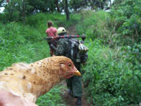
This is adventure style walk, led by knowledgeable local guides and assisted by cooks and porters who will carry the loads and prepare local dishes that are guaranteed to fill the end-of-day stomach holes. Tents, basic camping equipment and food are carried by the porters, leaving those trekking free to carry only lightweight day-packs.
On Top of Nigeria
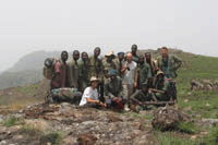
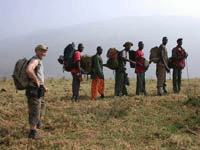
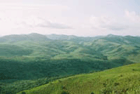
From the Park HQ at Serti, good metalled roads, followed by bumpy bush tracks, lead to Njawai, the start of the climb. Njawai is a small town on the Mambilla plateau, an agricultural area famed in Nigeria for tea production (near to the Cameroon border). At Njawai, as you start walking, you move to the border itself, passing first through land where maize and millet are the main crops. A metal sign translated into most of the local languages welcomes you to the Park, the path then descends to the remote village of Jauro Hammasale completing a full days walk.
Jauro Hammasale is a typical small community, lying at the foot of Gangirwal consisting of a few dozen thatched mud hats and grain stores next to a small stream. As you descend to the village you may hear the rhythmic thud of women hand pounding maize in wooden mortars and sometimes the “phut-phut” of the one local mechanical grinding mill that was delivered here on donkeys and assembled on site. The village is a good spot for bird watching and you are sure of a warm, curious welcome from all the villagers.
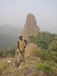
The climb proper starts from Jauro Hammasale, following a prominent spur up the flank of the mountain with dense forest visible on the left (Nigeria side of the border). The land to the right in Cameroon is more densely populated and is largely devoid of forest. At about halfway up it is easy to make a detour to view the largely unexplored Podocarpus forests that envelop the prominent rocky spire known locally as Dutsin Dodo. Local myth has it that the keeper of Gangirwal, an old and very bad tempered grey bearded man, sleeps at the base of this rock and to disturb him is to invite extreme misfortune- hence the ominous name of the mountain.
The 21 sq km area of the summit of Gangirwal itself is reminiscent of areas of the Scottish Highlands, consisting of a varied landscape of lichen covered bare rock, low layers of shrubs and herbs, montane grassland and montane riparian woodland. Many plant and tree species found here are not found elsewhere in Nigeria, and their sensitivity is such that both man made fire and overgrazing by cattle from Cameroon represent threats to their survival and to the integrity of many of these unique habitats.
With the heavens as your roof and after the exertions of the day, you will rest knowing that you are higher than the other 120+ million people who are sleeping below you in Nigeria's crowded cities, towns and villages.
Descend to Chappal Delam
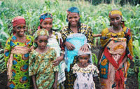
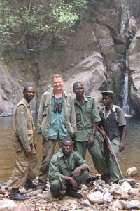
When heading towards the park enclave of Chappal Delam, the descent off the mountain is spectacular with views across rugged cols and buttresses.
You should inspect the cliffs for movement. If you are lucky you may see the illusive west African Klipspringer, a specialist of rocky terrain. These small but robust antelope stand on the tips of their two small hooves and can maintain a complete motionless posture for long periods as they examine you while trying not to draw attention to themselves. The males have short horns, but they may be difficult to see because of a tuft of hair between their prominent erect ears. Get too close and you will witness some death defying cliff moves that are rarely equalled in the animal kingdom.
The watershed between Cameroon and Nigeria follows a prominent undulating ridge towards Chappal Delam. The forests are dense and trees are hung with lichens and matted with bryophytes receiving their nutrients in part from the heavy mists that rise daily from the expanse of forest below. These are some of the most remote and unexplored forests in Nigeria and the opportunity of finding new species of various animals and plants is highly likely.
Chappal Delam, meaning the hill where salt is found, is one of 6 enclave areas within the park where nomadic Fulani have been allowed to settle and raise cattle. The route from here descends to follow the headwaters of the Ngiti River that flows at these altitudes as a swift, clear stream. One of the main reasons that WWF-UK established a project in GGNP back in 1992 was to assist with protecting these important watersheds that provide a large share of the Benue River's water that serves many millions of people in Nigeria.
The Filinga Enclave
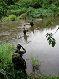
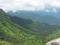
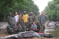
The range of mountains known as Hamman Kankadu, named after a crazy hermit who was the first person to settle there, lie between Chappal Delam and the Filinga plateau. The highest peaks in the bowl-like Hamman Kankadu range provide a wonderful view over Gangirwal, the route to Chappal Delam, the Filinga plateau and Chappal Hendu (“windy mountains”) beyond. Immediately below is a mosaic of grassland, woodland savanna, riparian forest and lowland rainforest stretching away as far as the eye can see. It is this great variation in natural habitats that provides for the great floristic and faunal diversity of GGNP. The route follows these lowlands.
The Filinga enclave is centred on the Filinga plateau, an undulating area with an average altitude of about 1,100 m above sea level. There is more farming in this enclave that the others, giving a clearer impression of the value of the enclaves to local people. The path winds through isolated homesteads to the border village of Filinga.
The rangers patrol post, built by the NCF/WWF GGNP Project in 2001, overlooks the Chappal Hendu massif. The dusty footpath to Serti can be seen climbing these hills. The highlights of Chappal Hendu include the great views back across the Filinga Plateau, wonderful bird watching opportunities in isolated patches of montane forest and a close look at more Fulani settlements on top on the mountains, with the possibility of being woken up by spotted hyena calling in the night.
Filinga is a small trading village, with goods arriving on foot (on head to be exact) or occasionally by donkey (there is also one bicycle). It is 50 miles from Serti, o1 1-day walk from Cameroon. There are a number of small shop/bed-sits where traders squat amongst a multitude of goods, mostly from Cameroon. After 6 days walking, these shops sill seem like Aladin's caves and you are sure to spend a few hundred naira (perhaps a pound) on packets of biscuits, local cakes, chocolate drink and the like. This is a very traditional village, with the mosque and village roundhouse dominating the high street. At night, suya traders sometimes set up shop preparing fried beef, there is often music when Fulani some into town to celebrate something and people are always happy to see outsiders and show them around.
On the Path of War
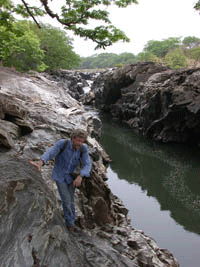
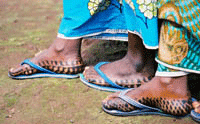
The low-route from Filinga to Gashaka follows through Yakuba and avoids the climb of the Chappal Hendu mountains. Once more, the path passes through farmland outside the village to the Jagal River. After the river, the path becomes more prominent as it descends in a series of steps towards the forests below. The Germans invaded this region in the 1890's and built this and other paths to allow their men and supplies to be transported between various stations. The British finally drove out the Germans after fierce fighting during the 1914-18 war that impinged heavily on the region, the tracks remain to this day. It is difficult to imagine what it must have been like to be garrisoned somewhere like this all those years ago.
The descent from the plateau affords some great views of both dry montane forests and areas of lowland rainforest. These forests are rich in wildlife and in particular primates, and you may be lucky enough to hear chimpanzees pant-hooting to one another on the steep slopes below.
The path levels out and follows cross-country through a mosaic of savanna woodland, riparian forest and patches of lowland rainforest. Both savanna and forest dependant mammals take advantage of the diversity of habitats and feeding opportunities and it is possible that you will see giant forest-hog, buffalo, waterbuck and bush pig. Riparian forests also provide an opportunity to see primates and relax next to the cooling clear water. In the dry season, these streams dry up into pools, leaving hundreds of fish stranded, attracting kingfishers and otters.
Yakuba is an abandoned village site the position of which is now marked by mango and Gmelina trees. A hand-maintained road is cleared most dry seasons, and a vehicle or motorcycle can take you from here back to Gashaka and Serti. The trip, however, is far from over and it is worth keeping a look out for large mammals and birds as you drive. It is good to leave early in the morning to stand a chance of seeing some of the important savanna species found in this area including buffalo, waterbuck, warthog and the strange be-spectacled hartebeest.
The Forests of Gashaka
En route to Gashaka, it is worth detouring 800 metres on the road to visit Kwano research station where you may be lucky enough to meet some of the Nigerian and international primatologists working under the umbrella of the “Gashaka Primate Project”.
The focus of the Gashaka Primate Project is primarily to habituate a community of chimpanzees resident in the forest near the research station. Other researchers are also at work studying baboons and facets of primate ecology and behaviour. As part of their work, the researchers have cleared paths through the forest and it is worth taking a few hours to slowly walk one of these to look for primates. Apart from the chance of seeing chimpanzees, it is likely you will see monkey species such as the silky black and white colobus, chirpy putty-nosed monkeys or the white faced Mona monkeys.
From Kwano, the next port of call is are the national park’s offices in Gashaka, many of which were built by a project of NCF/WWF that closed in 2008. The project was formed in 1992 to assist with the development of the park and has a broad based focus with activities including capacity and infra-structural improvement of GGNP, park protection, rural development, environmental education, research and monitoring.
The drive back to Serti from Gashaka takes about 1 hour, and at half way you cross the River Kam. This is an excellent camping spot and a great place for fishing. The river is rich in good eating species like the Nile Perch and fighting species such as the barracuda-like tiger fish.
A final night camping next to the calming waters of the River Kam will provide the opportunity to recover from the long journey and reflect on the myriad of sights, sounds, smells and feelings that you will have experienced on this epic trek. Alternatively, the cold beer and food of Serti may prove to be more irresistible. From wherever you leave, the locals will bid farewell to you with a “Sai ka zo” meaning “until you come back”, and you may just do that!
