|
|
|
|
|
|
|
|
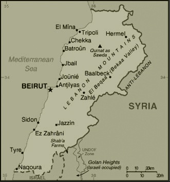
Beirut, Lebanon by Mona Fawaz and Isabelle PeillenSummary A particular challenge to undertaking the mapping slums in Beirut is the absence of a unified understanding of the city. Indeed, during the years of the civil war (1975-1990), the city was divided into two sections, each run by one or several antagonistic groups. The developments of the city during this phase followed somewhat different trajectories, and studies conducted at the time generally concentrated on specific sections or neighbourhoods (eg Charafeddine 1985, 1991, Halabi 1988). Furthermore, and prior to 1975, most slums were located near the industrial suburbs of Beirut, essentially its north-eastern suburbs and almost all studies of slums and poverty looked at living conditions in this area. At the time, the southern suburbs did not attract the same scale of industrial development, notably because the development of large-scale public works (eg the Gulf Club, the Sports Stadiums, Beirut International Airport) and high-income beaches led to land speculation and made access more costly. However, shortly after 1975, most of the residents of the north-eastern suburban slums of Beirut were evicted from their houses and many started squatting in various areas of the southern suburbs, in expensive sea-front beach resorts, empty green lots, or institutional buildings. Their numbers, compounded by an extensive rural to urban migration fuelled by the two Israeli invasions (1978 and 1982) and the Israeli occupation of South Lebanon (1978-2000), led to the transformation of most of the open spaces of the southern suburbs of Beirut into large slums. Today, it is the southern suburbs of Beirut that carry the label of “illegal settlements” in most people’s minds, while the eastern suburb slums, now relatively limited in scale, are more or less invisible for the research community and others. Another difficulty in mapping slums is the mobility of many of their dwellers, whether Lebanese or not, without any tangible means for quantification, before, during, and after the war. Rather than a period of stability, the post-war scene has been a phase of important population changes in all the slums in Beirut. Indeed, policies to reverse the population exchanges that occurred during the war as well many reconstruction projects, whether the rehabilitation of downtown, the southern suburbs, or infrastructure projects, are all generating important patterns of displacement. The impacts of these projects are either in displacements to make way for developments, or in attracting labour to work for the projects. Quantifications are available for important moments of the war, such as the estimated 200,000 individuals who navigated from the eastern to the southern suburbs of Beirut between 1975 and 1976, or the 700,000 to 900,000 displaced at least once over the 15 years of the war ( Virely 2000). Prior to the war, reports on slums also often mention Arab workers (especially Syrian), and the transformation of some of the slums over time with changes in their dwellers, especially Qarantina. Finally, a major hindrance to the mapping of slums is the scarcity of information on the topic, especially on current conditions. We often had to rely on limited fieldwork and interviews with public officials conducted personally for our information. Despite the difficulties faced in creating a reliable typology, the analysis we propose below attempts a first unified understanding of the slums of Beirut that we think is useful for initiating a discussion of the slums in the city.
|
 source:www.cia.gov/cia/publications/factbook/
To read the full report, choose & click on one of the pdf icons below. Document size: 5.5 MB Document size: 4.3 MB (b&w) |