Mapping for Change: new social enterprise to support sustainable communities
1 July 2010
Links:
 mappingforchange.org.uk/" target="_self">
UCL today launches Mapping for Change, a social enterprise that will support sustainable communities through online mapping and Geographical Information Systems (GIS).
Mapping for Change is a partnership between UCL Civil, Environmental and Geomatic Engineering, and London 21 Sustainability Network, a charity that works across Greater London to help create a greener, healthier and more sustainable city.
The organisation will specialise in providing a suite of innovative mapping tools that communities, voluntary sector organisations, local authorities and developers can use to communicate complicated information in a visual format that is affordable and easy to understand.
The services can be applied across a range of sectors including school programmes, food growth, distribution, town planning and sustainable tourism. There are a wide variety of potential uses, such as supporting funding applications or creating interactive maps that help engage communities as part of a consultation process.
Through a joint award made personally to Dr Muki Haklay (UCl Civil, Environmental and Geomatic Engineering) who leads the UCL part of the enterprise, and Louise Francis, Chief Executive of Mapping for Change, the partnership is one of the first recipients of a Higher Education Social Entrepreneurship Award - a programme of financial and other support provided by UnLtd, the foundation for social entrepreneurs, and the Higher Education Funding Council for England to help higher education institutions develop their expertise, skills, knowledge base and business support structures in social entrepreneurship and social enterprise activity.
Mapping for Change is also the first social enterprise - defined by the government as a competitive operation that reinvests profits into social purposes or the community - that is partly owned by UCL.
The partnership's staff
have worked in community mapping and participatory GIS for over a decade. The
team can draw on its experience and understanding of community to offer four distinct services:
- Participatory local mapping: Mapping for Change has already worked with a wide range of communities and schools to map the issues that are important to them and to develop online and paper-based maps. The communities select the kinds of data they wish to include - such as local history information, events, and local health service providers and the organisations themselves provide the information to go on the maps. Recent projects include 'noise mapping' around an airport and a new community map for Brixton.
- Mapping organisations and resources at district or city level: Mapping for Change has already produced maps of action related to climate change in London, Newcastle upon Tyne and North Dorset. It has also developed a London-wide map of climate change resources and related action by faith-based organisations across London, which is fully searchable by issue and by faith.
- Geographic Information Systems development and analysis: Mapping for Change can work with third sector organisations keen to utilise geographical information and mapping to target and analyse their activities; demonstrate the effectiveness of their actions; or to communicate their activities to others.
- Training: The partnership offers a range of training and skills development that include providing teachers with the tools and skills to develop lesson plans using Google Earth and other technologies. Mapping for Change also provide one-day workshops designed to give local authorities and other professionals working with communities a range of participatory mapping tools and techniques to enhance community engagement.
Dr Muki Haklay (UCL Civil, Environmental and Geomatic Engineering), who leads the UCL part of Mapping for Change, said: "Mapping for Change is the culmination of many years of research into participatory mapping and citizen science at UCL, so the knowledge can be shared across the third sector instead of being locked in academic publications. UCL has been very supportive of establishing Mapping for Change and it is one of the examples where research can lead to real impact on communities and places."
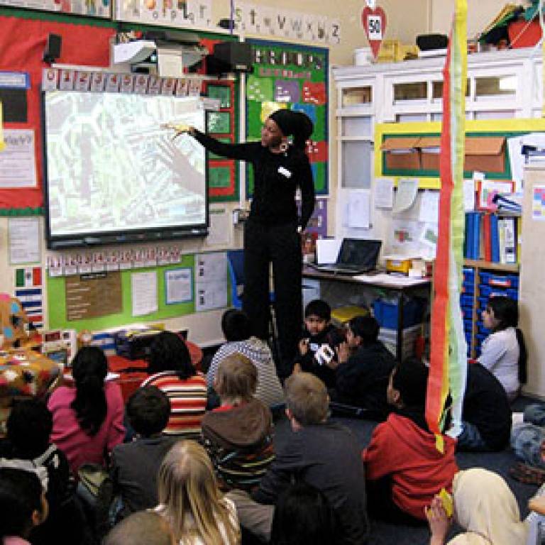
Image: Mapping for Change has
been working with the Humanities Education Centre and Maggie Hewitt, a specialist
on learning and 'place', in three schools in Tower Hamlets to pilot a new
process in which Year 4 pupils, aged 8-9, personalise maps of their local area with their
own likes, memories and views on change. The process includes learning how to
navigate online systems such as Google Earth, Google maps, and will help
develop a child-centred view of the area.
UCL context
UCL Civil, Environmental and Geomatic Engineering runs courses that encompass the full spectrum of civil engineering from
structures through earthquakes to transport, while continuing to
provide a sound understanding of civil engineering principles. The department's research is innovative and at the forefront of engineering
development. Staff are leaders in their fields and are often called
upon to provide detailed knowledge to anyone from the media to industry
to policy makers. They work with other academics, industry partners
and with local and national government to supply relevant research and
expertise.
 Close
Close

