UCL earthquake expert visits China
23 July 2008
Links:
 eefit.org.uk/" target="_self">The Earthquake Engineering Field Investigation Team
A group of earthquake engineers, including Dr Tiziana Rossetto (UCL Civil, Environmental & Geomatic Engineering) has become one of the first international teams to visit the region affected by the earthquake that struck China in May this year.
Although two months have passed since the event, very little information has been made available to the international engineering community on the specifics of the extent and type of damage incurred. On 11 July, The Earthquake Engineering Field Investigation Team (EEFIT) sent a reconnaissance mission to the affected region. They spent seven days in the disaster zone, with the aim of recording structural and geotechnical damage to report back to the UK civil engineering industry.
They found that the seismic activity and subsequent landslides had caused widespread infrastructure damage, which hindered post-disaster relief efforts. In particular, 34 new 'lakes', created by the blockage of rivers, created further risk of flooding.
UNICEF reports that more than 7 million houses have been destroyed and more than 24 million buildings have been damaged in Sichuan and the surrounding regions. Over 5 million people were made homeless. Officially, the death toll stands at over 69,000 with around 18,000 individuals still missing.
Schools suffered particularly badly in the earthquake event with over 7,000 collapsing. Thousands of kilometres of roads, tap water pipelines and over 2,400 dams had sustained damage. Several national highways also suffered extensively from landslides.
The UCL Earthquake and People Interaction Centre (EPICentre), headed by Dr Rossetto, is part of an international consortium to develop a unique 'Virtual Disaster Viewer', a website with satellite images which will have the data collected from the disaster zone superimposed on them. The aim is to produce a way of generating a preliminary estimate of the damage caused by an earthquake event, before visiting affected areas, from satellite imagery.
Dr Rossetto explained: "There are areas of damage which are inaccessible on foot during post-disaster surveys, either because of geographical or political reasons. We are looking to be able to estimate damage remotely using satellite images and data already collected by ground truthing."
The consortium includes EEFIT, the Earthquake Engineering Research Institute (EERI), the Multidisciplinary Centre for Earthquake Engineering research (MCEER) and ImageCat Ltd.
To find out more, follow the links at the top of this item.
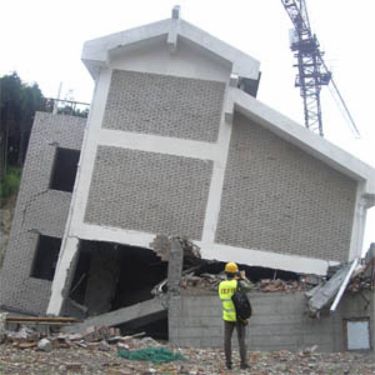
Image: A reinforced concrete frame building in Dujiangyan that was under construction at the time of the earthquake
 Close
Close

