 Close
Close

New digital platform helps to protect cultural heritage across central Asia
A digital platform, developed at UCL in partnership with institutions across central Asia, is transforming the way cultural heritage is recorded and protected for local and global benefit.
14 June 2022
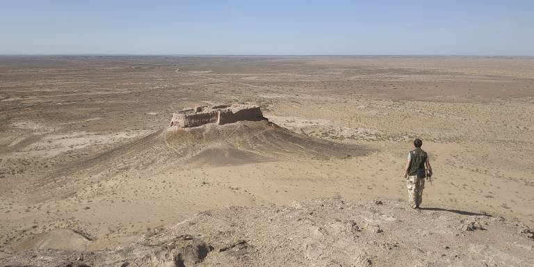
A vast array of archaeological heritage sites across central Asia are under threat from the climate crisis, urbanisation and changing agricultural practices. Many of the sites are yet to be documented.
A team of archaeologists, data analysts and historians from the UCL Centre for Asian & Archaeological Landscapes (CAAL), is working with partner institutions across central Asia to develop a comprehensive digital inventory of the area.
The database of maps, photographs and satellite images will provide valuable insights to inform local policies to protect and manage these precious sites.
Archaeological sites in central Asia date back thousands of years and range from megacities to religious sites, nomadic camps and burial mounds to mountain forts and complex water management systems.
So far, the team has mapped more than 60,000 across the central Asian republics (Kazakhstan, Kyrgyzstan, Tajikistan, Turkmenistan and Uzbekistan), as well as the Xinjiang Uyghur Autonomous Region of China.
““Already, by comparing historical Soviet maps from the 1970s and 1980s with current satellite images, we can see that in recent decades many ancient monuments have been destroyed.”
Around 20,000 of these were previously known sites, gathered from archival research and digitisation, that the team has enhanced with improved locational information. The other 40,000 are sites identified from remote sensing, most of which were previously unrecorded.
The new resource provides multiple layers of data on archaeological heritage, historical and contemporary land use.
The platform combines: satellite images; digitised historical maps archival records, often fragile and unpublished; and records of land use and water courses. This creates a mosaic of information that can be used to identify and measure changes to historical sites and landscapes.
“Many archaeological sites are protected by legislation, but many others are not,” explains Professor Tim Williams (UCL Archaeology) and Principal Investigator of CAAL. “Already, by comparing historical Soviet maps from the 1970s and 1980s with current satellite images, we can see that in recent decades many ancient monuments have been destroyed.”
The team is also using satellite images to monitor seasonal landscape changes following glacial melts in the Himalaya-Hindu Kush Mountain range. As icecaps melt, encroaching water can dramatically impact local communities and heritage sites. Capturing images of the same area over time will help teams to monitor how these changes are affecting agricultural practices and whether they present a danger to local heritage.
The combination of satellite images, archival maps and historical data provides a powerful visual toolkit for archaeologists, land managers and policymakers to consider how best to preserve these precious sites for future generations, while at the same time informing policy developments that support local economies and sustainability.
“With our wide network of international partners, we are developing digital tools that will help local agencies to manage cultural heritage in ways that will benefit local people and at the same time protect against threats,” explains Professor Williams.