|
|
|||||||||||
|
Unpaid Subscriptions Editorial Prehistoric Presents Anniversary for an Old Lady Rock Art of the Central Namib Desert A Suprise for John Wymer Bahn on the 'Sorcier' Society's Tour of Dumfries and Galloway, 3-9 July 1998 Prehistoric Society Study Tour to Southern Sweden, 14-21 June 1999 A Visit to Teyjat Champion's Choice Conferences and Exhibitions
|
|||||||||||
|
AN
AERIAL SURVEY CONTRIBUTION TO PREHISTORIC ARCHAEOLOGY IN JORDAN, 1998
|
|||||||||||
|
Both authors have had an interest in the Middle East for over twenty years, Bob Bewley mainly in the prehistory of the region and David Kennedy in the archaeology of Jordan, with a particular interest in the Roman frontier (Kennedy and Riley 1990). Aerial photography for archaeology (on a systematic basis) has not been possible in Jordan since Sir Aurel Stein's last flights in April 1939, but Jane Taylor's books have shown that aerial photography is possible and has great potential (Taylor 1989, 1993). However, the clearest demonstration lies in the vertical photographs taken by Hunting Ltd in 1953, provided by the Jordanian authorities to Kennedy. A valuable source of information, these have been archived in Western Australia in a collection under the patronage of Crown Prince Hassan of Jordan. Recent interpretation of these photographs has yielded in excess of 25,000 sites from the western half of Jordan which the survey covers (Kennedy 1996; 1997a; Web 1; cf Kennedy 1997b for a recent application). Many of the sites seen on these photographs show a high density of prehistoric settlement and land use. Further targeted surveys, both on the ground and in the air are necessary to try to understand the rise and fall in prehistoric population of Jordan. |
|||||||||||
| For
many years Kennedy had been trying to carry out aerial reconnaissance
and in 1997 a first trial flight, provided by the Royal Jordanian Air
Force (RJAF), in a helicopter, proved very successful (Kennedy 1998b;
1998c). In 1998, with the backing of the Crown Prince, the Military Chiefs
of Staff promised an unlimited number of flights for a project (again
in military helicopters) to carry out a select survey of specific sites
throughout Jordan. This promise became a reality: from May 6 - 20th there
were 10 sorties, in which over 33 hours were flown and over 175 targets
photographed and some 4000 frames taken in 35 mm colour slides, 35 mm
black and white and colour print, and in medium format black and white
and colour print (Kennedy, Web 2). Prior to arriving in Jordan there was no certainty that the conditions (political, climate, financial) would be favourable so it was impossible to predict what to expect. Equally our collective experience in helicopters was low; it is amazing how quickly you learn even with only a few hours sleep and a 5.45 am take off. Fortunately none of the possible pitfalls materialised and the dedication of the pilots, crew and squadron commanders was impressive - without the support of the RJAF the project would, literally, have not got off the ground. |
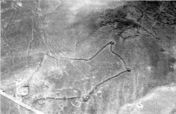 Fig. 1: Kite enclosure in the Azraq area. The long walls which guided the gazelle into the enclosure are just visible (centre left) |
||||||||||
|
The purpose of the project was to test the feasibility of archaeological
aerial photography in Jordan, using the helicopters provided by the RJAF.
To that end the aim in the first year was to compile enough photographs
for a book on Ancient Jordan from the Air. One of the reasons we
received the generous help we did was because of the declared intention
to help make the archaeology of Jordan "relevant" to its people and their
needs. The book will promote tourism through advertising the vast and
varied cultural heritage Jordan has to offer. On the basis of the c. 25,000
sites identified on the 1953 air photographs a careful selection of sites
of all periods and kinds and in varied geographical and environmental
contexts was compiled. Although this is not the appropriate place to discuss
methodology (see Kennedy and Bewley forthcoming) it must be stressed that
time taken to undertake the aerial surveys in Jordan represents only a
small part of the time and effort required to prepare for the survey and
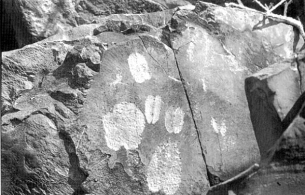
for the post-reconnaissance cataloguing and analysis of the photographs. From this first season it became abundantly clear just how effective aerial photography can be in Jordan and that its continuation is a desideratum. Surveying the landscape during the flights, a number of reasons for continuing aerial surveys became apparent. The density and distribution of sites means it will be a very cost-effective technique in future surveys. This is no surprise, but it has to be proven in every new situation. The 25,000 sites already identified in the examination of the 1953 photographs indicate a high density of sites in large areas of the country. Not surprisingly the regions of long-term arable farming are ones of high risk. More surprising and of particular relevance to readers of this present paper is the great sweep of what is called the "basalt desert". The millennial immunity of this region from significant development has begun to lift, and everywhere could be seen disturbing traces of extensive land clearance for development (below). In short, the case for continuation of aerial survey is based on the fact that so little has been done before, and huge areas of the Jordanian landscape are undergoing widespread and rapid change. Jordan contains a score of significant internationally renowned prehistoric sites - Baidha, Buseira, Deir Alla, Hasban, Jawa, Teleilat el-Ghassul and early Petra spring to mind. But there are landscapes littered with prehistoric sites. The variation in landscape types, from the Dead Sea and the Jordan valley to the black basalt deserts in the east provide enormous potential for research. Despite decades of dedicated fieldwork on a wide range of sites and the proliferation of surface surveys, the prehistory of the region remains in its infancy. A very recently published overview of the earlier periods (Palaeolithic to early Neolithic) is very useful (Henry 1998) and there have been important surveys of the Bronze and Iron Ages (Dornemann 1983; Zwickel 1990). The numerous ground surveys have added hundreds of prehistoric sites to the database (see for example. MacDonald 1988). One very good example of prehistoric archaeology, which has been noted before (see Riley 1981) is the area around the Azraq Oasis, on the boundary between the bush steppe and the black basalt desert. There, just west of the village of Azraq Duruz, two types of site are found in close proximity - the so called 'kite' and 'wheel-houses' sites, both stone built. Kites take their name from how they first appeared to pilots on the 1920s Air Mail route across Transjordan: a "head" consisting of an irregular enclosure, anything up to several hundred metres in circumference. Two or more long walls ran out from an opening in the enclosure, diverging over anything up to one or two kilometres and forming what looked like "tails" streaming out from the head. Around the perimeter of the latter were small rooms or hides (Fig. 1 and Kennedy 1981, plate 1). The gazelle which were prolific in this region into this century, could be herded between the widely separated ends of the tails then driven into the head which is usually situated just beyond a slight rise so that they have no time to see what awaits them as the progressively converging tails bunch them in. Hunters are lying in wait in the "hides" on the perimeter of the enclosure. These are elaborate, and no doubt efficient, killing fields which have continued to attract attention for several generations (most recently by Fowden 1999). It is little wonder that no gazelle exist in the wild in this region today. The wheel-houses (Fig. 2) have a variety of forms but are stone built and generally curvilinear with a number of internal divisions. There are also hut circles which are not contained within a stone wall or walls. |
|||||||||||
|
The wheel-houses at Azraq are in a close physical association with the kites and the significance of this has yet to be proven, but field work by Derrick Riley in 1981 has provided some prehistoric artefacts (see also Helms 1981, 46) indicating a prehistoric date. Examination by Kennedy in 1994 recovered numerous flints and pottery of the Roman and early Islamic periods. Work in the region by Betts has also indicated a prehistoric date, perhaps as early as the sixth millennium BC (Betts 1998). When flying over the sites today it is possible to see that the wheelhouses are often re-used as pens for sheep and goats by the Bedouin. |
 Fig. 2: Wheel-house enclosure in the black basalt desert |
||||||||||
| Jordan has attracted a considerable number of International, multi-disciplinary landscape projects. Kennedy is currently collaborating with two existing surveys and now a Canadian team is building into their plans for a new survey the data from the 1953 photographs. The results of these surveys, especially if they can be augmented and guided by aerial surveys, will increase our understanding of the prehistoric communities in Jordan (Kennedy forthcoming). | |||||||||||
|
At the level of specific sites there is also a need for individual site plans, for example at the Roman city of Jerash (Fig. 3). This is one of the Decapolis cities, but has had occupation in the area since the Neolithic; part of the site has been extensively excavated and is the object of a major tourism project. This is but one example of hundreds of sites which require further work. Kennedy is currently developing plans both to help elucidate the plan of the city and to survey its catchment area (cf. Kennedy 1999). Proposals are now being developed to target one (or possibly two) landscape zones so that a greater understanding of the prehistory can be obtained through integrated aerial and field work. In terms of promoting tourism there is no doubt that Jordan would make a superb holiday destination for a wide variety of people (young, old, families) and it is becoming renowned for its cycling holidays. If you get the chance, go there - if you can't get there then buy the book when it's out. |
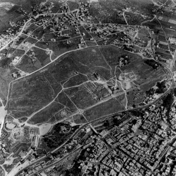 Fig. 3: The Roman city of Jerash, N of Amman. One of the Decapolis cities but with evidence of occupation since the neolithic |
||||||||||
|
Kennedy D.L. and Bewley R.H. Forthcoming. Aerial Archaeology in the Middle East: methodology, potential and objectives: In preparation. Kennedy D.L. and Riley D.N. 1990. Rome's Desert Frontier. London MacDonald B. 1988. The Wadi el-Hasa Archaeological Survey 1979-1983, West-Central Jordan,Waterloo, Ont. Riley D.N. 1981. The contribution of aerial photography to archaeology in Jordan: with special reference to the Roman period. in Kennedy 1981, 327-344 Taylor J. 1989. High above Jordan. London Taylor J. 1993. Petra. London Zwickel W. 1990. Eisenzeitliche Ortslagen Ostjordanland. Wiesbaden.
| |||||||||||
|
|
|||||||||||
| This will be the last PAST
for some readers, if they have not paid their subscription to the Society
for 1998. They will also not receive their copy of the 1998 Proceedings.
Despite individual reminders (which cost the Society postage and administrative
time) some 'members' have failed to respond, and Council will have to
assume that these people have left the Society. If you wish to avoid this,
please send your 1998 subscription immediately - and why not include
your 1999 subscription at the same time, as it is due on New Year's Day. Some members who had not changed their Standing Orders for 1997 did respond to our letter by sending the difference between the old subscription and the current one for that year, but still did not amend their Standing Order for this year, thus making them in arrears again. Please make an effort to write or go to your bank now, so that you do not miss out on the publications and events which make the Society such good value for money. And please send your arrears for 1998!
| |||||||||||
|
|
|||||||||||
|
We have had two further comments on the Trois Frčres 'sorcier', one of which is held over, for space reasons, until the next issue; and I have received an email from the originators of the discussion who intend to offer a reply to all the comments received so far in the next issue of PAST. It would be nice to think that other interesting questions of archaeological interpretation will be raised and pursued in this forum, which comes out often enough to keep the discussion alive. So please think of PAST when you wish to try out some new ideas. I would be very grateful if people sending me items for PAST would include a copy of the text on disk, or send it as a file attachment to (or within) an email message to the address on the front page. Otherwise everything has to be retyped onto the disk which I send to the printers. I realise that not everyone has access to a PC or email, and of course I am delighted to receive contributions in any form - but it would be very helpful indeed if those who could would. Can I take this opportunity to wish all members a happy Christmas, and hope that many of you will receive Prehistoric Society presents!
| |||||||||||
|
|
|||||||||||
| Worry no more about Christmas and birthday presents! The Prehistoric Society has commissioned a range of new merchandise sporting the triple spiral logo, at prices to suit all pockets. The new tie has gold spirals on dark blue, with subtle dark blue spirals in the background, and is available now in silk at Ł14.95 and polyester at Ł7.95 inc p&p. These can be ordered from Julie Gardiner at the address below (please make cheques payable to the Prehistoric Society). | |||||||||||
|
In response to requests from members, a limited range of silver jewellery has been designed exclusively for the Society by Christopher Milton Stevens of Bath (see design below). We hope to have these in time for Christmas if your orders are made immediately. The following are available: earrings (stud or clip), pendant, brooch, tie pin, lapel pin, and cufflinks. Prices have not yet been finalised as it depends how many items we order as a first run, but they will be in the range of Ł20-Ł30 per item/pair. If you would like to place a preliminary order please contact Julie Gardiner at Wessex Archaeology, Portway House, Old Sarum Park, Salisbury SP6 4EB. Tel 01722 326867; Fax 01722 337562; email wessexarch@dial.pipex.com. Do not send any money at this stage, but please let Julie know if you are interested so that we can get the first order under way. All items can also be made in gold - please contact Julie for details. On their way are new T-shirts, sweatshirts, silk scarves and little 'stick' pins - details and prices available in the next issue of PAST. 
|
 Examples of the jewellery, shown as earring, pendant and cuff-link. The design shows the triple spiral in relief against a flat sheet of silver. A combination of polished and matt finishes emphasises the depth of the relief. |
||||||||||
| ANNIVERSARY
FOR AN OLD LADY Clive Gamble reports on the Neanderthal conference in Gibraltar and dinner among the stalagmites
|
|||||||||||
|
One hundred and fifty years ago the Forbes' Quarry skull was found in Gibraltar. It was not the first Neanderthal - Engis in Belgium has that distinction. Gibraltar also missed out on becoming the type site. Instead, thanks to William King, the Neander valley in Germany got there first in 1864. But for this accident of history it could have been Homo calpicus rather than Homo neanderthalensis that we go in search of, while witnesses to anti-social behaviour would be exclaiming in disgust "What a Calpican thug!". |
|||||||||||
|
To mark this anniversary of the discovery of the Forbes' lady, followed in 1926 by another Gibraltar find - the Devil's Tower child, - a conference was organised by (Clive Finlayson of the Gibraltar Museum in conjunction with Chris Stringer of the Natural History Museum, London and Nick Barton of Oxford Brookes University. The Government of Gibraltar provided tremendous hospitality. They have marked the find with a special plaque in Forbes' Quarry and the skull also graces the "Welcome to Gibraltar" sign at the Airport. During the conference both skulls were on loan from London and were displayed in an excellent exhibition at the Museum.
|
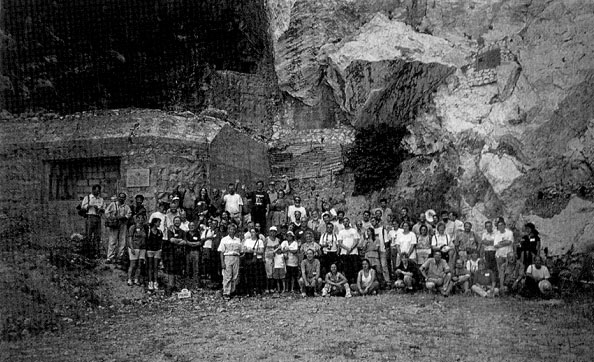 The site of the discovery: Forbes' Quarry, Gibraltar |
||||||||||
| Over two hundred delegates attended. There were many highlights for them to remember in a packed three days. The conference dinner was held amidst the stalagmitic wonders of St Michael's cave high on the rock and where your glass was re-filled by the natural drip from the roof. Then there were the 300 or was it 600 steps ?, the number kept changing like a calibrated radiocarbon date, down to the current excavations led by Chris and Nick at Gorham's and Vanguard caves on Governor's beach. Here we saw the emerging evidence for the transition from the Middle to the Upper Palaeolithic and the oldest dinner-time camp of mussel shells anywhere in Europe. Then there were the CAP (Computer Assisted Palaenanthropology) images of the Devil's Tower Child presented to us on video by (Christoph Zollikofer. Before our eyes the fragments grew into a reconstructed skull and all perfectly choreographed to the soundtrack of Charlie Mingus playing Pitbecanthropus. | |||||||||||
|
But it is not possible to have a conference about Neanderthals without some heat. The temperature has now been turned down under the argument over their replacement or continuity. Replacement at this conference was accepted. Instead the heat has been turned up under the question of contact and the likelihood of acculturation between Neanderthals and Modern people, particularly along the Ebro frontier in Iberia and in the Dordogne pocket. Our President, Paul Mellars, acted as ringmaster as competing views, particularly by Iberian archaeologists Joao Zilhao, Luis Raposo, Vicky Cabrera-Valdes and Federico Bernaldo de Quiros were strongly put. Had the Neanderthals developed their own "Upper Palaeolithic" or just imitated what they saw around the necks and in the hands of the first modern people who came into their territory? Had Gibraltar, like Manhattan island much later, been sold for a few trinkets to unscrupulous adventurers 27000 years ago? The north Europeans added their perspective through Jean-Philippe Rigaud, a recent Europa lecturer to the Society, and Jean-Jacques Hublin, while Ofer Bar-Yosef put the bigger picture from the eastern Mediterranean. The result is that we have a fresh agenda to pursue in this fascinating interface between ourselves and the Neanderthals. This debate will run and run up to the next anniversary and well beyond.
|
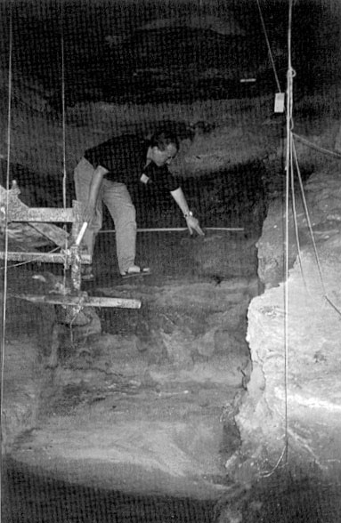 Paul Pettitt to the middle/upper palaeolithic interface in Gorham's Cave |
||||||||||
|
ROCK
ART OF THE CENTRAL NAMIB DESERT
|
|||||||||||
| Rock art of southern Africa comprises both images painted onto rock surfaces and images engraved into rock. Until now paintings and engravings have been simply thought of as two different techniques of image production by hunter-gatherer San, or 'Bushman', artists. Recent research indicates that painting and engraving is more likely to have been a conscious decision made by artists in specific social and historical circumstances. Different communities chose to mark their landscapes in different ways. | |||||||||||
|
Students and staff from the Department of Archaeology, University of Southampton, are engaged in a five year rock art project in Namibia. The aim of this project, funded by the British Academy and the University of Southampton, is to investigate the context in which rock paintings and engravings were produced in the Ugab River Valley, of the central Namib Desert. This research is both timely and relevant to more general archaeological enquiries in the region. Current debates on the introduction of pastoralism, and interactions between hunter-gatherers and pastoralists, refer to rock art in general terms. This project will provide specific data and analyses on the role the production of symbolic imagery had in shaping the prehistory of the region. It is assumed that both paintings and engravings were made by hunter-gatherer peoples. |
 Southampton University students making tracings at Okonguami, Namibia | ||||||||||
|
We have carried out two extensive field seasons. During the first we concentrated on locating rock art sites in a small area to get some idea of the density of archaeological sites in the overall research area. In the second field season, July 1998, we located and recorded rock engraving sites. The first survey revealed that the density of rock art sites in the research area was quite high. In two weeks an area of 5000 hectares was covered and some 43 sites were found. During the survey and recording of engraving sites we made a number of interesting observations, both of the engraved images and of the places at which engravings were made. Perhaps the most intriguing were sites where the geomorphology of the outcropping rocks has resulted in basin-like features. During rainy seasons these basins fill up with water, and almost certainly would have provided a source of drinking water for both animals and humans in prehistory. But there is more to these places than the provision of water. Engravers chose to peck into the rock surface around the rim of the waterholes with vast numbers of animal hoof prints. They chose to represent large animals, such as rhinoceros, giraffe, kudu, eland, gemsbok and lion. To understand the significance of this feature we need to explore fully the attitudes hunter-gatherer peoples in southern Africa had towards big game and waterholes. This is now the focus of our ongoing research. But, briefly, I offer the following comments. |
|||||||||||
| Large game animals are seen as a source of supernatural power medicine people harnessed to go into the spirit world. In the spirit world shamans were believed to have cured the sick, resolved social tensions, controlled the game and the rain. Waterholes were seen by shamans as entrances to the spirit world. During a trance ritual shamans would invoke and harness the power of certain animals through singing and dancing. This would enable them to go into an altered state of consciousness, or for them to cuter the spirit world. They would talk of entering holes in the ground, swimming through the underground until they reached the spirit world. There are similar physical sensations to being in an altered state of consciousness and being underwater: both include a sense of weightlessness, as well as altered vision and hearing. In fact shamans often used an underwater metaphor to describe their experiences in the spirit world. |
 Animal spoor engraved on a rock surface in Outjo district, Namibia | ||||||||||
|
These brief comments in no way account for the richness, both technical and conceptual, of the engravings we surveyed. Rather; they provide a direction for exploring the art in a non-eurocentric manner.
|
|||||||||||
|
A
SURPRISE FOR JOHN WYMER
|
|||||||||||
| The annual Palaeolithic and Mesolithic Day Meeting in London on 25 September served up the usual high quality menu of papers on topics as diverse as horse-hunting at Solutré, Pleistocene survey in South Africa, Neanderthals on Gibraltar and the Mesolithic of County Kerry. Its ending was, however, unprecedented. At the reception which concluded the meeting Clive Gamble presented John Wymer with a volume of papers written in his honour - and without his knowledge - by friends and colleagues. | |||||||||||
| The contents reflect the successive and successful stages of John's career summarised in PAST 17 in 1994. The story is now told at greater length in an introductory memoir, 'Bifaces, booze and the blues. Anecdotes from the life and times of a Palaeolithic archaeologist' by Andrew Lawson and Andrew Rogerson. The papers which occupy the rest of the volume demonstrate the scale and scope of John's contribution to the study of early humans and their world. The discovery of part of the Swanscombe skull in 1955 was the beginning of a series of classic excavations, chief among them Thatcham in the Thames valley, Klasies River Mouth in South Africa, and Clacton and Hoxne in East Anglia. |
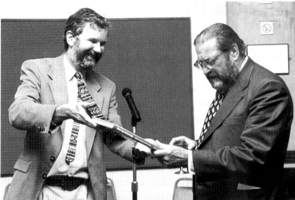 Clive Gamble presenting the volume to John Wymer © Cath Price | ||||||||||
|
John has been a teacher, a museum curator, a field officer in an archaeological unit and an independent archaeologist, excavating and publishing sites of all periods, in particular clocking up a Neolithic and Bronze Age publication record which would put many specialists in that field to shame. The concrete blocks protecting some Norfolk round barrows from the encroaching plough resulted from a Wymer initiative. He has always been actively involved in his 'home' archaeological societies, serving as an officer and working hard as a communicator; whether teaching WEA classes or demonstrating flint-knapping, rabbit-butchery, fire-making and rabbit-stewing to school children, and, most impressively of all, persuading them to taste the end product. National societies have been served with equal diligence. He has, for example, been President of the Quaternary Research Association, Vice-President of the Prehistoric Society and Chair of the Lithic Studies Society. A parallel thread has been the outstandingly generous process of compiling works of reference which have smoothed the path of those following behind. Lower Palaeolithic Archaeology in Britain as Represented by the Upper Thames Valley (1968), the Gazetteer of Mesolithic Sites in England and Wales (1977), Palaeolithic Sites of East Anglia (1985), and the recent documentation of the Southern Rivers and English Rivers Projects are all ready, readable sources of information and provide the basis for research which could not otherwise be undertaken. These works are an enduring aspect of the support which John has consistently given to colleagues. The enthusiasm and encouragement which he has dispensed over the years have stimulated and sustained research as much his publications have. John has recently, and deservedly, been made a Fellow of the British Academy. Clive Gamble's alternative rendering of FBA as Father of the British Acheulean is no more than the truth.
| |||||||||||
|
BAHN
ON THE 'SORCIER'
|
|||||||||||
|
This is an interesting contribution to the study of one of the best-known figures in European Ice Age art, but one important point that must be made is that the authors are discussing a drawing by Breuil, not the original engraving. Since access to Les Trois Frčres has always been restricted, and time spent in the "Sanctuary" with its incredible abundance of engravings is usually short, relatively few people have had the chance to study this small figure carefully at first hand. Breuil's drawing, on the other hand, immediately became one of the best known and most widely published images of the Ice Age after its first publication in 1930 (Breuil & Bégouën 1930) - so much so, in fact, that it is impossible to look at the original without Breuil's version in one's mind. And one has to remember that it may not be an entirely accurate copy of the engraving. As I have shown (Bahn & Vertut 1997, 51), Breuil's tracings of engravings were often imperfect, inaccurate or incomplete, especially where portable art was concerned, but also in some cases of parietal engravings (e.g. at Altamira). It is generally recognised that his work at Les Trois Frčres is among the best he ever produced but nevertheless, his drawings cannot and should not be accepted as accurate without being checked. A comparison of his drawing of this figure with Vertut's macro-photograph of the engraving's tiny head (Bahn & Vertut 1997, 178) shows that the two have distinct differences; it follows that the same is probably true of the body and tail, so that it is risky to base one's interpretation on such details. That said, I agree with the three authors that there has never been much to be said in favour of the traditional interpretation of a "musical bow", and the lines that leave or enter the figure's muzzle could be any number of things, such as breath or sound - or indeed a hunting bow, as the authors suggest. I also agree that there is not necessarily any association with the two almost equally strange herbivores to the left of the figure (the trio is often extracted from the mass as a separate group, for example on the cover and title page of the cave's monograph, Bégouën and Breuil 1958). I find the suggestion that the animal should be seen as horizontal unconvincing; there are certainly many cases of "vertical" quadrupeds in palaeolithic parietal art, and indeed in this cave, but this one has such a rounded, un-bisonlike head, in contrast to the very bisonlike heads of the many bison figures in its vicinity, that the human body and vertical posture seem to denote something special. The view that it might represent a disguised hunter coincides with the same suggestion made recently by Kehoe, who likewise compared it (1996, 198-9) to a Blackfoot bison drive decoy runner. In short, the authors' suggestion is a plausible speculation, and one mercifully free from the ill-founded obsession with shamanism that currently dominates one approach to this art corpus, but I see no reason to turn the figure through 90 degrees.
|
|||||||||||
|
SOCIETY'S
TOUR OF DUMFRIES AND GALLOWAY, 3-9 JULY 1998
|
|||||||||||
|
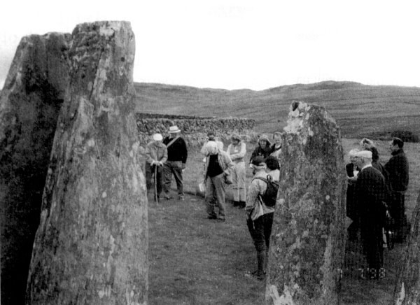
Some 40 members seized the chance of this highly scenic field trip to gather late one afternoon at the Lockerbie Manor Hotel, in rolling country a mile out of the town. Run by a Hong Kong Chinese couple, the hotel's motto is 'Where East meets West' (but Chinese fare was never on our menu, though some prawn crackers went past our table once ...). Two chocolate Labrador dogs and half a dozen near-feral cats were also on the staff. Our President, Paul Mellars, was unfortunately unable to be with us so John Coles, a past President, had agreed to resume his old familiar role, discharging it throughout with his customary grace, humour and unobtrusive concern for our welfare, and winding up the conference dinner with an excellent address. The field guide prepared for us by Stratford Halliday and colleagues was as beautifully done, and exemplarily proof-read, as we expect from RCAHMS staff and their colleagues. lts carefully themed programme allowed us plenty of 'compare and contrast' experiences as we travelled through the different landscapes of SW Scotland and looked at a wide variety of monuments. Three speakers gave us scene-setting talks. Iain Banks described some of the extraordinarily interesting archaeology coming out of the M74 motorway route, despite the worst that Scottish weather could throw at the diggers. Kenneth Brophy then talked about cursuses in Scotland: over 50 are now known, mostly from the areas where aerial reconnaissance is possible, and they show considerable variety. The third talk, on later prehistoric settlement of the region, was by David Cowley, who also did much of the guiding on subsequent days: he indicated the usual biases in the evidence due to differences in fieldwork concentration and differential preservation. Many sites seen from the air remain unclassifiable, so the M74 excavations will be crucial to interpretations in SW Scotland and beyond. |
|||||||||||
| The important native and Roman site of Burnswark was our first goal that afternoon: on later days we were able to appreciate from afar its commanding position on the Annandale skyline. The larksong-drenched hill demanded a steep climb, so it was a relief to pause at the corner of the Antonine fortlet to examine the traces of native re-use within it, together with the three lumps of ?artillery emplacements associated with the Roman temporary camp on the south face of the hill. Then onwards and upwards to the summit's native embankments and a ruined cairn, and down a precipitous sheeptrack to look at a later prehistoric triangular enclosure at the foot of the hill. Next came Woodycastle, a lovely but undated earthwork evidently designed to impress despite its small size. A small lake nearby caused John Coles to daydream about prehistoric bronzes perhaps lying below its waters... |
 Negotiating a stile, Prehistoric Society-style | ||||||||||
|
Day two's theme being 'Ceremony and settlement in an upland landscape', we set off for Eskdalemuir; which mercifully failed to live up to its sodden Met Office reputation. We looked at both terminals of a recently discovered earthwork, classed as a 2 km bank barrow although its middle gets entirely lost in the intervening valley. Doubtless it looks convincing under winter vegetation, but amid the July growth of grass and sedges I fear scepticism in our party was evident. The lunch break was spent, surprisingly but rewardingly, continuing the ceremonial theme at the Tibetan Buddhist monastery of Samye-Ling (whose astonishing pagoda we had seen from the northern terminal of the bank barrow). So it was off with the footgear and into the impressive red and gold of the temple's interior, where a charming young monk with a strong Sahf London accent expounded Buddhist philosophy to us. Then Roger Mercer joined us for a rapid tour of two stone circles, Loupin' Stanes and Girdle Stanes, only two fields apart but as different as Cream of Galloway ice-cream and Mr Whippy. Next came Roger's extraordinary site of Over Rig, a natural, acoustically impressive amphitheatre beside the River White Esk within which a ceremonial monument had been constructed in a period spanning the BC to AD turn of the millennia. (Did the foxgloves march out for them too?). Just up the road Castle O'er; the multiphase fortification which rivals Burnswark for regional pre-eminence, contains numerous house-sites, and dates to the first half of 1st millennium AD. Last of the day came Boonies, a defended settlement which George Jobey had shown contained up to 13 intercutting timber houses; the unfortunate diggers had shifted large amounts of prehistoric cowdung ('squish'). The theme of the third day was 'Regional variations and the withdrawal from the margins', in which, passing the spectacular viewpoint of the Devil's Beeftub, we crossed the watershed into Peeblesshire to emphasise some settlement differences and view abandoned Bronze Age landscapes. On the way we looked at the small but strong fort at Beattock, just above M74, and the feature-filled landscape of Stanshiel Rig - trackways, enclosures, lynchets. Here David Cowley showed us a burnt mound, purpose unknown, but 'there are many things you can do with a hot stone'. Over the watershed lay markedly different terrain and an unenclosed platform settlement, Peddirie Dod, where only repeated visits had revealed the faint field-system below. (Oyster catchers were particularly noisy here, swooping ceaselessly over the stream). The next two sites were real postgraduate stuff: after a long plod over bog and tussocky grass, the palisaded settlement and ruined cairn at Nether Dod were hard to read under summer vegetation. But the spotted orchids made the plod worthwhile. Weird Law was easier to reach and see - cremation cemetery, cairn and platform settlement. |
|||||||||||
|
On day four we travelled westwards into the machars, the flat fertile coastal lands of the Wigtown area to see under the welcome guidance of Jack Scott the magnificent chambered cairns at Cairnholy, dug by Stuart Piggott. Jack proposed (based on excavated evidence from Lochhill and Slewcairn) a timber exposure platform preceding the visible monument. The sea views were splendid and a recorder played tunefully in the nearby garden. On to Torhouse, a stone circle of stumpy boulders with nearby stone alignments: a fresh bonfire at the centre and cut foxgloves suggested pagan rites... |
 In the forecourt at Cairnholy 1 with Jack Scott | ||||||||||
|
By its nature, Mesolithic Luce Bay was taken on trust from Jane Murray's excellent description in the guide, because our next goal was the cup-and-ring stones and alignment at Drumtroddan, where Doreen Grove (Historic Scotland inspector) set off a vigorous debate about 'stories' in archaeological presentation: do we set out a preferred theory on the interpretation boards or leave visitors to spin their own? This one could run for ever. Lastly on this day, Rispain Camp, although excavated to reveal timber houses spanning the BC/AD turn, remains a strange site, very deeply ditched and rectangular in form. Day five took us on to the 'threshold of history' with visits to the 7th century jewellery-working fort of Mote of Mark, and to Castlehill Point fort a couple of miles away along the beach. Lunch was in the sleepy town of Kirkcudbright, then on to Castle Haven, a largely reconstructed dun (again, modern pagan rites in one of its galleries), and (seen from the bus only) the impressive Mote of Urr which has interesting connections with Balliol College. The final site of the day, and of the tour, was Pict's Knowe henge, now a sad wreck with rabbit burrows, dead tree and abandoned photographic hide, but a most intriguing site well expounded by Julian Thomas. Altogether a splendid tour which, as ever, could have welcomed more participants from the world of paid archaeology. If they truly cannot afford to come, could the Society somehow find a source of subsidy for them? We would all be the gainers for it. The thanks of all the party go to the fieldbook writers, speakers and guides: Strat Halliday, David Cowley, Jane Brann (much of the planning, plus guiding on several days and also giving valuable commentaries as the bus went along) Angela Gannon, Roger Mercer, Jack Scott, Jane Murray, Julian Thomas and Ronan Toolis; David McOmish was the Meetings Secretary and Doreen Grove of the Historic Scotland Inspectorate collected our comments on HS interpretations
|
|||||||||||
|
PREHISTORIC
SOCIETY STUDY TOUR TO SOUTHERN SWEDEN, 14-21 JUNE 1999
|
|||||||||||
| The Society will visit the beautiful Swedish province of Scania in June 1999, under the guidance of Professor Lars Larsson and Dr Deborah Olausson of Lund University, with Professor John Coles guiding on the rock carving sites. In early summer; Scania should be enjoying warm weather and plenty of sunshine, although there will be a chance of some rain. |
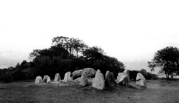 Megalithic tomb at Havĺng | ||||||||||
|
We fly to Malmö and transfer to the old university city of Lund where we are based for two nights. An introductory lecture on the prehistory of Scania will open the proceedings, and a full day excursion to sites in and around Lund will follow, including mesolithic bog sites, a passage grave, rune stones, an iron age settlement and the museum. Then we set off along the southern coast of Scania, seeing bronze age mounds, the Trelleborg Viking fortress, the mesolithic Skateholm cemetery displays, a long barrow etc, arriving at our second hotel, an ancient inn at Brösarp on the eastern coast. From here we have four days of visits, none of long distance, to see the splendid rock carvings at Simris and other sites, megalithic tombs, iron age cemeteries, castles and churches, the immense stone ship-setting high on the cliffs at Ale stenar, bronze age sites including the Kivik cairn with its elaborately decorated cist slabs, hillforts aud so on. The landscape of south and eastern Scania is very attractive, with low hills and valleys, lovely cottages, no large urban centres, and plenty of opportunity for walks. Mid-June should have many hours of sunlight each day, if we are lucky as we will be! The Brösarp inn is a very fine place for our base for these four days. We then travel back to Malmö for a return flight to London City airport (not Heathrow).
|
 Rock carvings at Simris | ||||||||||
|
A
VISIT TO TEYJAT
|
|||||||||||
|
The Grotte de la Maire at Teyjat in the Dorgogne, having once been more widely open to the general public, is now only open to small groups by arrangement in high summer We were fortunate in being able to set up a visit at short notice in January 1998 with the assistance of the Museum of Prehistory in Les Eyzies. The site is notable both for its fine frieze of cows and bulls, shown in superb and delicate anatomical detail, and for the part it played in the acceptance of the true age of cave art, due to the presence of engravings on stalagmite blocks partially buried by Upper Palaeolithic deposits.
The site was shown to us by a member of the museum staff who was both helpful and knowledgeable in her presentation. She was clearly concerned about the possibility of the entire ensemble of calcite blocks being undermined by water entering the cave from the top of the slope behind the blocks but, on closer examination, it appeared to us that the water was in fact depositing fresh calcite rather than eroding the clay from beneath the blocks and so was more likely to stabilise than undermine the pile. The engravings are mainly well preserved although some have suffered from deposits of bat guano subsequently calcified by water from the ceiling. To protect against this an internal "roof" of corrugated plastic on a metal frame has been erected. The cave is being passively conserved by the limitation on visits and these may well he further limited when the small interpretation centre planned for a neighbouring building opens, probably in the coming year. However, in addition, the cave would benefit from a degree of active conservation. The plastic internal roof has been erected horizontally which currently allows the water drops forming on its underside to drip straight down onto the blocks below, which can only, as time goes by, prove damaging. This sheeting should be re-erected on an angle allowing the water to run harmlessly down to a collecting channel on the other side of the passage. In addition, there are a number of old display items consisting of the type of "light box" with line drawings still seen at Bara Bahau in situ in the cave. These are long since redundant and should be removed, as rusty iron work contributes nothing to the cave environment or to the display of the engravings. For this to be done, however; it will be necessary to overcome what we have found to be an inherent fear of any active measures at many such sites (even Lascaux, where rusty iron railings can still be found). The aim of all such sites, whether open to visitors or not, should surely be to allow the display of the art in as close to its original setting as possible, uncluttered by such remains which have neither use nor value. Thanks to the staff of the Museum of Prehistory, in particular Mlle. Gizardin, for their kind help in facilitating an excellent visit.
|
|||||||||||
|
CHAMPION'S
CHOICE
|
|||||||||||
|
Kennewick Man Virtual Interpretive Center: A fascinating set
of pages from the Tri-City Herald, Kennewick's daily newspaper, which
includes all the news reports of the controversies surrounding the 9,200-year-old
body, from the first report of the discovery in July 1996 to the most
recent report on 30.10.98 of the bones' removal to Washington State
University for further study. Details of 'the players' in the controversy,
and online legal documentation including the NAGPRA legislation and
legal submissions relating to the court case, are included among other
topics.
|
|||||||||||
|
|
|||||||||||
|
The Ethnoarchaeology of Hunter-Gatherers/The Palaeolithic and Mesolithic
of Europe and Britain: 5.2.99-6.2.99.
|
|||||||||||

 |
The Prehistoric Society Home Page |