Planetary surfaces record geological events which are a combination of internally and externally driven phenomena, which together define the origin and evolution of a planetary body and solar system.
RESEARCH THEME CONTACTS:
- ANDREW COATES
- JAN-PETER MULLER
- RAMY EL MAARRY
The surfaces of planetary bodies and natural satellites record geological events. These events are a combination of internally and externally driven phenomena, which together define the origin and evolution of a planetary body and to a certain extent the wider solar system. Externally driven forces are dominated by impact cratering (across an eleven order-of-magnitude spatial scale), but also include and electromagnetic, particle and plasma irradiation on airless bodies ('space weathering') and 'traditional' fluid-mediated weathering on bodies with atmospheres. Internally driven forces are dominated by volcanism and tectonics, although in the case of smaller bodies, such as Io, Europa, Enceladus, and Triton, the ultimate power source is the external gravity field of their primary.
The geological record of other planets is often multi-layered and complex, and forming an understanding of these geological events from the planetary surface requires a combination of techniques: Mapping, Measurement, Interpretation and Modelling:
- Mapping of geological structures and rock units using remotely sensed data;
- Measurement of chemical and mineralogical properties both in situ (on landers and rovers) and ex situ (using returned samples);
- Interpretation of the data sources using machine learning approaches in terms of their formation processes;
- Modelling (both theoretical and experimental) of geological processes based on terrestrial analogues.
On the Moon, for example, we use visible-light images to map crater-size distributions and establish age relationships between mapped units. These are combined with elemental abundance maps from orbital remote sensing to learn about changes in the composition of erupted lavas with time, and to study the chemistry of deeper crustal units exposed in impact basins and crater walls. Detailed petrological analysis of returned rock samples and lunar meteorites are then slotted into this broader context to provide detailed clues to understanding the Moon's thermal evolution. Solar wind ions implanted in the lunar soil also yield a record of the Sun's evolution. In addition, studies of lunar geology also help us assess the extent to which the Moon may harbour resources which may make future space exploration more affordable. These considerations guide our development of instruments and of observing strategies for future lunar studies.
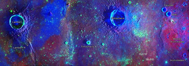
Rapidly increasing computer power allows synthesis of imaging and spectroscopic data sets to extract global shape and local topographic data, as well as mapping of compositional variations. Combining image-based digital data with topography, gravity and magnetic field data can help to resolve difficult problems, such as the Martian hemispheric dichotomy and the existence of a putative northern ocean shoreline. An example is the production of a global set of HRSC (High Resolution Stereo Coverage camera, on board ESA’s Mars Express) and CTX (Context Camera, on board the NASA Mars Reconnaissance Orbiter)-derived topography and more recently the generation of super-resolution restoration for detection of Recurring Slope Lineae (RSL) and small rock distributions.
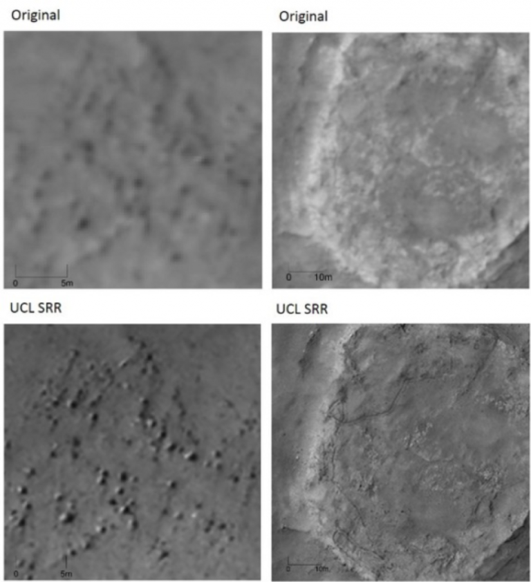
Image: Example of super-resolution restoration with 5-cm images generated from stacks of 25-cm images.
The UCL/Birkbeck Centre for Planetary Sciences conducts world-class research using all four of these techniques, and the work done within this theme provides not only the input for work across the other CPS research themes of Astrobiology, Atmospheres and Magnetospheres, and Interiors, but also the evidence for discriminating between hypotheses generated by modelling in these other areas.
Our researchers play key roles in a number of high profile ESA and NASA space missions. For instance, we are Principal Investigator team for the PanCam instrument on the ESA-Russia ExoMars 2020 rover, now called Rosalind Franklin, and have several PanCam science team members at CPS. Rosalind Franklin will drill up to 2m underneath the harsh surface of Mars, at Oxia Planum, in 2021 to gather samples. The mission will search for biomarkers indicative of past or even present life on Mars. PanCam includes two Wide Angle Cameras (WACs) providing 3D stereo views of the surface, and each WAC has an 11-position filter wheel providing geological and atmospheric context. PanCam also includes a High-Resolution Camera (HRC), providing close up views and rock texture. PanCam is the only UK led instrument on the rover. We are also co-investigator on the NASA Mars 2020 Mastcam-Z team. Both of these instruments will carry out detailed geological analyses of the Martian surface.
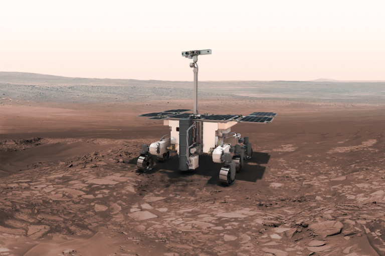
Image: The ESA Rosalind Franklin (ExoMars 2020) rover. We lead the PanCam instrument team for the rover. PanCam is seen at the top of the mast. Credit: ESA.
We are also involved in the science teams of cameras on the ExoMars Trace Gas Orbiter TGO. We are specifically involved with both image planning and data analysis of the CaSSIS camera onboard TGO. The CaSSIS camera acquires colour and stereo images of the Mars surface at resolutions that exceed those of the CTX camera, and covers larger swaths in colour and stereo than HiRISE (see CaSSIS image below).
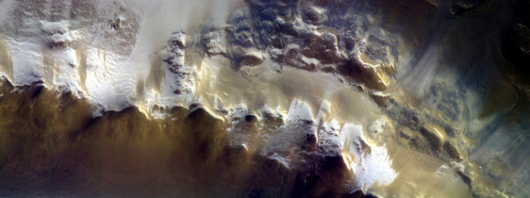
Image: CaSSIS colour image covering parts of Korolev Crater on Mars. The image covers an area nearly 40 km in width. Credit: ESA/Roscosmos/CaSSIS.
In addition, we are co-investigator on the JANUS imager on the ESA JUICE mission, complementing our co-investigator involvement in the Particle Environment Package. JUICE will orbit Jupiter in 2030 after its launch in 2022, and will fly by Europa, Ganymede and Callisto before orbiting Ganymede in 2032. We are specifically involved in planning observations of Ganymede’s surface and aurora.
We are also involved with missions that study small bodies to investigate the conditions during the time of formation of our Solar System. Notably, we were involved with the ESA Rosetta mission that investigated comet 67P/Churyumov-Gerasimenko for more than 2 years (ending in Sep 2016). Our researchers and students are actively analysing the data by investigating the changes that occurred on the surface in order to better understand the geologic processes that act on a cometary body, as well as studying the plasma interaction with the surface.
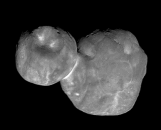
Image: Image taken by New Horizons of 2014MU69 (Ultima Thule) when it was 4200 km away from the spacecraft (body is nearly 30 km long). Credit: NASA/Johns Hopkins University Applied Physics Laboratory/Southwest Research Institute.
 Close
Close

