UCL researchers reveal 'polycentric' London
11 February 2010
Links:
 org/abs/1001.4915" target="_self">Commuting in a polycentric city (link to page where study is available for download)
Researchers from UCL have analysed millions of Oyster Card journeys in a bid to understand how, why and where we travel in London.
Professor Michael Batty (UCL Centre for Advanced Spatial Analysis) and Dr Soong Kang (UCL Management Science and Innovation) applied the techniques of statistical physics to their mountain of raw data.
The pair joined forces with a computational social scientist and a physicist, both based in Paris, to explore patterns of commuting by tube into central London.
They used Transport for London's database of 11 million records taken over one week from the Oyster Card electronic ticketing system.
The existence of such detailed data sets is fast heralding a new age for the study and planning of cities, as it gives researchers a greater insight into the complex web of relationships and interactions that constitute urban life.
Professor Batty said: "Using techniques of statistical physics, we can extract the patterns of how we travel and explore the regularities in these, linking these movements to the polycentric nature of the centres that compose the core of large world cities such as London."
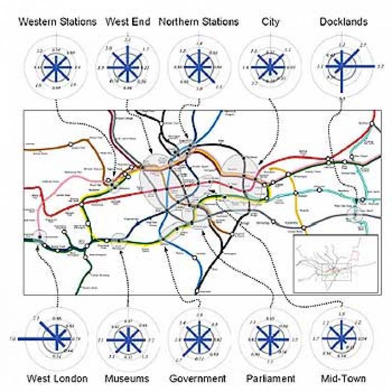
The patterns revealed by Professor Batty and Dr Kang's study show how complex such city centres actually are - London contained no single centre, but instead has around 10 'polycentres' that interlink in complex patterns.
The researchers believe the analysis of such patterns could help predict and mitigate the impact of major changes to infrastructure such as the construction of Crossrail, a project that involves building a series of new railway connections under central London.
Image: A graphic showing the 'polycentric' nature of commuting patterns in central London
UCL context
UCL's Centre for Advanced Spatial Analysis was created as a focus for emerging computer technologies in several disciplines which deal with geography, space, location, and the built environment. As an interdisciplinary research centre, expertise is drawn from archaeology, architecture, cartography, computer science, environmental science, geography, planning, remote sensing, geomatic engineering, and transport studies.
Related stories:
Earthquake experts focus on helping Haiti
Bartlett architects explore relationship between nature and artifice
CASA launches MapTube
 Close
Close

