 Close
Close

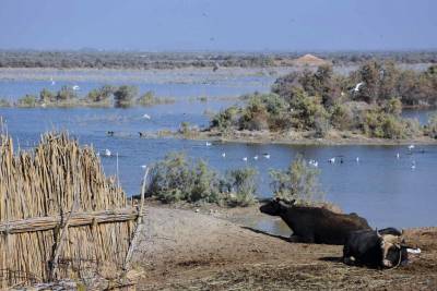
The Iraqi Marshlands of the Mesopotamian Plain are considered one of the largest wetland ecosystems and a unique historical and ecological environment. In the last three decades, the Marshlands witnessed actions of draining and reviving of water processes, which resulted in changes in its environmental and economic features.
The main objective of this project is to promote the tourism of the Marshlands as part of the ancient Civilization of Marshlands of Iraq and to increase tourist content. This can be achieved by assessing the environmental background and cultural values based on investigating past and present environmental studies to close research gaps and mapping its current status, in order to establish a tourism model in the region.
The team aims at increasing awareness by educating students at universities and preparing trained and fully qualified tour guides whose must obtain knowledge in history of Marshlands from the perspective of their cultural heritage which is relevant to the nature, viability and traditions of the society of southern Iraq. The team hope this project provides job opportunities for graduate students in the tourism sector.
This project has produced tourism maps of the Marshlands and its archaeological sites using Geographical Information system (GIS) programs and Remote Sensing Platforms, which is a brand new attempt in the region. In addition, it optimized citizen science that has opened up science to the public in conflict zones. The project also aims to raise the awareness of local governments and decision-makers about the importance of tourism in marshlands region to attract tourists on a global scale.
Watch video from the Nahrein Network Colloquium to learn more about the project.
Project Outputs
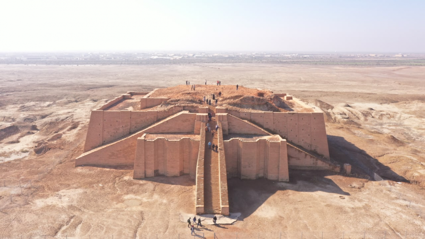
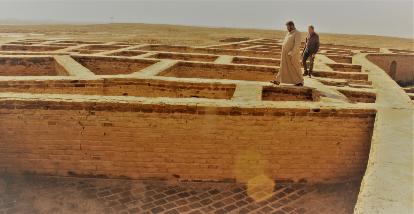
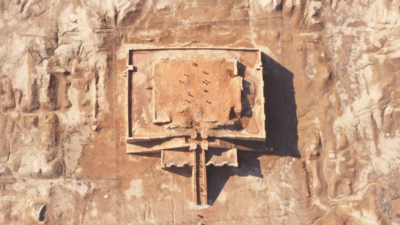
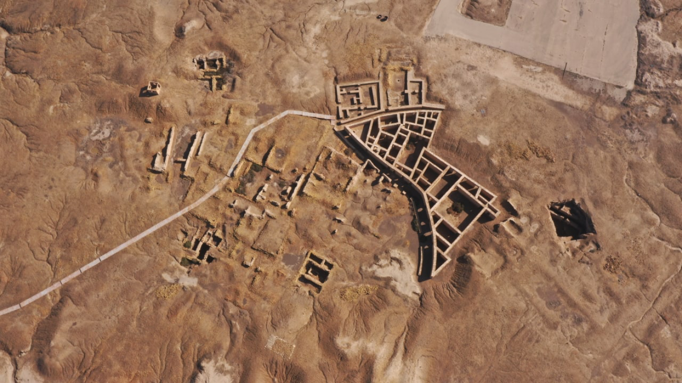
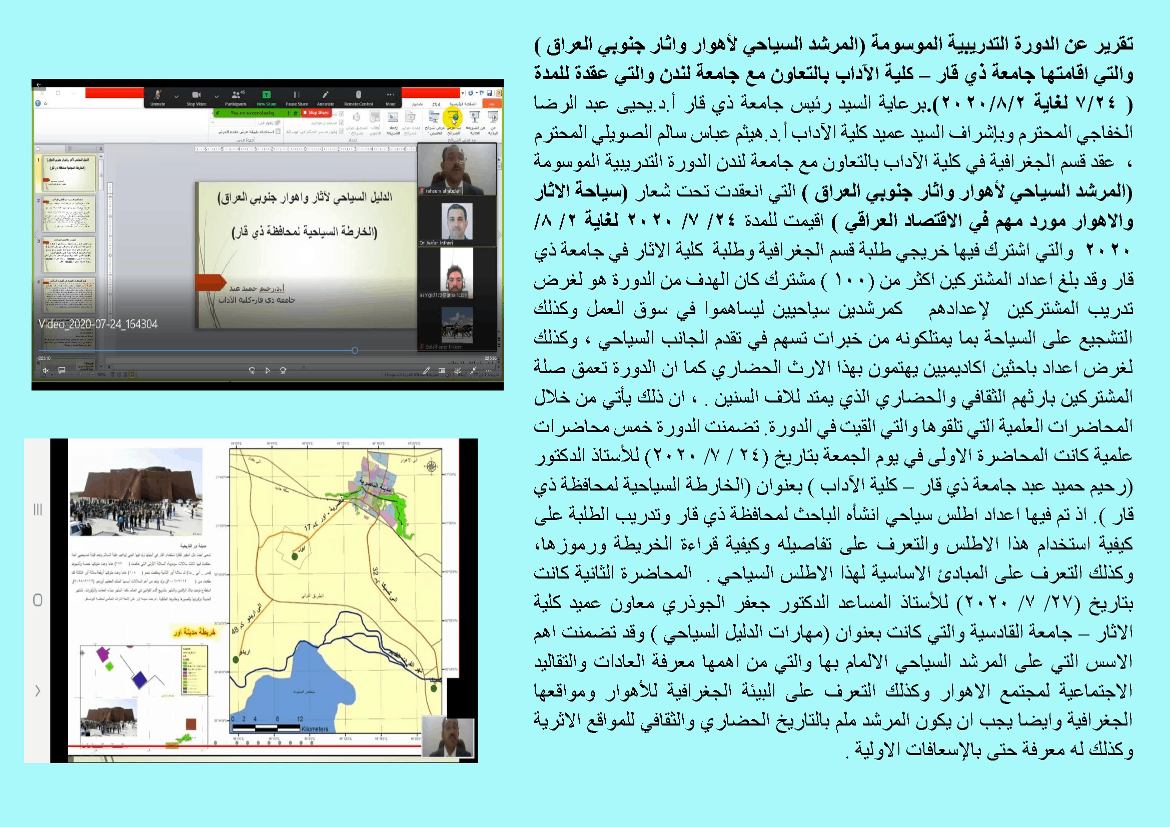
Tourism atlas brochure of the marshlands with detailed maps of Nasiriyah, including Eridu, Ur and all archaeological sites. The Atlas consists of detailed maps for the city of Nasiriyah, ERIDU and UR. The maps identify past and current threats and the condition of marshlands, their accessibility and available facilities. The tourism atlas is available in hard copy, citizen science maps in A3 format and copy booklets of tourism for visitors and tour guides.
Training workshop and seminar of 335 geography and archaeology students, teachers and researchers. The training programme aimed at developing tour guides in sustainable tourism. To learn more about the workshop visit link (Arabic).
Conference titled: The Sustainable Development of the Marshes in collaboration with the Ministry of Higher Education and Scientific Research and Al-Nahrain University
Published a book focusing on the marshlands of Iraq. The book consists of 4 chapters that cover history, geomorphology and geographical location, environmental changes and natural and hydro-geomorphological properties of marshlands.
Citizen Science Tourism Report of the Iraq Marshlands by Zeyad Ahmed, Eoghan Darbyshire, Raheem Abdan.
Project report titled: The past, present and future of the Mesopotamian marshes published on The Conflict and Environment Observatory blog. Read the blog post in link below.
Follow Dr. Raheem Al-Abdan on Twitter, Youtube and Facebook for more updates on this project.