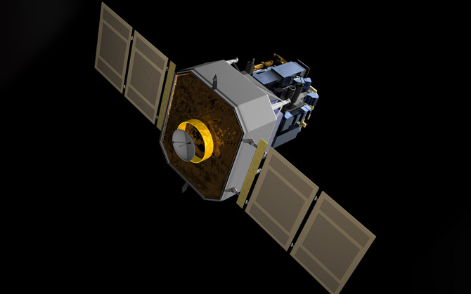
Solar and Heliospheric Observatory (SOHO)
MSSL is a co-investigator institute on the Coronal Diagnostic Spectrometer (CDS) on SOHO investigating the outer layer of the Sun, solar wind and probing the interior structure of the Sun. 1996

23 May 1996
- MSSL built the UV detectors for the GIS part of CDS, as well as on-board electronics
MSSL is a co-investigator institute on the Coronal Diagnostic Spectrometer (CDS) on SOHO, along with the Rutherford Appleton Laboratory (the PI institute), Max-Planck-Institut fur extraterrestrische Physik (MPE), Goddard Space Flight Center, University of Oslo, and others. CDS is one of twelve instruments to fly on the ESA/NASA Solar and Heliospheric Observatory and has two complimentary systems; the Normal Incidence Spectrometer (NIS) and the Grazing Incidence Spectrometer(GIS).
The three main scientific objectives of SOHO are:
- Investigation of the outer layer of the Sun, which consists of the chromosphere, transition region, and the corona. CDS, EIT, LASCO, SUMER, SWAN, and UVCS are used for this solar atmosphere remote sensing.
- Making observations of solar wind and associated phenomena in the vicinity of L1. CELIAS and CEPAC are used for "in situ" solar wind observations.
- Probing the interior structure of the Sun. GOLF, MDI, and VIRGO are used for helioseismology.
In the CDS project, MSSL is responsible for:
- The Grazing Incidence detector System (GIS) and associated electronics and software
- The Command and Data Handling System (CDHS)and software
- The Experiment Power Supply (EPS)
- Software for analysis of the GIS data
In addition to its scientific mission, it is the main source of near-real-time solar data for space weather prediction.
In the CDS project, MSSL is responsible for:The Grazing Incidence detector System (GIS) and associated electronics and softwareThe Command and Data Handling System (CDHS) and software The Experiment Power Supply (EPS) Software for analysis of the GIS data. Click here for more details.
 Close
Close

