Venus in 3D
10 May 2013

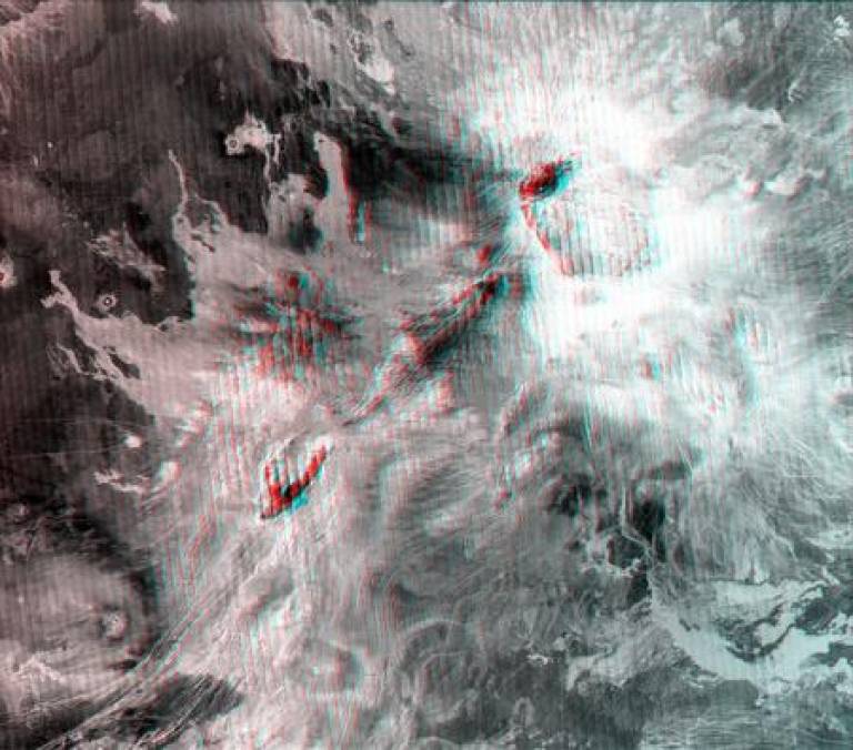
NASA's Magellan probe mapped almost the entire surface of Venus during its four-year mission in the early 1990s. Because of the thick clouds that entirely hide the planet's surface, the probe could not take traditional photographs of the surface. Instead, it scanned the planet in long strips using a method called synthetic aperture radar, which allows for high-resolution images to be made even with a relatively small antenna.
The spacecraft also recorded data about the elevation of the surface, and by combining this with the radar images, scientists are able to produce 3D models of the planet's surface.
Because the surface of Venus is relatively flat, the elevation in these images is multiplied by 10, to make the contours of the landscape more visible.
UCL's Earth Sciences department is home to one of NASA's Regional Planetary Image Facilities - the only one of its kind in the UK - and has a full collection of these Magellan images, and the equipment required to view them. However, viewing them has until now required a bulky stereoscope and careful alignment of the images - not to mention making an appointment to visit the archive.
This new anaglyph of one of the Magellan images lets you see the 3D structure on your computer screen without the need for bulky equipment: simple and cheap red/cyan 3D glasses are all you need.
Credit: NASA/JPL/USGS, anaglyph by P. Grindrod (UCL Earth Sciences)
Related links
- UCL Department of Earth Sciences
- UCL/NASA Regional Planetary Image Facility
- UCL-Birkbeck Centre for Planetary Science
High resolution images
This image can be reproduced freely as it is in the public domain
 Close
Close


