 Close
Close

Map-making by City-makers
The urban poor are exposed to higher risks through poor housing and services. Thanks to cutting edge mapping technology, we’re proving that they are not the drain on resources some city-dwellers believe – their contribution needs to be recognised.
UCL researchers together with inhabitants living in the peripheral slopes of the city of Lima used cutting edge mapping technology to develop a methodology to better understand what is happening in marginalised settlements and inform solutions to improve the living conditions of impoverished dwellers.
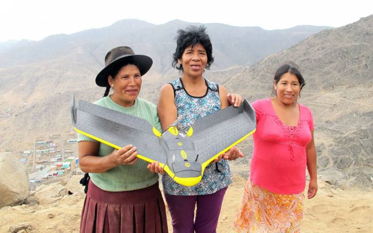
Using drones, 3D modelling and on the ground contributions from local women and men, the team was able to build a 3D map of the neighbourhoods settled on steep slopes. Mapping helped to better understand the everyday risks they face, where these are located, who is affected and how they are produced. Some of the main risks affecting local inhabitants include rockfalls, housing collapse and diseases due to the lack of clean water and adequate sanitation. Most importantly, the mapping process made local dwellers and the problems they face visible in their own terms.
The team at the Bartlett Development Planning Unit, led by Professor Adriana Allen and Dr Rita Lambert (UCL Development Planning Unit), is working with grassroots organisations, NGOs and policy makers to change discriminatory attitudes towards informal settlements and reframe their dwellers as valuable contributors to the city.
Many in the city see the urban poor as a drain on the city’s resources, but the project has proven that they contribute an average of 87% of the total cost of making their neighbourhoods habitable, while the State provides only 8.3%.
Rita commented:
“It was crucial to quantify the considerable income, time and labour that the urban poor spend on improving collective accessibility and services, and improving housing conditions. This has provided a counter argument to the often-heard assumption that the poor are a problem for the city, and rather highlighted their resilience and the need to support such efforts through coordinated public investments.
The results of the project so far have been influential on national and local policy for housing and services, as well as enriching the city authorities’ understanding and recognition of the contributions of these communities to city-making. A similar approach to mapping the invisible has been adopted by Adriana and Rita in Freetown (Sierra Leone) and Karonga (Malawi), revealing the power of participatory mapping to make visible the invisible.
Meet the minds behind this discovery at the It's All Academic Festival on 5 October.
Links
- cLIMASinRiesgo - the project website
- ReMap Lima blog
- News item: Reimagining Lima
- Professor Adriana Allen - academic profile
- Dr Rita Lambert - academic profile
- UCL Development Planning Unit (DPU)
Image
- Three community mappers holding the drone that captured the point clouds and aerial images of their settlements on the peripheral slopes of José Carlos Mariátegui (2014). Credit: Rita Lambert