 Close
Close

SCALE: (Small Changes leAd to Large Effects)
Transport and residential location consume substantial quantities of energy whilst serving only to facilitate primary economic and societal activities. The relationship between urban form and travel patterns is inherently complex: it can be influenced by policy but through many individual personal responses rather than being subject to explicit control. Managing the energy used in transport is therefore an indirect process that works by influencing the amount and distance of travel, the means by which travel takes place, and the energy requirement of the resulting travel. Achieving this effectively requires a full understanding of the many complex interacting social processes that generate the demand for travel and impinge on the ways in which it is satisfied in terms of its supply.
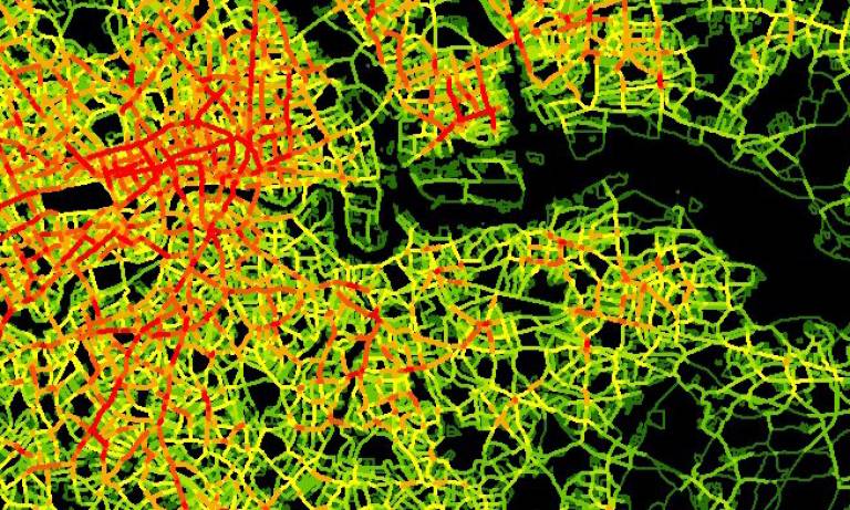
At UCL, we are building models of urban and transport systems which provide related perspectives on these responses to changing energy costs. Wilson pioneered the development of entropy maximising approaches to transport and location in which energy and travel costs are essential determinants of travel and his recent work in nesting these models within a dynamics that generate unanticipated effects is key to understanding the kinds of changes that are now being effected by changing energy costs.
In a complementary way, these models can be provided with a much stronger rationale using recent theories of spatial agglomeration which date back to Turing but find their clearest expression in the work of Krugman (TK models). These models thus inform the Boltzman-Lotka-Volterra (BLV) models developed by Wilson. Translating these models into physical infrastructures involves explicit developments in network science and Zhou and Heydecker's models suggest ways in which energy costs might be reduced by linking physical networks to flows generated by the BLV and TK models. What we propose here is to extend and develop these three approaches, extending our existing operational land use transport model for Greater London (built as part of the Tyndall Centre's Cities programme) to enable our partners to explore 'what if' questions involving changing energy costs on the city. The project runs from April 2010 to September 2012 and is supported by EPSRC.
- People
Michael Batty
Principal Investigator, CASA
View Mike's profile
Send Mike an emailBen Heydecker
Co-Investigator, Civil, Environmental and Geomatic EngineeringJohnny Kelsey
Research Associate, Civil, Environmental and Geomatic EngineeringFrancesca Medda
Co-Investigator, Civil, Environmental and Geomatic EngineeringJoan Serras
Research Associate, CASACamilo Vargas-Ruiz
Research Associate, CASAAlan Wilson
Co-Investigator, CASA
View Alan's profile
Send Alan an emailShi Zhou
Co-Investigator, Computer Science- Outputs
Batty, M. (2011) Dynamics of Land-Use Change and Growth, in D. Robinson (Editor) Computer Modelling for Sustainable Urban Design: Physical Principles, Methods and Applications, Earthscan, London, 237-258.
Batty, M., Vargas-Ruiz, C., Smith, D., Serras, J., Reades, J., and Johansson, A. (2011) Visually-Intelligible Land Use Transportation Models for the Rapid Assessment of Urban Futures, CASA Working Paper 163
Dawson, R., Hall, J., Barr, S., Batty, M., Bristow, A., Carney, S., Dagoumas, A, Evans, S., Ford, A., Harwatt, H., Kohler, J., Tight, M., Walsh, C., And Zanni, A. (2009) A Blueprint for the Integrated Assessment of Climate Change in Cities, in K. Tang (Ed) Green CITYnomics: The Urban War against Climate Change, Greenleaf Publishing, Chippenham, UK, 32-51.
Medda, F., Nijkamp, P. and Reitveld, P. (2009) A morphogenetic perspective on spatial complexity: transport costs and urban shapes, in A. Reggiani and P. Nijkamp (eds.) Complexity and Spatial Networks, Springer, Berlin, 51-60.
Wilson, A. (2010) A general Richardson-Lotka-Volterra-reaction diffusion model, CASA Working Paper 159, CASA Working Paper 159
- Impact
- We are providing state-of-the-art modelling software and capabilities to deal with important problems of volatility in cities occasioned by massive changes in energy costs which have impacts on how we travel and where we locate.
- We are suggesting a uniquely different approach to anything that has gone before but this kind of complexity science in the urban realm has taken a long time coming and we are only now at the point where it can be demonstrated unequivocally. The work is generalisable to all cities globally and although there will be different impacts in different sized cities in different cultural and economies, the mechanisms and processes of feedback and change intrinsic to this kind of science are the same everywhere.
- This project (and all our related work noted here) has many benefits in understanding the impact of changing energy regimes on society. This work would bring these by: a) informing the debate about compactness and sprawl in cities in ways that are quite different from the somewhat old fashioned notions that still dominate the argument; b) informing our wider knowledge of complexity science and what it might bring to understanding volatility and resilience not only in transport and urban location but in economic market systems more generally; and by informing ways in which the markets for energy associated with transport and residential heating and cooling determines elastic demand in terms of fixed supply and flexible supply with respect to fixed transport costs.
- Our key means of dissemination is through the visual demonstration of our models. Most of the software that we will write in this project will be desktop based but we have expertise in embedding maps, models and related multimedia from these projects into web environments. There you can download movies of how we can explore the phase space in the BLV models and how the LUTM is driven on the desktop by an informed user. As yet we have not translated these types of model into web-based services although we have produced some pilot demos of urban models based on cellular automata in 3-D virtual worlds within Nature's Second Nature island which is part of Second Life; an example is at http://digitalurban.blogspot.com/2008/10/cellular-automaton-and-agents-in-second.html.
- Our experience in developing web-based services for spatial analysis as part of our ESRC GeoVUE project in the form of web mapping (see www.maptube.org) provides a general sense of how we will go about disseminating this research.