 Close
Close

PhotoOverlays are photographs that are directly embedded in the Google Earth's landscape
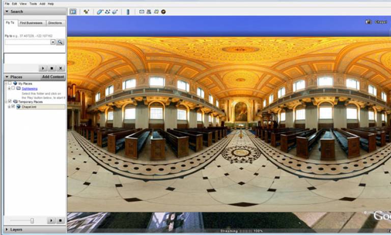
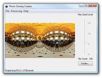
PhotoOverlay Creator is a free software tool allowing you to quickly and easily create your own PhotoOverlay. Overlay's can be 2D rectangles, or images projected onto cylinders and spheres to create virtual panoramas that the user can "enter," explore, and inspect in detail. In addition, KML 2.2 accommodates very large PhotoOverlays, containing many megapixels of data, PhotoOverlay has been created specifically to cut high resolution images up into many sections, allowing giga pixel images to be viewed within a low bandwidth environment.
Further Information
For additional support email support@casa.ucl.ac.uk
Related Links
A tutorial can be found at digital urban.
The Google Earth Photo Overlay Creator is part of the GENeSIS project at CASA. This project is sponsored by the ESRC as a node in the National Centre for e-Social Science.