 Close
Close

We're very pleased to introduce three fantastic keynote speakers for the BIM/GIS Integration Workshop and 3D GeoInfo 2020
Anne Kemp
Dr Anne Kemp OBE has 25 years of experience and is Fellow and Technical Director for Digital Engineering (DE) and BIM Strategy and Development, at Atkins, part of the SNC Lavalin Group, providing advice to some of the UK’s major infrastructure clients, including Crossrail, Eight2o, HS2 and Heathrow. She is Chair of the UK BIM Alliance (which hosts BuildingSMART UKI), and convenor of the International Standards Organisation committee for ISO19650, which has evolved out of the UK’s BIM Level 2, and the committee developing the strategy for global standards focused on managing information for the whole life cycle of infrastructure projects. She works closely with the Centre of Digital Built Britain, sitting on the Management Advisory Board and the Digital Framework Task Group which is developing the National Digital Framework for the UK. She was chair for ICE’s State of the Nation “Digital Transformation” Report 2017, and of the Association of Geographic Information from 2014 to 2016. She is one of the ICE’s Invisible Superheroes: Digital Dynamo, and was awarded the ICE’s President’s Medal 2017. In 2019, she was awarded an OBE for “Digital Construction Innovation” in the Queen’s birthday Honours.
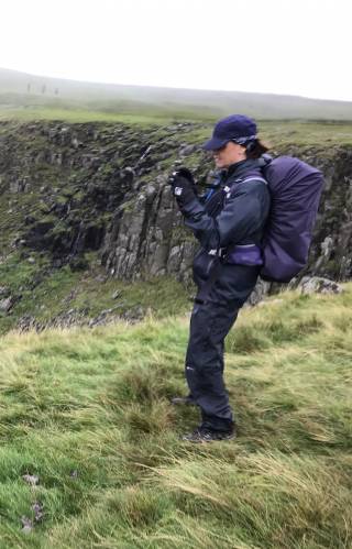
Anne has recently completed a 258 mile walk across the Penine Way in aid of three charities - homeless and rough sleeper charity CRASH, humanitarian mapping charity MapAction and mental health charity Mates in Mind. Find out more about Anne's doubly challenging walk and make a donation.
Polly Hudson

Polly is a Senior Research Fellow at UCL's Centre for Advanced Spatial Analysis (CASA), who has been involved in 2D/3D and 4D GIS projects since the 1990s. Initially working on the design of community GIS systems at the Building Exploratory charitable trust, which she founded in 1997, from 2000 she experimented with longitudinal animations, first collaborating with Steve Evans on testing 4D animations of the stock and later with Flora Roumpani and Kiril Stanilov on the animation of historical networks. .
Since 2010 her academic research has focused on the use of microspatiotemporal data on buildings, and particularly age and demolition data, in forecasting vulnerability and resilience in urban stocks and in geolocating building typologies to support retrofit programmes. This has included the manual collection of the age of 20,000 buildings in London and the manual vectorisation of over 10,000 building footprints from historical maps. Owing to the lack of availability of open, spatial building attribute data at building level in the UK, necessary to understand the age and composition of stocks, and of demolition data required to track change and loss of finite reserves, in 2016 Polly set up Colouring London, an open data/ knowledge exchange platform, working in collaboration with colleagues at UCL, Ordnance Survey, Historic England, the Greater London Authority - the platform code is available for testing by other cities as seein in Colouring Beirut.
From 2020 to 2021 Colouring London will be hosted by The Alan Turing Institute. This will allow experimental work to be undertaken on the computational generation of current attribute data, on the use of AI to accelerate automated extraction of data from historical maps, and for role of a range of advanced computational approaches in the analysis, modelling and forecasting of stock dynamics, and stock resilience, to be tested.
Jantien Stoter

Prof Dr Jantien Stoter chairs the 3D Geoinformation research group at the Delft university of technology, The Netherlands. She also works as innovations researcher at both Kadaster and Geonovum. Jantien did her PhD on 3D Cadastre (2004), received a personal grant from the Dutch Science Foundation on 5D modelling (2011) and was awarded a grant from the European Research Council for her current research on urban modelling in higher dimensions. She is initiator of the 3D Special Interest Group of EuroSDR (European Spatial Data Research group) in which research institutes and national mapping and cadastral agencies from all over Europe collaborate on 3D geoinformation-related innovations.
![]()
![]()
