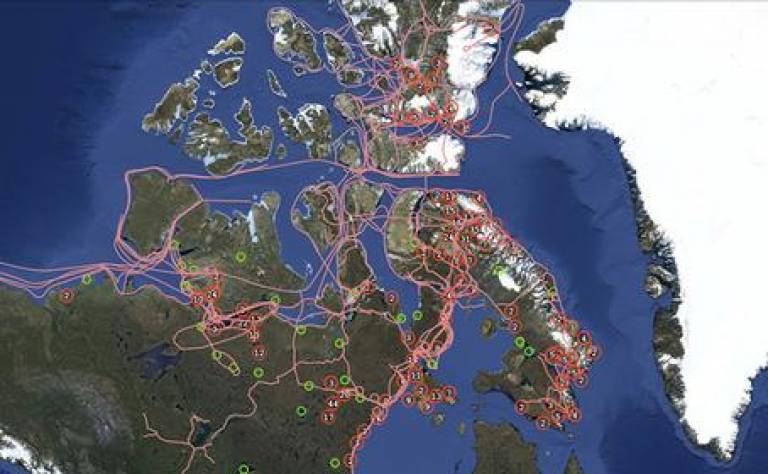
LIVINGMAPS: Indigenous Cartographies
09 June 2015, 6:00 pm–8:00 pm

Event Information
Open to
- All
Location
-
UCL, Room G22, Pearson Building, Gower Street, London WC1E 6BT
Maps
have often been used to stake territorial claims over resources. This
practice is not confined to the era of European colonialism, it
continues to be an operating principle of nation states or
multi-national corporations wherever they seek to extend their domains
by ignoring or delegitimising the customary rights of indigenous
peoples. In this seminar we will be looking at how far cartography can
become a means of resistance challenging the prerogatives of power and
re-asserting historical entitlements to land and landscape.
Michael Bravo
Envisioning Inuit Homelands with Trails and Tracks: a Discussion of the Pan-Inuit Atlas
Jerome Lewis
Using Maps to Create a Third Space in Which to Contest Power: Experiences From the Extreme Citizen Science Group UCL
Michael
is based at the Scott Polar Research Institute where his current
project is producing the Pan-Inuit Trails Atlas. He is the author of
Narrating the Arctic (2002). Jerome has been working to support Pygmy
hunter-gatherers defend their land and rights since 1993. He currently
co-directs the Extreme Citizen Science Group at UCL to develop
indigenously co-designed mapping software for smartphones to address
problems identified by participants.
Tickets can be purchased on Eventbrite. £10 for professionals/academics, £5 for concessionaries.
error message: 'NoneType' object has no attribute 'to_html'
Image courtesy of Michael Bravo
 Close
Close

