Ελληνικά

under the aegis of the Canadian Institute in Greece and the Hellenic Ministry of Culture
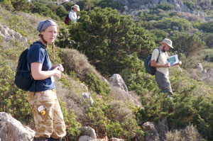
Team M walking a tract downhill. Photograph by J. Conolly.
Our investigative strategy for exploring the surface archaeological remains of Antikythera comprised two stages, the first of which adopted a well established intensive survey technique known as tractwalking. In our case, this involved dividing the landscape into sub-hectare units that were then walked across in straight lines by surveyors spaced 15m apart. Overall, we have walked over 95% of the island in this manner (a task which took ca. 5,000 person hours), with the only unwalked areas being some exceptionally steep scarps and coastal cliffs. Each surveyor recorded separate counts of the total pottery and lithics they observed and also made a permanent collection of any feature sherds (i.e. decorated pieces and shape diagnostics) or worked lithics that they encountered.
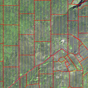
Tract units shown in red and individual wlaker lines in yellow, both mapped onto a Quickbird satellite image. Image by A. Bevan (background satellite image is copyright Digital Globe, 2004)
Collected finds were bagged separately for each 10m segment of walker's line, making it possibly to automate far more detailed plotting of the finds that would be otherwise possible. Such an approach has the benefit of making the spatial accuracy of these tractwalking finds far more comparable to those retrieved from stage-two grid collections, our other digital datasets (e.g. DEMs and remote sensing imagery) and any chance finds recorded by handheld GPS. A full mapping of ASP's tract units is available from the downloads page.